MyTopo
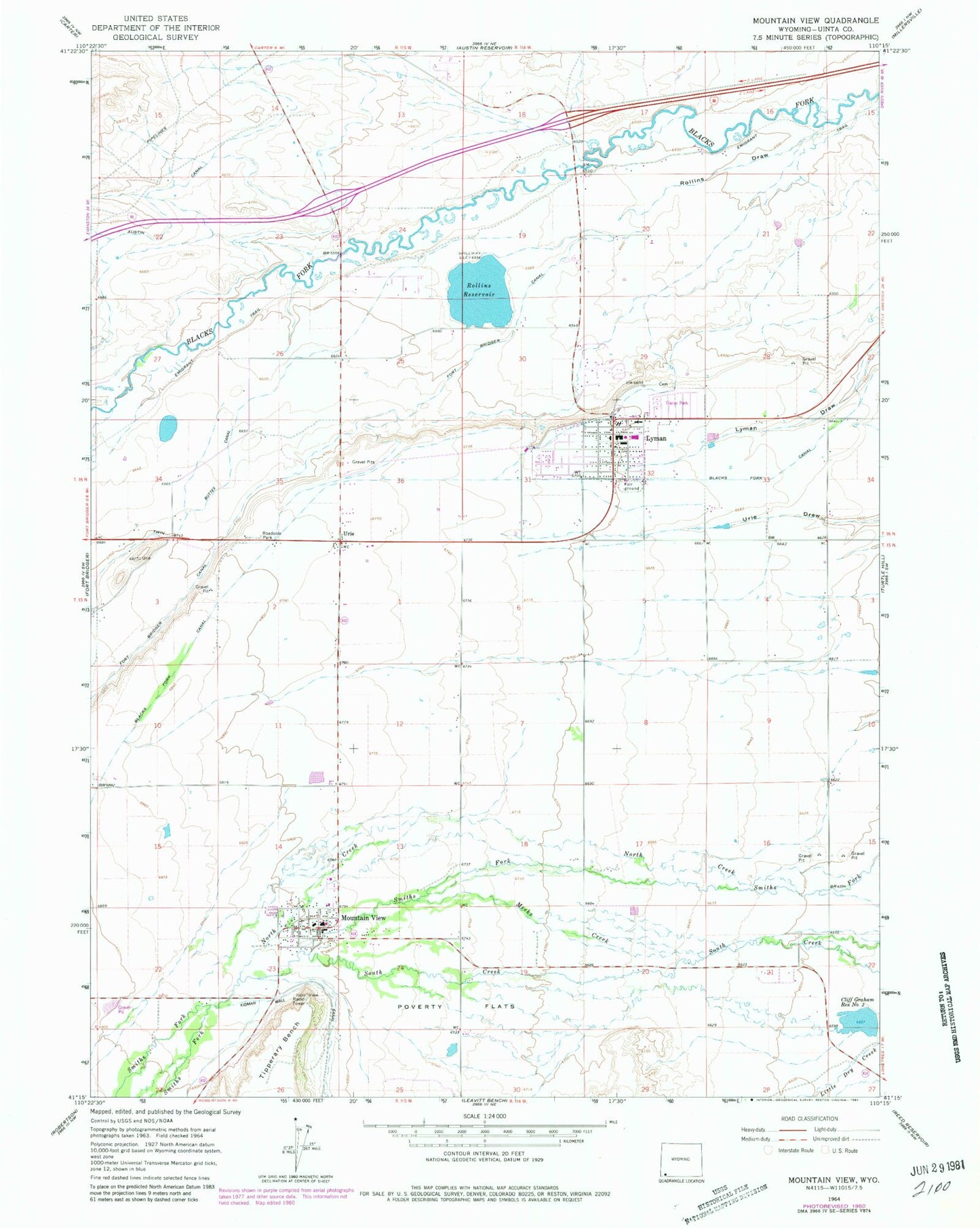
Classic USGS Mountain View Wyoming 7.5'x7.5' Topo Map
Couldn't load pickup availability
Historical USGS topographic quad map of Mountain View in the state of Wyoming. Map scale may vary for some years, but is generally around 1:24,000. Print size is approximately 24" x 27"
This quadrangle is in the following counties: Uinta.
The map contains contour lines, roads, rivers, towns, and lakes. Printed on high-quality waterproof paper with UV fade-resistant inks, and shipped rolled.
Contains the following named places: Blacks Fork Canal, Bridger Valley Division, Cliff Graham Reservoir Number Three, Clifford F Graham Dam, Fort Bridger Canal, Fort Bridger School, KBVZ-FM (Fort Bridger), Lyman, Lyman City Cemetery, Lyman Draw, Lyman High School, Lyman Middle School, Lyman Police Department, Lyman Post Office, Lyman School, Meeks Creek, Mountain View, Mountain View Fire Department, Mountain View High School, Mountain View Middle School, Mountain View Police Department, Mountain View Post Office, Mountain View School, North Creek, Paterson Lake Dam, Smiths Fork, Town of Lyman, Town of Mountain View, Twin Buttes Canal, Uinta County Emergency Medical Services Lyman, Uinta County Fire Protection Lyman, Uinta County Sheriff's Office Mountain View, Urie, Urie Census Designated Place, Urie School, ZIP Code: 82937