MyTopo
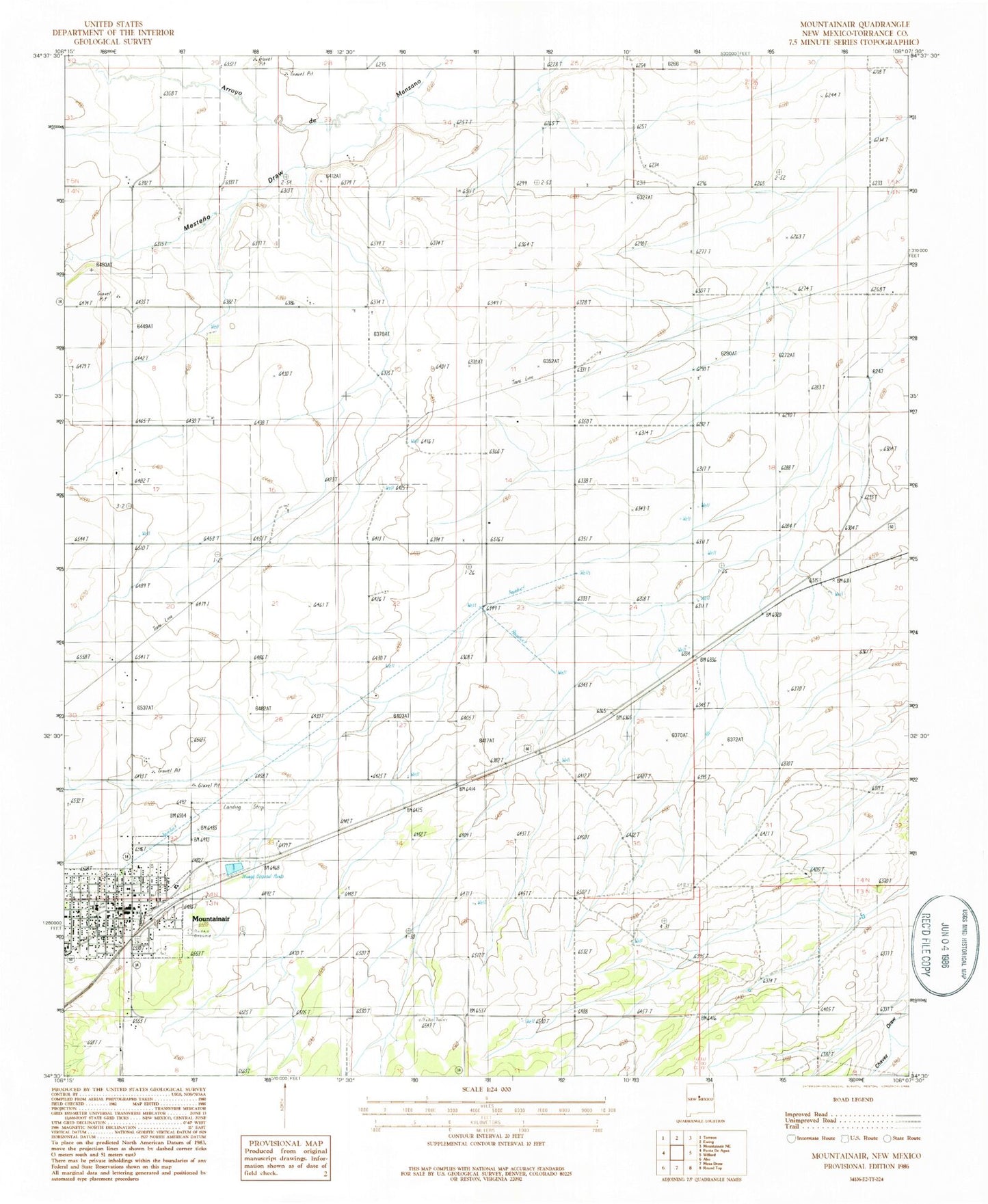
Classic USGS Mountainair New Mexico 7.5'x7.5' Topo Map
Couldn't load pickup availability
Historical USGS topographic quad map of Mountainair in the state of New Mexico. Map scale may vary for some years, but is generally around 1:24,000. Print size is approximately 24" x 27"
This quadrangle is in the following counties: Torrance.
The map contains contour lines, roads, rivers, towns, and lakes. Printed on high-quality waterproof paper with UV fade-resistant inks, and shipped rolled.
Contains the following named places: 10239 Water Well, Assembly of God Church, AT and SF RR Depot in Mountainair, Broncho, Bullington Ranch, Church of the Nazarene, First Baptist Church, Hinman Ranch, Jacks Pit, Mesteno Draw, Moiuntainair Christian Center, Mountainair, Mountainair Civic Library, Mountainair Elementary School, Mountainair Historical Marker, Mountainair Municipal Airport, Mountainair Municipal Auditorium, Mountainair Pit, Mountainair Police Department, Mountainair Post Office, Mountainair Rodeo Ground, Mountainair Volunteer Fire Department, Mountainair Weather Station, New Beginnings Christian School, Number 2 Water Well, Saint Alice Church, Salinas National Monument Headquarters and Visitor Center, Salinas Pueblo Missions National Monument Visitor Center, Spangler Windmill, Test 4 Water Well, Town of Mountainair