MyTopo
Classic USGS Mountainburg SE Arkansas 7.5'x7.5' Topo Map
Couldn't load pickup availability
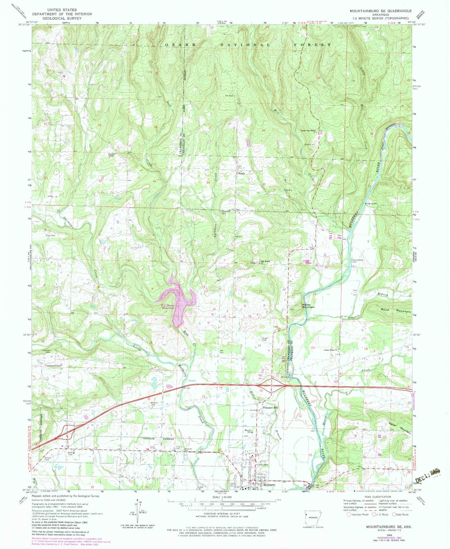
Historical USGS topographic quad map of Mountainburg SE in the state of Arkansas. Map scale may vary for some years, but is generally around 1:24,000. Print size is approximately 24" x 27"
This quadrangle is in the following counties: Crawford, Franklin.
The map contains contour lines, roads, rivers, towns, and lakes. Printed on high-quality waterproof paper with UV fade-resistant inks, and shipped rolled.
Contains the following named places: Alexander Cemetery, Boney Mountain, Brandenburg Lake, Brandenburg Lake Dam, Bratton Cemetery, Brooks Chapel, Bruce Lake, Bruce Lake Dam, Center Point Church, Chastain Cemetery, Church of Christ, City of Mulberry, Concord Cemetery, Crawford County Rural Fire District 3 Turner Station, Dougan Cemetery, Echols Cemetery, King Cemetery, Kirksey Park, Latter Day Saints Church, Latter Day Saints Curch, Little Mill Creek, Little Mulberry Creek Site Number One Dam, Marlar Cemetery, Marvin Elementary School, Maxey Creek, Maxey Mountain, Mill Creek, Miller Branch, Mulberry, Mulberry High School, Mulberry Rural Fire District 2, Mulberry Rural Fire District 2 Station 2, New Cemetery of Mulberry, Oak Bower Church, Piney, Pleasant Hill, Pope Cemetery, Queensbury Ford, Quesenbury Cemetery, River Ridge Park, Rock Creek, Ryles Cemetery, Sherman Creek, Simpson Branch, Sycamore Creek, T J House Reservoir, Township of Black Oak, Township of Maxey, Township of Miller, Township of Mulberry, Township of Whitley, ZIP Code: 72947