
MyTopo
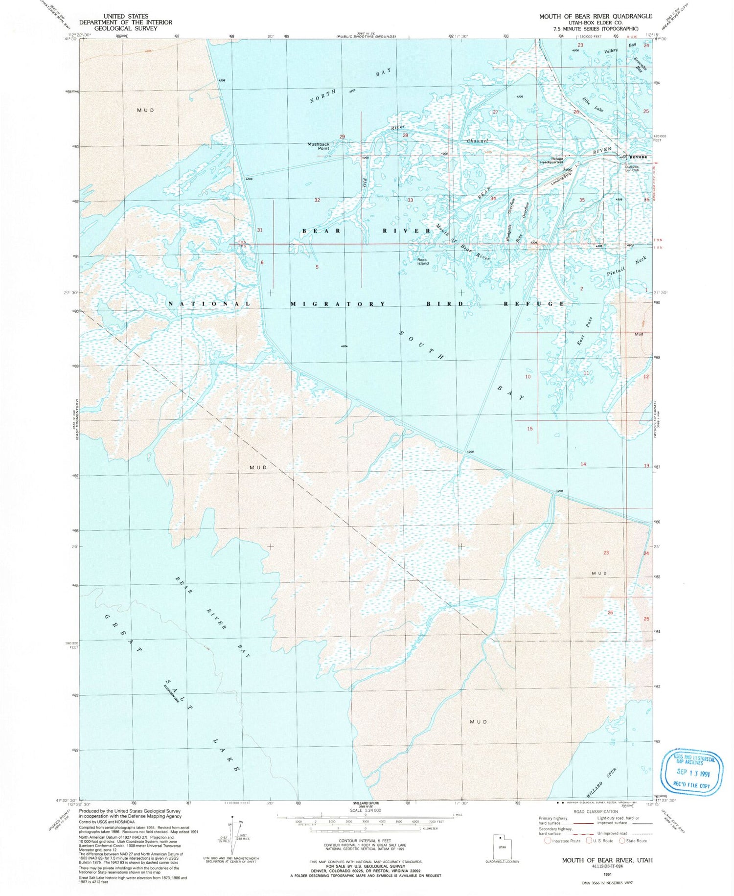
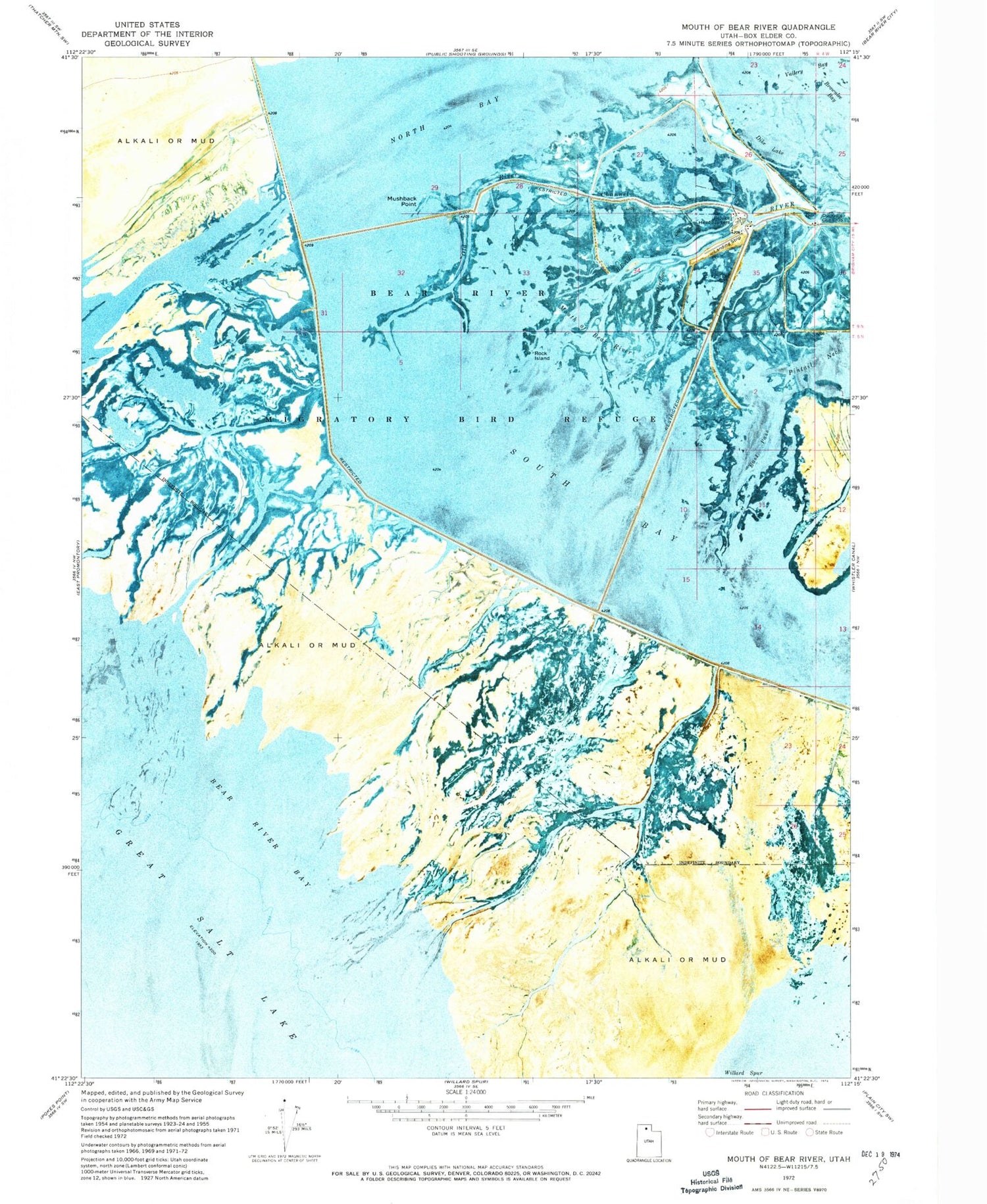
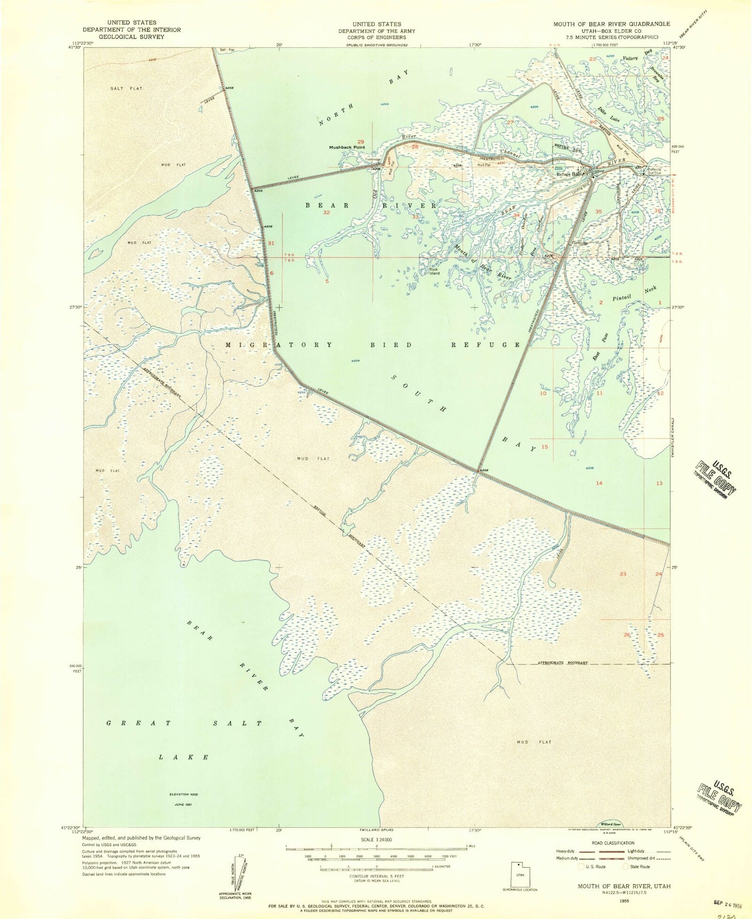
Classic USGS Mouth of Bear River Utah 7.5'x7.5' Topo Map
Couldn't load pickup availability
Historical USGS topographic quad map of Mouth of Bear River in the state of Utah. Map scale may vary for some years, but is generally around 1:24,000. Print size is approximately 24" x 27"
This quadrangle is in the following counties: Box Elder.
The map contains contour lines, roads, rivers, towns, and lakes. Printed on high-quality waterproof paper with UV fade-resistant inks, and shipped rolled.
Contains the following named places: Bear River, Bear River Migratory Bird Refuge, Bear River National Migratory Bird Refuge, Bens Overflow, Blodgetts Overflow, Brownlee Bay, Dike Lake, Duckville Gun Club, East Pass, Mouth of Bear River, Mushback Point, North Bay, Old River Channel, Pintail Neck, Rock Island, South Bay, Vallery Bay


