MyTopo
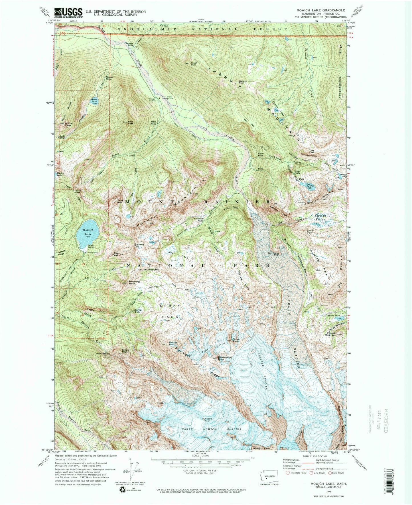
Classic USGS Mowich Lake Washington 7.5'x7.5' Topo Map
Couldn't load pickup availability
Historical USGS topographic quad map of Mowich Lake in the state of Washington. Typical map scale is 1:24,000, but may vary for certain years, if available. Print size: 24" x 27"
This quadrangle is in the following counties: Pierce.
The map contains contour lines, roads, rivers, towns, and lakes. Printed on high-quality waterproof paper with UV fade-resistant inks, and shipped rolled.
Contains the following named places: Alice Falls, Arthur Peak, Bee Flat, Carbon Glacier, Castle Peak, Cataract Creek, Cataract Falls, Cayada Creek, Chenuis Creek, Chenuis Falls, Chenuis Lakes, Crescent Creek, Crescent Lake, Crescent Mountain, Cress Falls, Curtis Ridge, Dick Creek, Division Rock, Doe Creek, Eagle Cliff, Echo Cliffs, Echo Rock, Elizabeth Ridge, Elysian Fields, Falls Creek, Fay Peak, Flett Glacier, Giant Falls, Goat Island Rock, Gove Peak, Grant Creek, Green Lake, Ipsut Creek, Ipsut Creek Campground, Ipsut Creek Trail, Ipsut Falls, Ipsut Pass, Knapsack Pass, Lee Creek, Marmot Creek, Mineral Mountain, Mist Park, Moraine Creek, Moraine Park, Mother Mountain, Mowich Lake, Mystic Lake, Needle Rock, North Mowich Glacier, Northern Crags, Northern Loop Trail, Observation Rock, Old Desolate, Pacific Point, Mount Pleasant, Ptarmigan Ridge, Ranger Creek, Ranger Falls, Russell Glacier, Rust Ridge, Seattle Park, Spray Falls, Spray Park, Spukwush Creek, Tillicum Point, Tirzah Peak, Lake Tom, Tyee Peak, Windy Gap, Yellowstone Cliffs, Hessong Rock, Chenuis Mountain, Wallace Peak, Mount Rainier Division