MyTopo
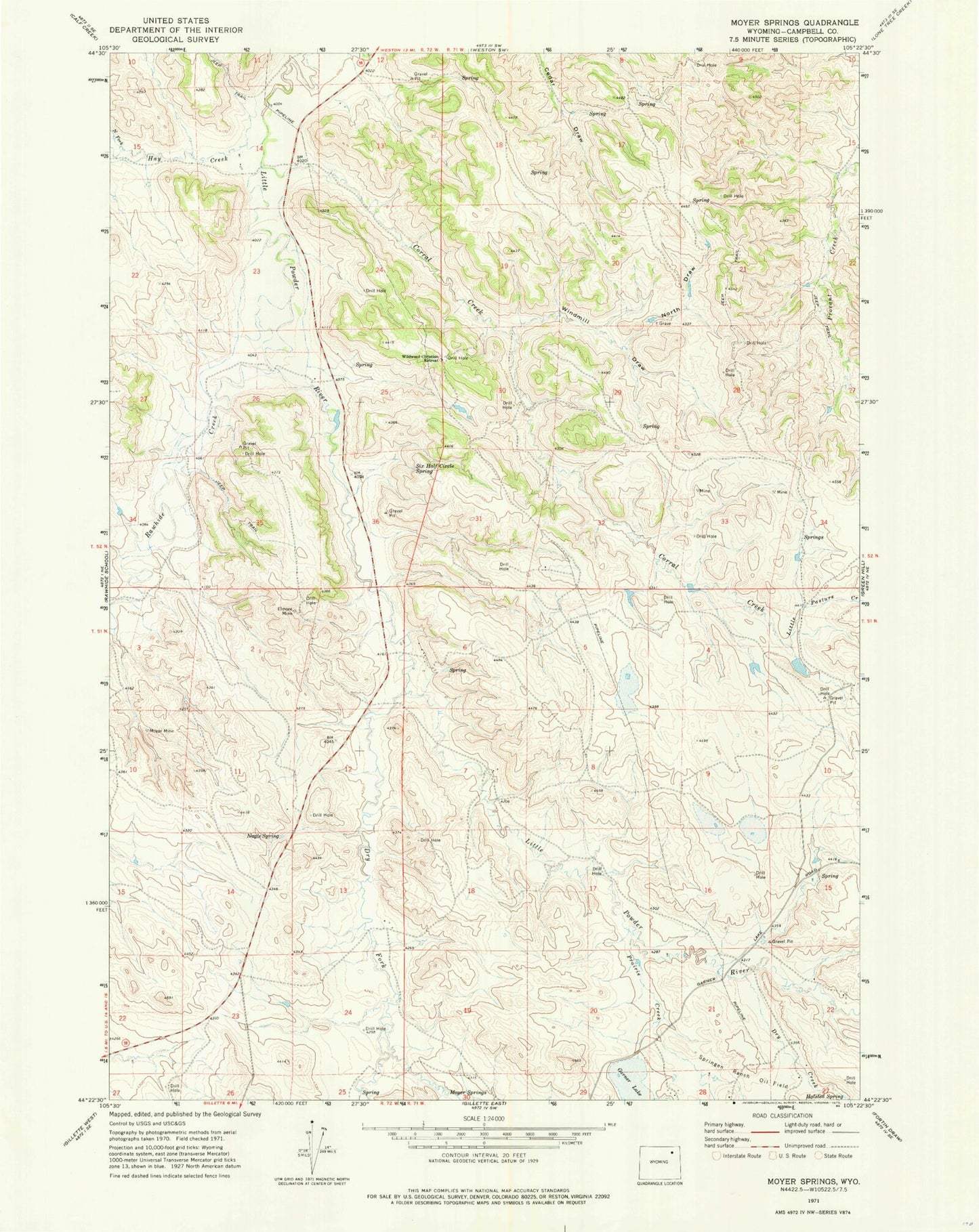
Classic USGS Moyer Springs Wyoming 7.5'x7.5' Topo Map
Couldn't load pickup availability
Historical USGS topographic quad map of Moyer Springs in the state of Wyoming. Map scale may vary for some years, but is generally around 1:24,000. Print size is approximately 24" x 27"
This quadrangle is in the following counties: Campbell.
The map contains contour lines, roads, rivers, towns, and lakes. Printed on high-quality waterproof paper with UV fade-resistant inks, and shipped rolled.
Contains the following named places: Cook Dam, Cook Reservoir, Corral Creek, Dry Creek, Dry Fork Little Powder River, Elmore Mine, Garner Lake, Halsted Spring, Hay Creek, Little Pasture Creek, Moyer Mine, Moyer Springs, Nagle Spring, North Draw, North Fork Hay Creek, North Rawhide Mine, Prairie Creek, Raw Hide Dam, Rawhide Creek, Rawhide Dam, Rawhide Mine, Rawhide Mine Main Dam, Rawhide Mine Main Reservoir, Rawhide Reservoir, Six Half Circle Spring, Wildwood Christian Retreat, Windmill Draw