MyTopo
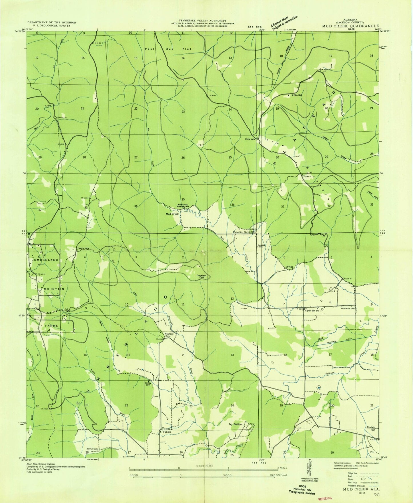
Classic USGS Mud Creek Alabama 7.5'x7.5' Topo Map
Couldn't load pickup availability
Historical USGS topographic quad map of Mud Creek in the state of Alabama. Typical map scale is 1:24,000, but may vary for certain years, if available. Print size: 24" x 27"
This quadrangle is in the following counties: Jackson.
The map contains contour lines, roads, rivers, towns, and lakes. Printed on high-quality waterproof paper with UV fade-resistant inks, and shipped rolled.
Contains the following named places: Austell Cemetery, Barbee Cemetery, Becky Hollow, Brandon Cemetery, Bucker Pond, Bynum Cemetery, Chicken Foot Cove, Chicken Foot Ridge, Clemmons Point, Cornelison Point, Crow Cemetery, Crow Mountain, Dean Ridge, Dolberry Cemetery, Dolberry Hollow, Dudley Ridge, Elkins Cemetery, Evans Creek, Evett Point, Fairfield Church, Flag Spring, Gizzard Point, Gold Cemetery, Harmony Cemetery, Harmony Church, Harris Hollow, Holland Chapel, Houston Hollow, Ivey Bottom, Low Gap, Mitchell Hollow, Moody Cemetery, Moody Gap, Moody Hollow, Never Hole, New Life Church, Peacock Hollow, Pegues Branch, Peter Gold Point, Piney Point, Pipeline Hollow, Poplar Spring Creek, Proctor Cemetery, Robinson Creek, Robinson Spring, Round Cove, Round Knob, Sanders Cemetery, Sanders Cemetery, Scraper Hill, Sharp Cemetery, Skyline Cemetery, Skyline Church, Skyline School, The Buzzard Roost, The Slipoff, Travis Cemetery, Tubbs Branch, Tupelo, Hill Pond Dam, Hill Pond, Bill Creek, Carricks Mill (historical), Cumberland Mountain Farm Colony (historical), Fairfield School (historical), Kyles School Number 1 (historical), Kyles School Number 2 (historical), Mud Creek (historical), Nila Church, Skyline, Cedar Gap Baptist Church, Central Church, Maynard Cove Cemetery, Nila School, Kyles, Maynard Cove, Harmony Church (historical), Harmony School (historical), Unity School (historical), Town of Skyline, Crow Mountain Volunteer Fire Department, Skyline Volunteer Fire Department Station 1, House of Prayer Community Church, Austell Cemetery, Barbee Cemetery, Becky Hollow, Brandon Cemetery, Bucker Pond, Bynum Cemetery, Chicken Foot Cove, Chicken Foot Ridge, Clemmons Point, Cornelison Point, Crow Cemetery, Crow Mountain, Dean Ridge, Dolberry Cemetery, Dolberry Hollow, Dudley Ridge, Elkins Cemetery, Evans Creek, Evett Point, Fairfield Church, Flag Spring, Gizzard Point, Gold Cemetery, Harmony Cemetery, Harmony Church, Harris Hollow, Holland Chapel, Houston Hollow, Ivey Bottom, Low Gap, Mitchell Hollow, Moody Cemetery, Moody Gap, Moody Hollow, Never Hole, New Life Church, Peacock Hollow, Pegues Branch, Peter Gold Point, Piney Point, Pipeline Hollow, Poplar Spring Creek, Proctor Cemetery, Robinson Creek, Robinson Spring, Round Cove, Round Knob, Sanders Cemetery, Sanders Cemetery, Scraper Hill, Sharp Cemetery, Skyline Cemetery, Skyline Church, Skyline School, The Buzzard Roost, The Slipoff, Travis Cemetery, Tubbs Branch, Tupelo, Hill Pond Dam, Hill Pond, Bill Creek, Carricks Mill (historical), Cumberland Mountain Farm Colony (historical), Fairfield School (historical), Kyles School Number 1 (historical), Kyles School Number 2 (historical), Mud Creek (historical), Nila Church, Skyline, Cedar Gap Baptist Church, Central Church, Maynard Cove Cemetery, Nila School, Kyles, Maynard Cove, Harmony Church (historical), Harmony School (historical), Unity School (historical), Town of Skyline, Crow Mountain Volunteer Fire Department, Skyline Volunteer Fire Department Station 1, House of Prayer Community Church


