MyTopo
Classic USGS Mud Lake Maine 7.5'x7.5' Topo Map
Couldn't load pickup availability
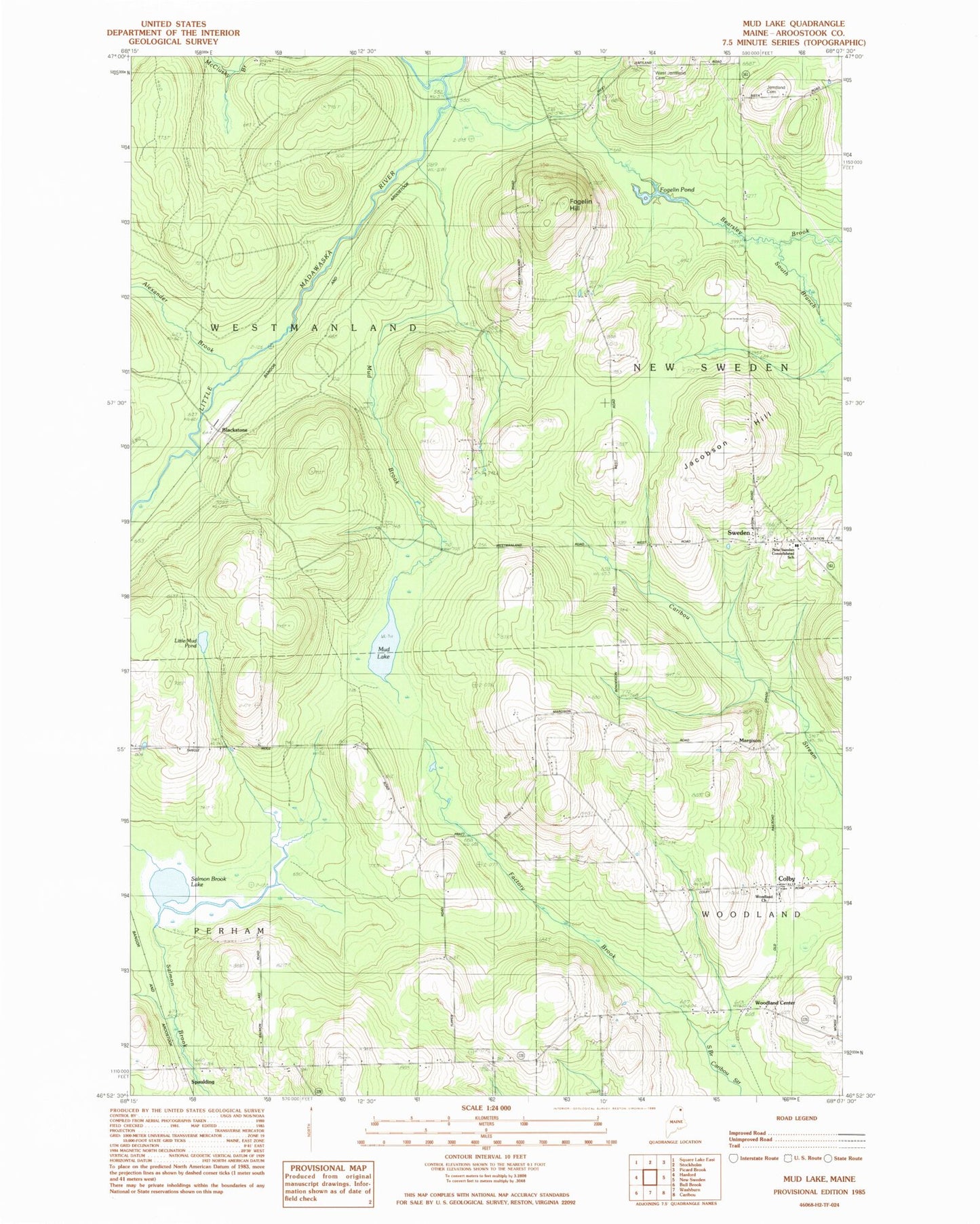
Historical USGS topographic quad map of Mud Lake in the state of Maine. Map scale may vary for some years, but is generally around 1:24,000. Print size is approximately 24" x 27"
This quadrangle is in the following counties: Aroostook.
The map contains contour lines, roads, rivers, towns, and lakes. Printed on high-quality waterproof paper with UV fade-resistant inks, and shipped rolled.
Contains the following named places: Alexander Brook, Blackstone, Carlson Pond, Colby, Factory Brook, First Baptist Church, Fogelin Hill, Fogelin Pond, Jacobson Hill, Jemtland Cemetery, Little Mud Pond, Margison, Mud Brook, Mud Lake, New Sweden Consolidated School, Nilsen Ackerson Family Cemetery, Salmon Brook Lake, South Branch Bearsley Brook, Spaulding, Sweden, Town of Perham, Town of Westmanland, West Jemtland Cemetery, West Road Cemetery, Westmanland Cemetery, Westmanland School, Woodland Center, Woodland Church, ZIP Code: 04766