MyTopo
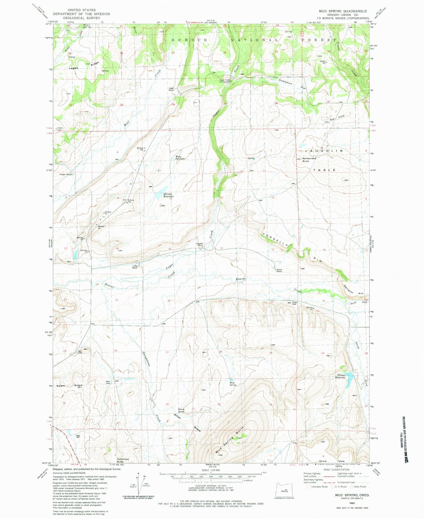
Classic USGS Mud Spring Oregon 7.5'x7.5' Topo Map
Couldn't load pickup availability
Historical USGS topographic quad map of Mud Spring in the state of Oregon. Map scale may vary for some years, but is generally around 1:24,000. Print size is approximately 24" x 27"
This quadrangle is in the following counties: Crook.
The map contains contour lines, roads, rivers, towns, and lakes. Printed on high-quality waterproof paper with UV fade-resistant inks, and shipped rolled.
Contains the following named places: Allyn Draw, Beaver Creek Cemetery, Cordella Rim, Dahlgren Rim, Durgan Ranch, Dutchman Flat, Elkins Butte, Grindstone Creek, Juniper Basin Spring, Laughlin Ranch, Laughlin Table, Lister Ranch, Logan Ridge, Marshy Reservoir, Miles Creek, Miller Ranch, Mud Spring, Mud Spring Butte, Myers Ranch, Noble Well, North Fork Beaver Creek, Palmer Dam, Palmer Reservoir, Powell Valley Butte, Puett Ranch, Rager Airstrip, Rattlesnake Butte, Salem Ridge, South Fork Beaver Creek, Sugar Creek, Sugar Creek Recreation Site, Sugar Creek Spring, United States Forest Service Rager Ranger Station, Widow Spring, ZIP Code: 97751