MyTopo
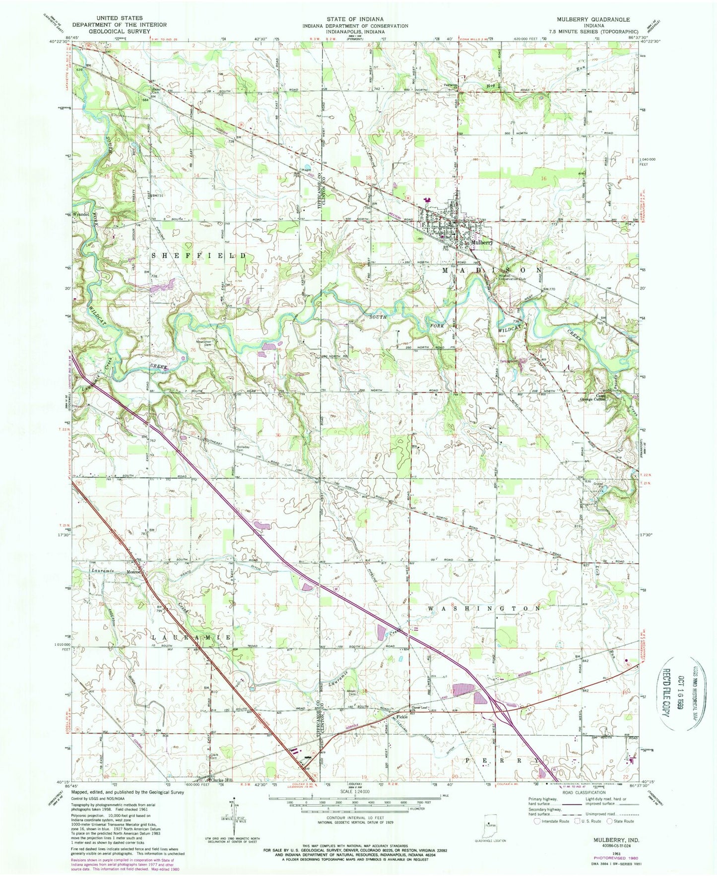
Classic USGS Mulberry Indiana 7.5'x7.5' Topo Map
Couldn't load pickup availability
Historical USGS topographic quad map of Mulberry in the state of Indiana. Map scale may vary for some years, but is generally around 1:24,000. Print size is approximately 24" x 27"
This quadrangle is in the following counties: Clinton, Tippecanoe.
The map contains contour lines, roads, rivers, towns, and lakes. Printed on high-quality waterproof paper with UV fade-resistant inks, and shipped rolled.
Contains the following named places: Abbot Cemetery, Anderson Ditch, Baker Cemetery, Camp George Cullom, Clark Cemetery, Clover Leaf Church, Deer Run Creek, Fairhaven Church, Fickle, Hentz Ditch, Holladay Cemetery, Lauramie Creek, Madison Township Volunteer Fire Department, McClellan Fickle Ditch, Miller Field, Monroe, Mulberry, Mulberry Elementary School, Mulberry Post Office, Mulberry Town Marshal, Newcomer Cemetery, Rutan Farms Lake, Rutan Farms Lake Dam, Spring Creek, Town of Mulberry, Township of Madison, Wildcat Conservation Club, Wyandot, ZIP Code: 46058