
MyTopo
Classic USGS Mulberry Mississippi 7.5'x7.5' Topo Map
Couldn't load pickup availability
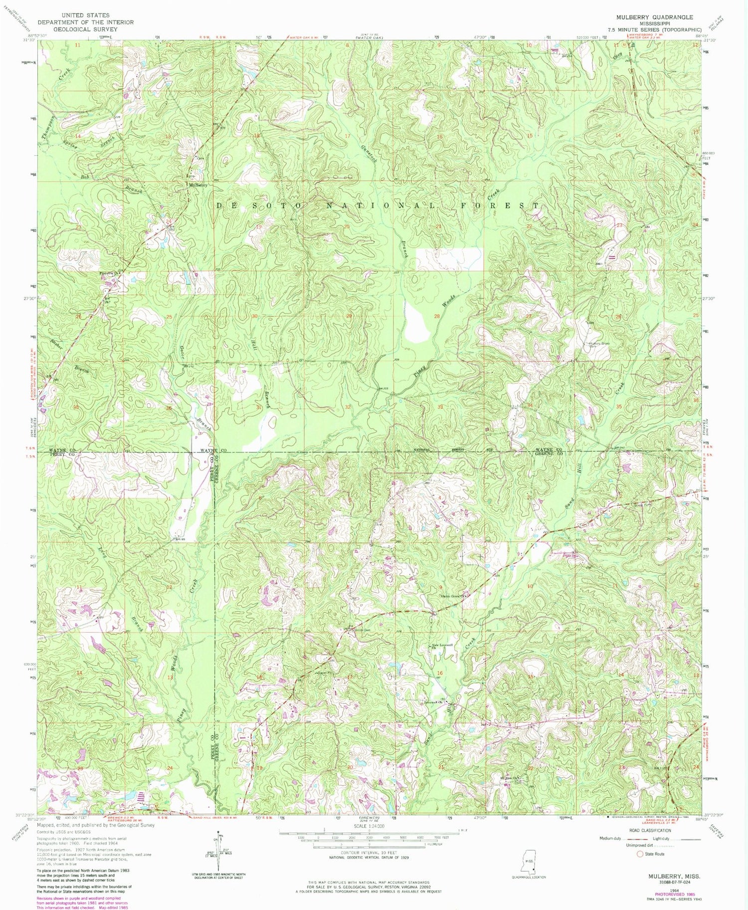
Historical USGS topographic quad map of Mulberry in the state of Mississippi. Map scale may vary for some years, but is generally around 1:24,000. Print size is approximately 24" x 27"
This quadrangle is in the following counties: Greene, Perry, Wayne.
The map contains contour lines, roads, rivers, towns, and lakes. Printed on high-quality waterproof paper with UV fade-resistant inks, and shipped rolled.
Contains the following named places: Fellowship Free Will Baptist Church, Gator Branch, Gunstock Branch, Hall Branch, Henderson, Hickory Grove Cemetery, J R Stinson Lake Dam, Lovewell Church, Mohlenoff Pond Dam, Mount Zion Cemetery, Mount Zion Church, Mulberry, Mulberry Cemetery, Mulberry Church, New Lovewell Church, Okey Branch, Pineview Church, Spring Branch, Union Cemetery, Union Grove Church, Union School, Wayne County Volunteer Fire Department Mulberry - Corinth Station, ZIP Code: 39476


