MyTopo
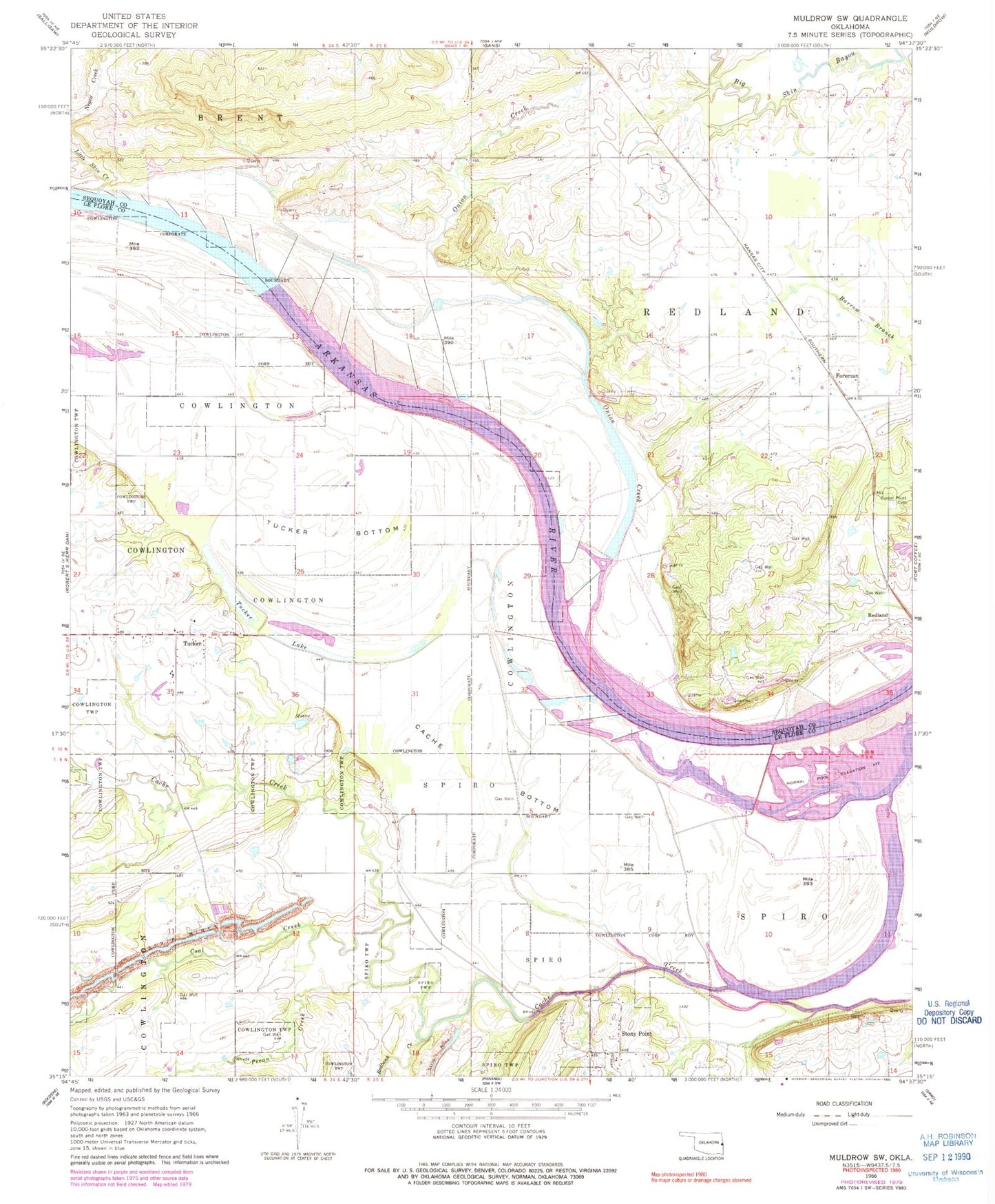
Classic USGS Muldrow SW Oklahoma 7.5'x7.5' Topo Map
Couldn't load pickup availability
Historical USGS topographic quad map of Muldrow SW in the state of Oklahoma. Map scale may vary for some years, but is generally around 1:24,000. Print size is approximately 24" x 27"
This quadrangle is in the following counties: Le Flore, Sequoyah.
The map contains contour lines, roads, rivers, towns, and lakes. Printed on high-quality waterproof paper with UV fade-resistant inks, and shipped rolled.
Contains the following named places: Cache Bottom, Cache Creek, Center Point Cemetery, Coal Creek, Cowlington, Foreman, Little Skin Creek, Onion Creek, Pecan Creek, Redbank Creek, Redland Cemetery, Redland Fire Department, Spiro Division, Stony Point, Township of Redland, Township of Spiro, Tucker, Tucker Bottom, Tucker Lake