MyTopo
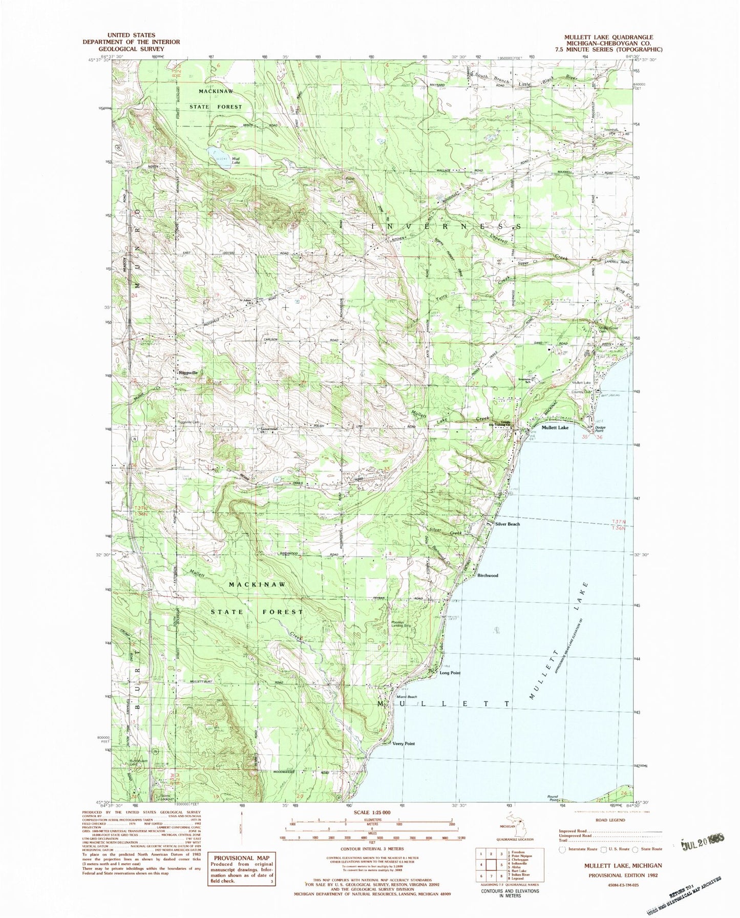
Classic USGS Mullett Lake Michigan 7.5'x7.5' Topo Map
Couldn't load pickup availability
Historical USGS topographic quad map of Mullett Lake in the state of Michigan. Map scale may vary for some years, but is generally around 1:24,000. Print size is approximately 24" x 27"
This quadrangle is in the following counties: Cheboygan.
The map contains contour lines, roads, rivers, towns, and lakes. Printed on high-quality waterproof paper with UV fade-resistant inks, and shipped rolled.
Contains the following named places: African - American Cemetery, Birchwood, Birchwood Creek, Birchwood School, Burt Cemetery, Cheboygan County Dry Training Center, Church of Christ Restored, Dodge Point, Inverness School, Long Point, Longpoint Post Office, Longpoint Station, Maple Grove Cemetery, Miami Beach, Mount Calvary Polish Cemetery, Mud Lake, Mullett Creek, Mullett Lake, Mullett Lake Country Club, Mullett Lake Creek, Mullett Lake Post Office, Passino School, Pbeaaye Airport, Polish Cemetery, Riggsville, Riggsville Cemetery, Riggsville Post Office, Round Point, Sacred Heart Church, Saint John Church, Saint John's German Lutheran Cemetery, School 1 North, School 1 South, Silver Beach, Silver Creek, Sipper Creek, Tallman School, Terry Creek, Topinabee Rest Area, Township of Inverness, Township of Mullett, Veery Point