MyTopo
Classic USGS Mulvane Kansas 7.5'x7.5' Topo Map
Couldn't load pickup availability
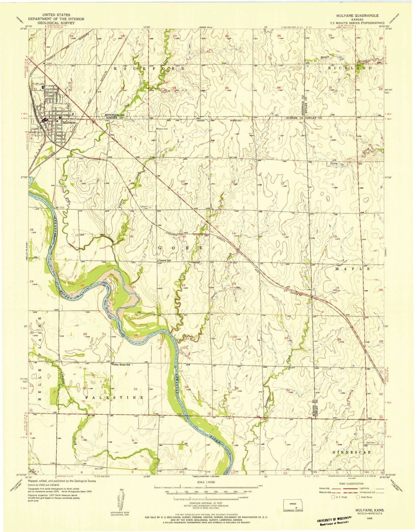
Historical USGS topographic quad map of Mulvane in the state of Kansas. Map scale may vary for some years, but is generally around 1:24,000. Print size is approximately 24" x 27"
This quadrangle is in the following counties: Butler, Cowley, Sedgwick, Sumner.
The map contains contour lines, roads, rivers, towns, and lakes. Printed on high-quality waterproof paper with UV fade-resistant inks, and shipped rolled.
Contains the following named places: Antelope Creek, Assembly of God Church, Belle Plaine Farms Airport, Bitter Creek, Central School, Church of Christ of Mulvane, City of Mulvane, College Hill Church of Christ, Dog Creek, First Baptist Church, Grand Prairie School, Island, Littleton Cemetery, Living Word Christian Church, Maria Court Assisted Living Facility, Mulvane, Mulvane Academy Charter School, Mulvane Brethren Church, Mulvane Cemetery, Mulvane Christian Church, Mulvane City Building, Mulvane Emergency Services, Mulvane First Church of the Nazarene, Mulvane Grade School, Mulvane Historical Museum, Mulvane Intermediate School, Mulvane Middle School, Mulvane Mobile Home Park, Mulvane Municipal Power Plant, Mulvane Police Department, Mulvane Post Office, Mulvane Public Library, Mulvane Recreation Center, Mulvane Senior Citizens Center, Mulvane Sports Complex, Mulvane United Methodist Church, Our Savior Lutheran Church, Rogers Airport, Saint Michaels Catholic Church, Sedgwick County Rural Water District 3 Water Tower, Short Creek, Township of Gore, Turner Creek, Udall Cemetery, Valley Home School, W.D. Munson Primary School, ZIP Code: 67110