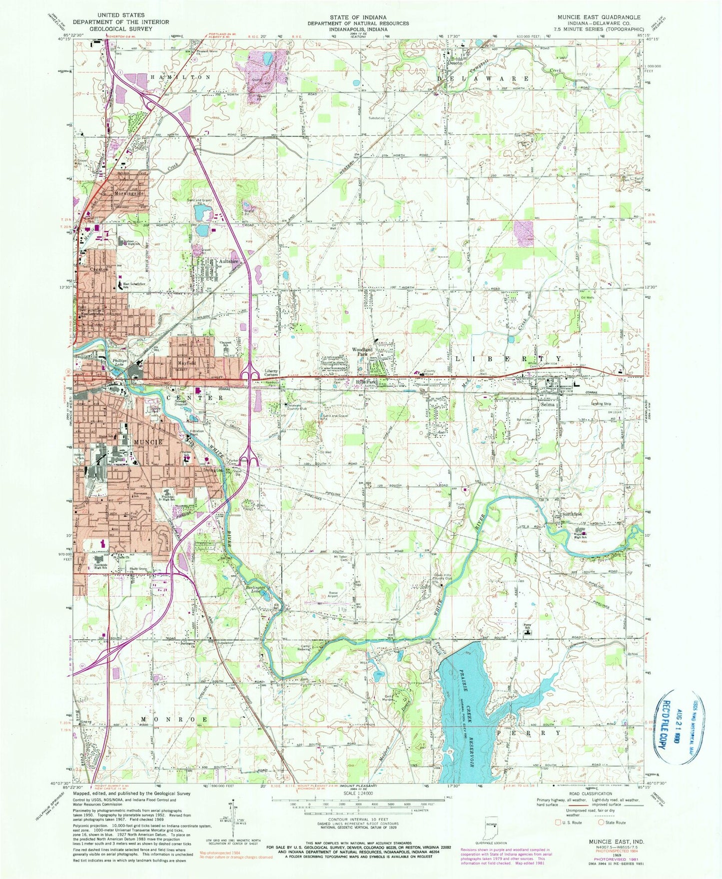
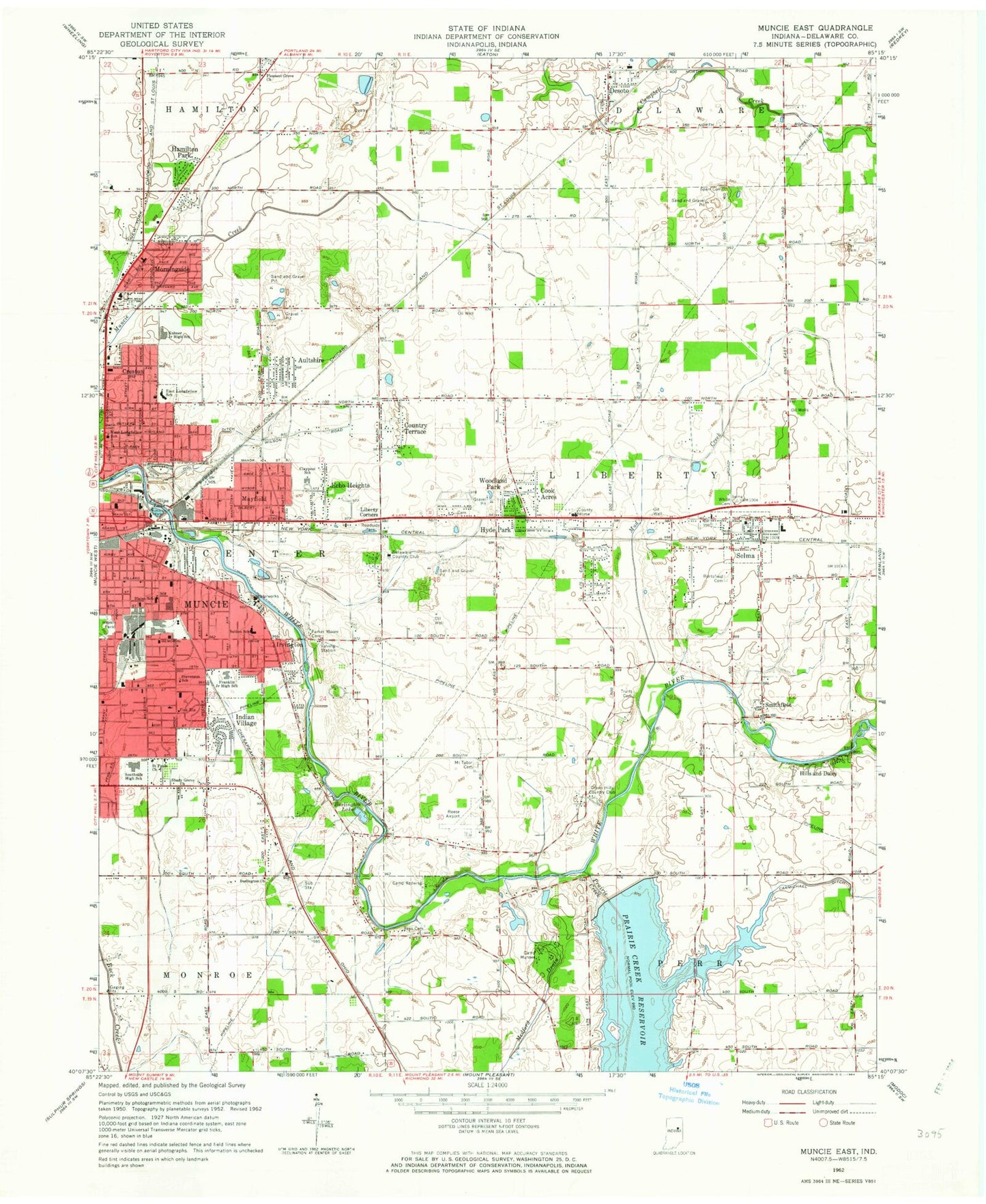
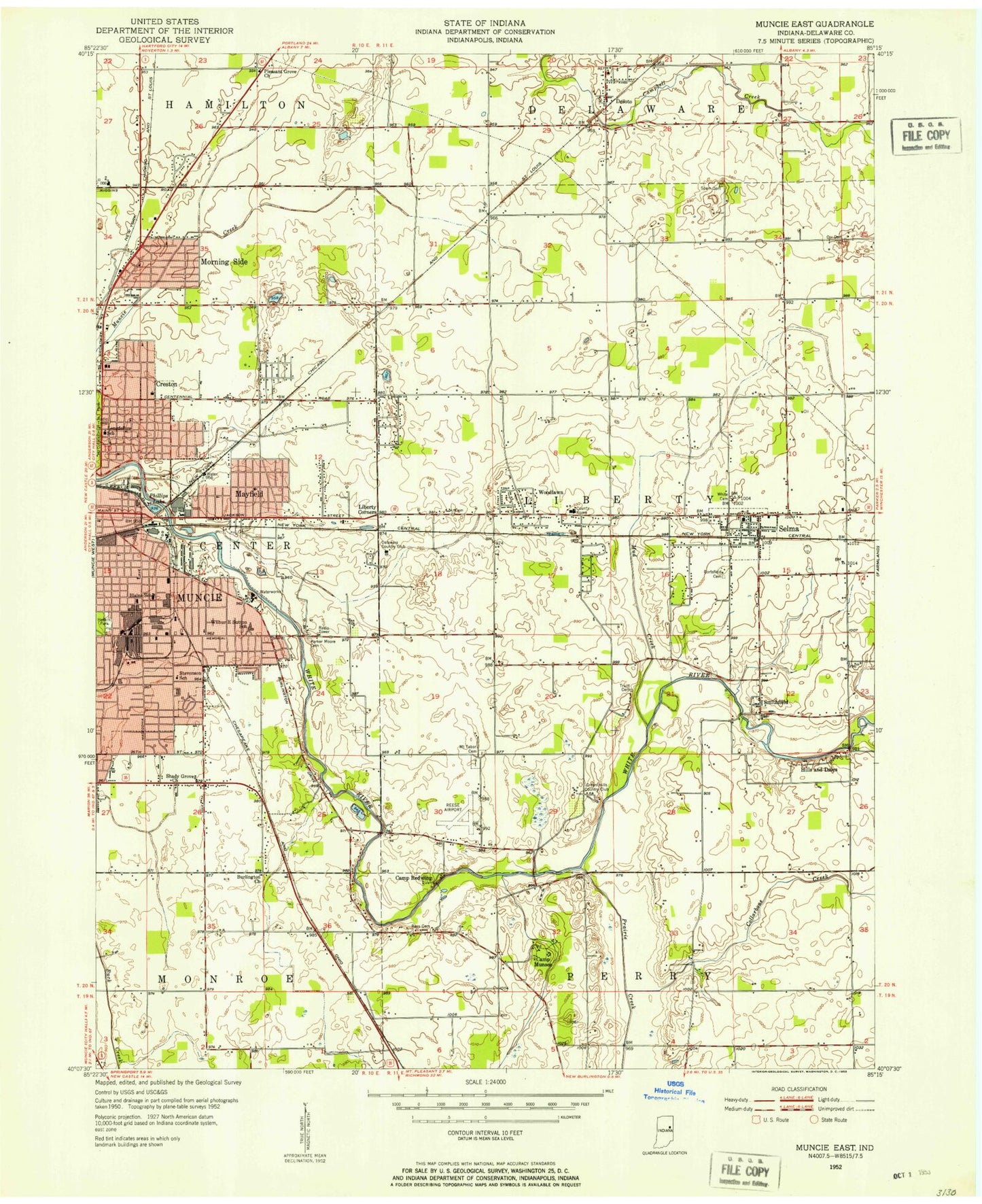
MyTopo
Classic USGS Muncie East Indiana 7.5'x7.5' Topo Map
Couldn't load pickup availability
Historical USGS topographic quad map of Muncie East in the state of Indiana. Map scale may vary for some years, but is generally around 1:24,000. Print size is approximately 24" x 27"
This quadrangle is in the following counties: Delaware.
The map contains contour lines, roads, rivers, towns, and lakes. Printed on high-quality waterproof paper with UV fade-resistant inks, and shipped rolled.
Contains the following named places: Aultshire, Benjamin Franklin Middle School, Blaine School, Bortsfield Cemetery, Burlington Church, Burlington Lake, Camp Munsee, Camp Redwing, Carmichael Ditch, Claypool Elementary School, Creston, Delaware Country Club, Desoto, Graham National Cemetery, Green Hills Country Club, Hamilton Ditch, Holt Ditch, Hyde Park, Irving Brothers Stone and Gravel Pit, Irvington, Kuhner Junior High School, Liberty Corners, Liberty Township Volunteer Fire Department, Longfellow Elementary School, Mayfield, McCullouch Park, Medford Drain, Morningside, Mount Tabor Cemetery, Mud Creek, Orr Cemetery, Parker Moore Cemetery, Perry Elementary School, Phillips Lake, Pleasant Grove Church, Prairie Creek, Prairie Creek Reservoir Dam, Reese Airport, Riverview Park, Saint Pauls Church, Selma, Selma Airport, Selma Elementary School, Selma Middle School, Selma Police Department, Selma Post Office, Shady Grove Church, Smithfield, Southside Senior High School, Sparr Cemetery, Stevenson School, Sutton Elementary School, Town of Selma, Township of Liberty, Truitt Cemetery, Truitt Ditch, Wapahani High School, West Longfellow School, White Cemetery, Woodland Park, ZIP Code: 47383