MyTopo
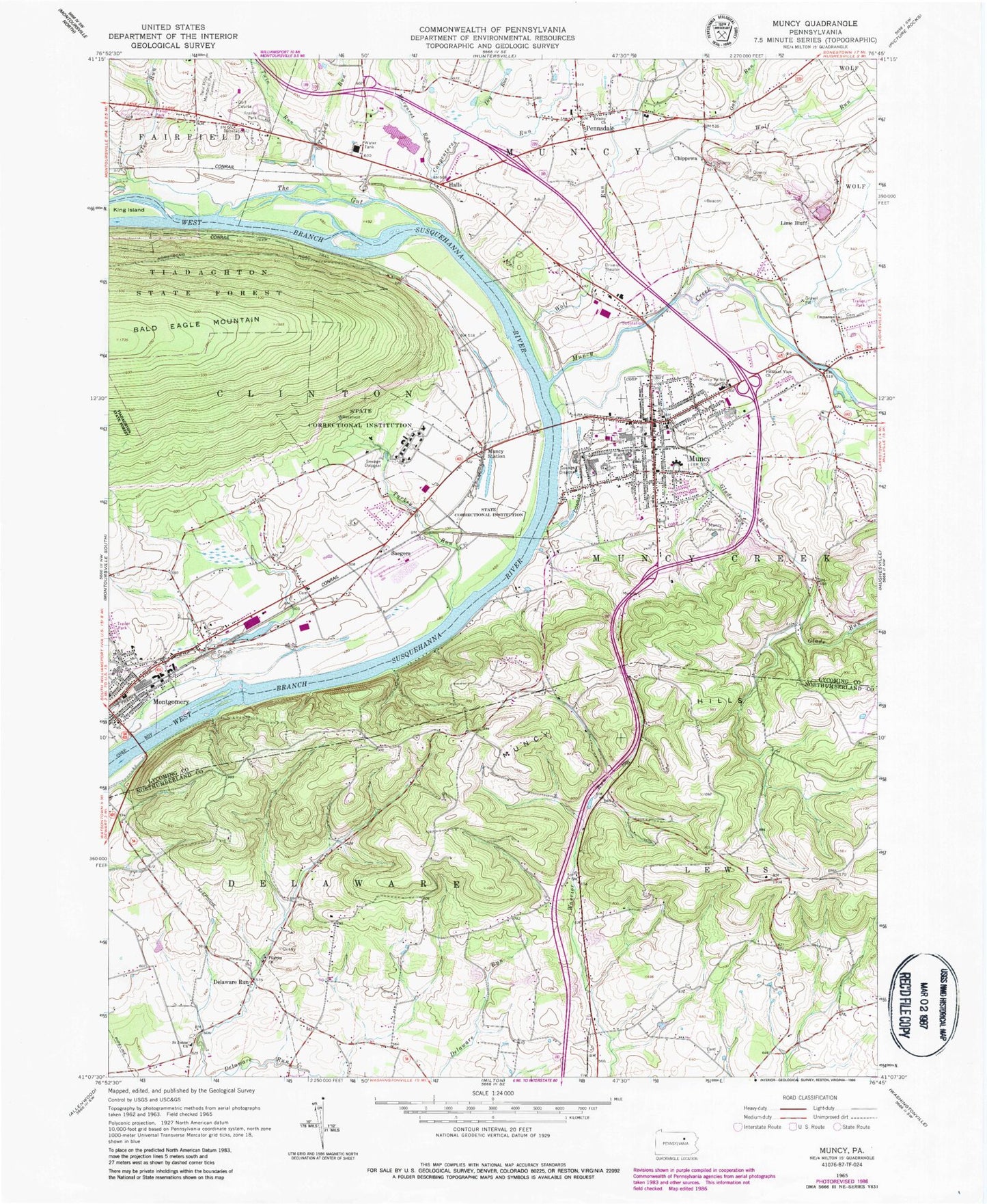
Classic USGS Muncy Pennsylvania 7.5'x7.5' Topo Map
Couldn't load pickup availability
Historical USGS topographic quad map of Muncy in the state of Pennsylvania. Map scale may vary for some years, but is generally around 1:24,000. Print size is approximately 24" x 27"
This quadrangle is in the following counties: Lycoming, Northumberland.
The map contains contour lines, roads, rivers, towns, and lakes. Printed on high-quality waterproof paper with UV fade-resistant inks, and shipped rolled.
Contains the following named places: Borough of Montgomery, Borough of Muncy, Carpenters Run, Chippewa, Clinton Baptist Church Cemetery, Davis School, Delaware Run, Dividing Ridge School, Dry Run, Fairview School, Friends Meeting House Cemetery, Glade Run, Glade Run School, Hall Station Cemetery, Halls, Halls Station, Hey Field, Hill Burial Grounds, Immanuel Church, Immanuel Lutheran Cemetery, King Island, Lime Bluff, Lime Bluff Quarry, Margaret Run, Mountain School, Muncy, Muncy Area Volunteer Fire Company Station 23, Muncy Borough Police Department, Muncy Cemetery, Muncy Industrial Home for Women, Muncy Post Office, Muncy Reservoir, Muncy Station, Muncy Valley Hospital, Oak Run, Pennsdale, Pennsdale Volunteer Fire Department, Pilgrim Church, Pleasant View Church, Road School, Saegers, Saint James Episcopal Cemetery, Saint Johns Church, Saint Johns Lutheran - Brick Church Cemetery, State Correctional Institution Muncy, Stony Batter School, Township of Muncy Creek, Trinity Church, Tules Run, Turkey Run, Twin Hills Memorial Park, Twin Run, Warrior School, West Point School, Wolf Run