
MyTopo
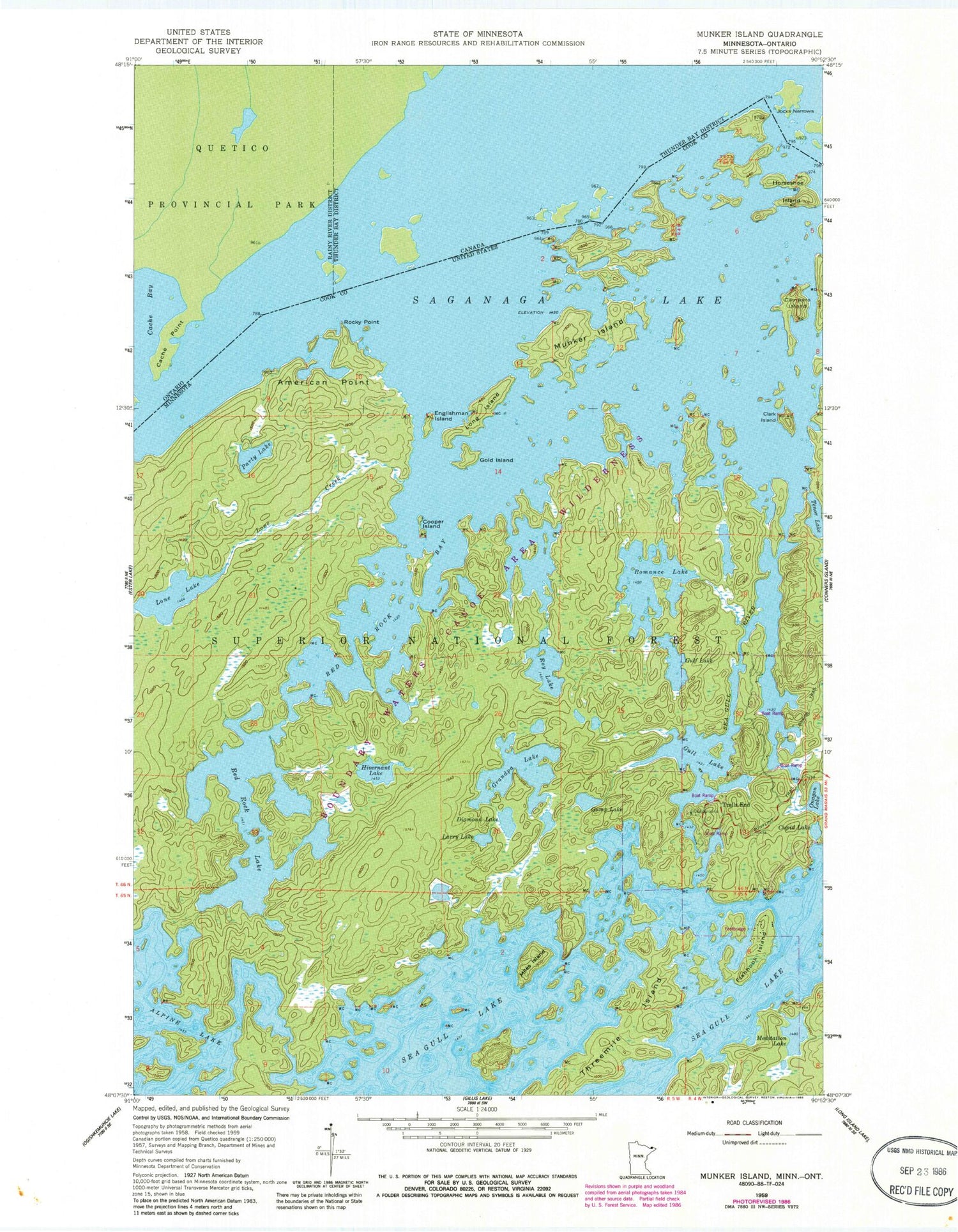
Classic USGS Munker Island Minnesota 7.5'x7.5' Topo Map
Couldn't load pickup availability
Historical USGS topographic quad map of Munker Island in the state of Minnesota. Typical map scale is 1:24,000, but may vary for certain years, if available. Print size: 24" x 27"
This quadrangle is in the following counties: Cook.
The map contains contour lines, roads, rivers, towns, and lakes. Printed on high-quality waterproof paper with UV fade-resistant inks, and shipped rolled.
Contains the following named places: Clark Island, Alpine Lake, American Point, Campers Island, Cooper Island, Cupid Lake, Diamond Lake, Englishman Island, Fishhook Island, Gold Island, Grandpa Lake, Gulf Lake, Gull Lake, Gump Lake, Hivernant Lake, Horseshoe Island, Larry Lake, Lone Creek, Lone Lake, Long Island, Meditation Lake, Miles Island, Munker Island, Onagon Lake, Party Lake, Red Rock Bay, Red Rock Lake, Rocky Point, Romance Lake, Roy Lake, Saganaga Lake, Sea Gull Lake, Sea Gull River, Tenor Lake, Threemile Island, Trails End, Sea Gull River Boat Landing, Jocks Narrows


