MyTopo
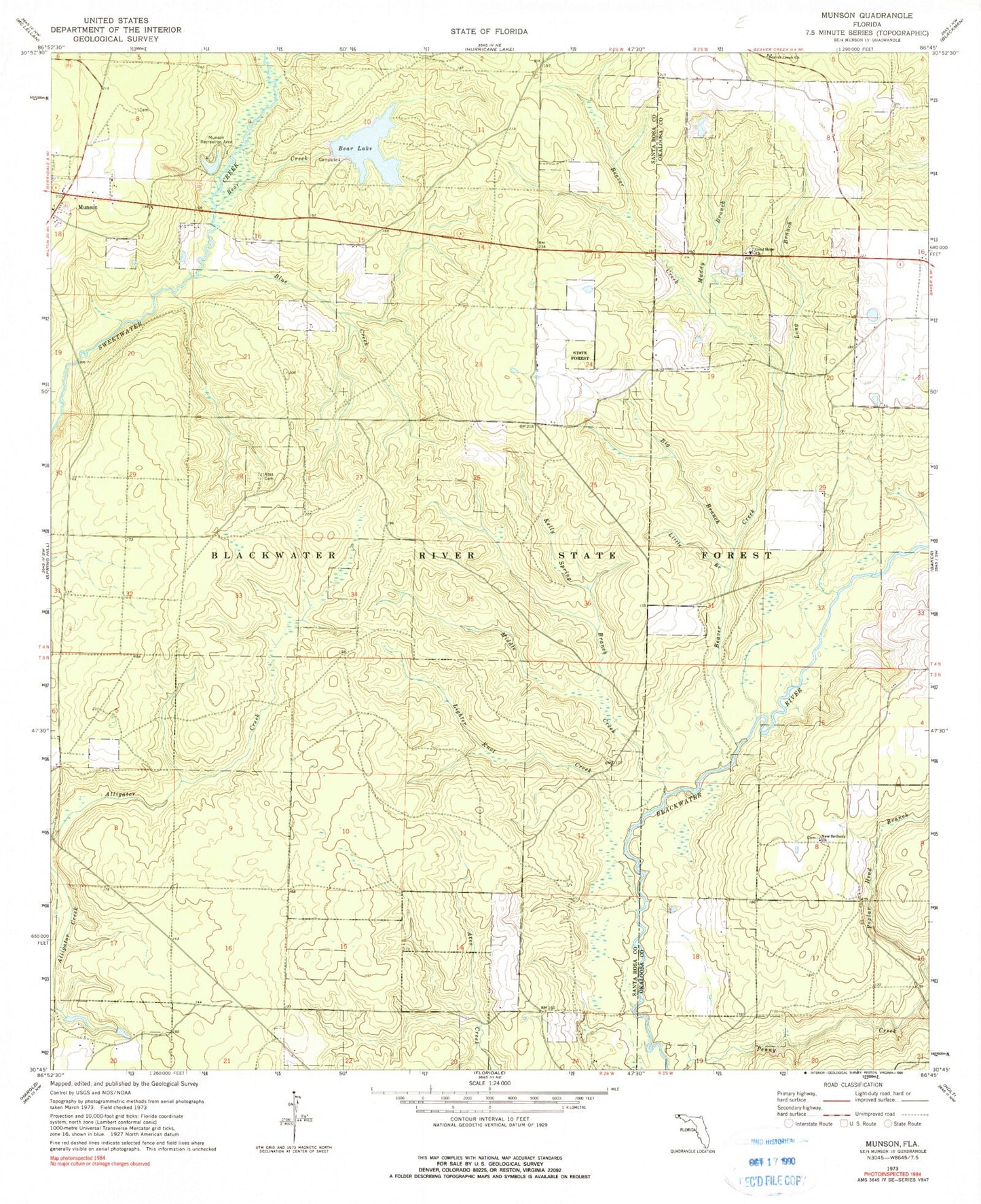
Classic USGS Munson Florida 7.5'x7.5' Topo Map
Couldn't load pickup availability
Historical USGS topographic quad map of Munson in the state of Florida. Typical map scale is 1:24,000, but may vary for certain years, if available. Print size: 24" x 27"
This quadrangle is in the following counties: Okaloosa, Santa Rosa.
The map contains contour lines, roads, rivers, towns, and lakes. Printed on high-quality waterproof paper with UV fade-resistant inks, and shipped rolled.
Contains the following named places: Ates Cemetery, Bear Creek, Bear Lake, Beaver Creek Church, Big Branch Beaver Creek, Blue Creek, Good Hope Church, Kelly Spring Branch, Lighter Knot Creek, Little Branch Beaver Creek, Long Branch, Middle Creek, Muddy Branch, Munson Recreation Area, New Bethany Church, Poplar Head Branch, Munson, Lake Munson, Martins Mill Pond (historical), Beaver Creek, Blackwater Wildlife Management Area, Munson Volunteer Fire Department District 19 Station 1