MyTopo
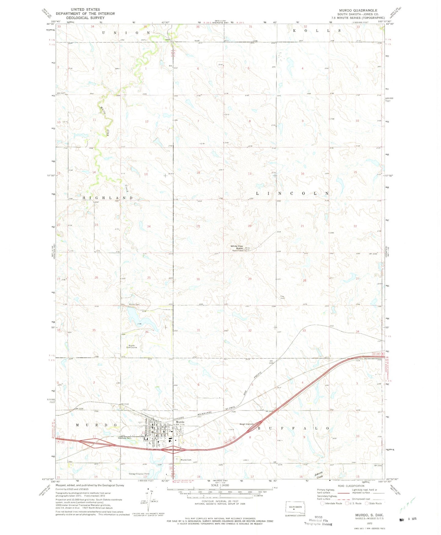
Classic USGS Murdo South Dakota 7.5'x7.5' Topo Map
Couldn't load pickup availability
Historical USGS topographic quad map of Murdo in the state of South Dakota. Map scale may vary for some years, but is generally around 1:24,000. Print size is approximately 24" x 27"
This quadrangle is in the following counties: Jones.
The map contains contour lines, roads, rivers, towns, and lakes. Printed on high-quality waterproof paper with UV fade-resistant inks, and shipped rolled.
Contains the following named places: Chambliss Number 1 Dam, City of Murdo, City of Murdo Number 2 Dam, Foster Number 1 Dam, Foster Number 2 Dam, Foster Number 3 Dam, Iversen Number 1 Dam, Iversen Number 2 Dam, Iversen Number 3 Dam, Iversen Number 5 Dam, Jones County, Jones County Ambulance Service, Jones County Courthouse, Jones County Elementary School, Jones County High School, Jones County Middle School, Jones County Sheriff's Office, King Number 1 Dam, Louder Number 1 Dam, Louder Number 4 Dam, Murdo, Murdo Auditorium, Murdo Cemetery, Murdo City Hall, Murdo Dam, Murdo Fire Department, Murdo Golf Course, Murdo Police Department, Murdo Post Office, Pratt County, Reynolds Number 1 Dam, Reynolds Number 2 Dam, Township of Lincoln, Unorganized Territory of Central Jones, White Clay Butte, ZIP Code: 57559