MyTopo
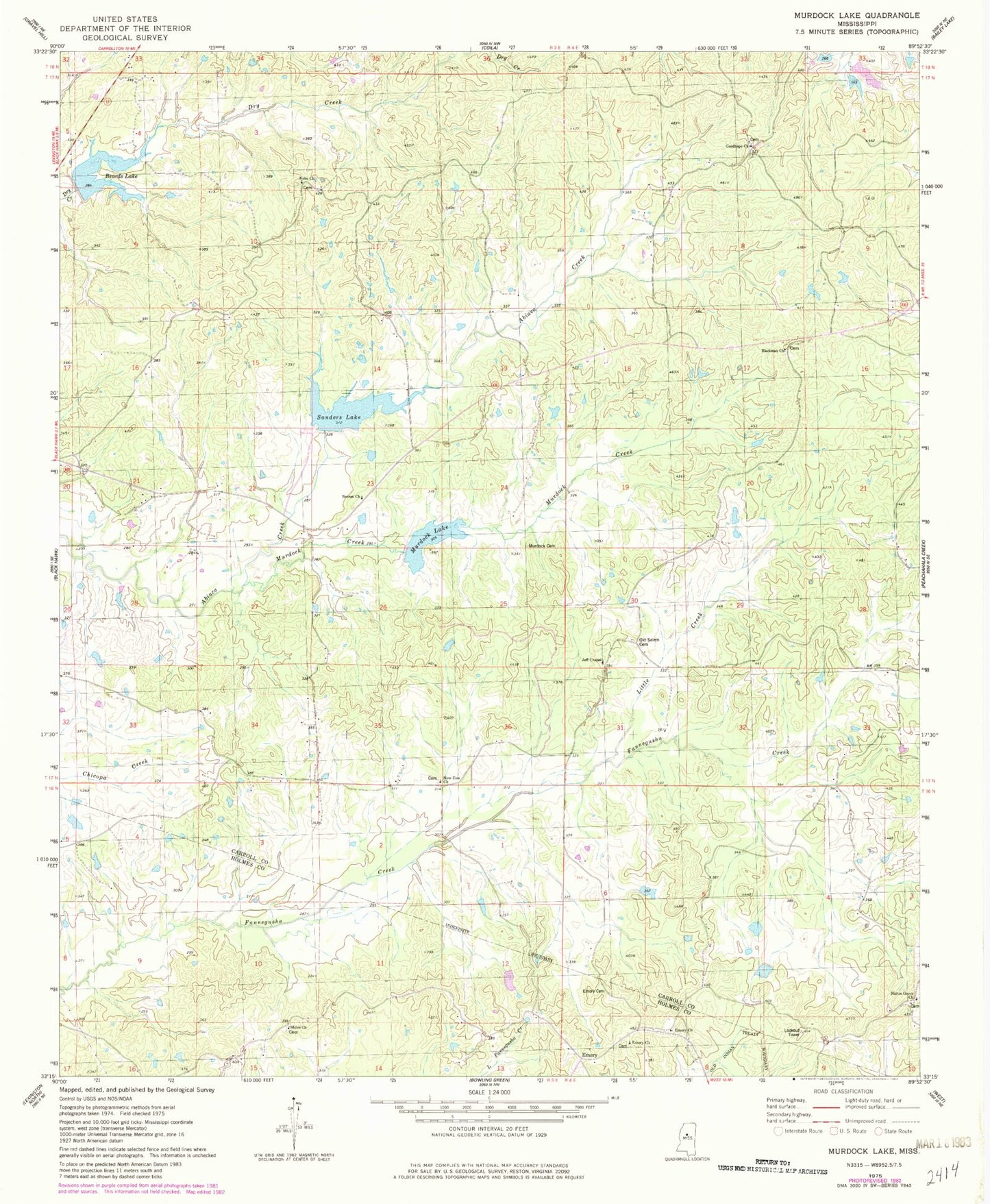
Classic USGS Murdock Lake Mississippi 7.5'x7.5' Topo Map
Couldn't load pickup availability
Historical USGS topographic quad map of Murdock Lake in the state of Mississippi. Map scale may vary for some years, but is generally around 1:24,000. Print size is approximately 24" x 27"
This quadrangle is in the following counties: Carroll, Holmes.
The map contains contour lines, roads, rivers, towns, and lakes. Printed on high-quality waterproof paper with UV fade-resistant inks, and shipped rolled.
Contains the following named places: Abiaca Watershed Y-34-8, Abiaca Watershed Y-34-9 Dam, Beards Lake, Bennet Church, Blackman Church, Blackmonton, Chun Corner, Emory, Emory Cemetery, Emory Church, Goodhope Church, Jeff Chapel, Little Creek, Martin Grove Cemetery, Martin Grove Church, Murdock Cemetery, Murdock Creek, Murdock Lake, Nebo Church, New Zion Church, Old Salem Cemetery, Reeves Cemetery, Sanders Lake, Shiloh Church