MyTopo
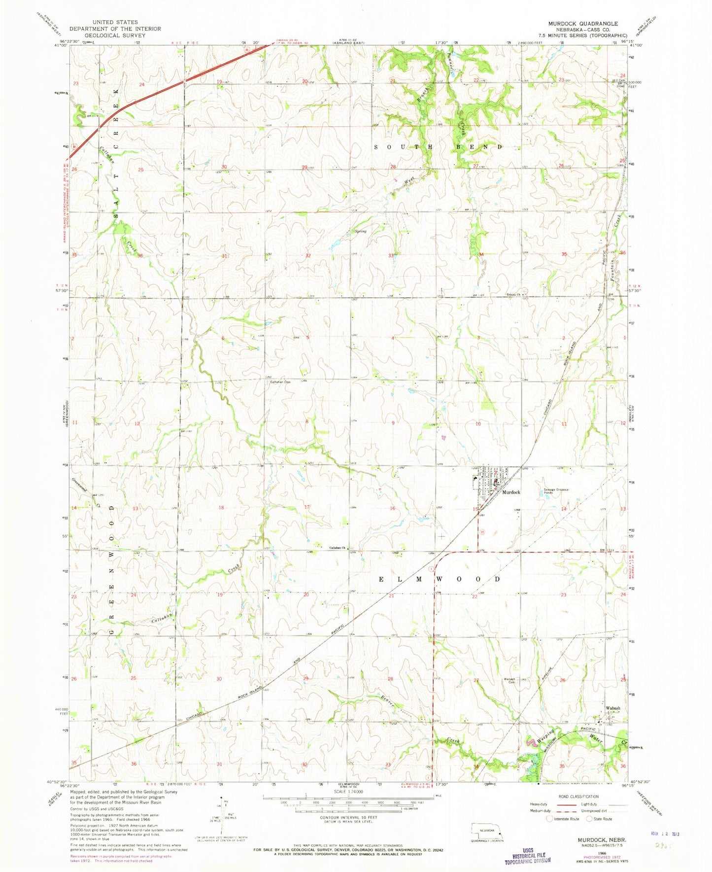
Classic USGS Murdock Nebraska 7.5'x7.5' Topo Map
Couldn't load pickup availability
Historical USGS topographic quad map of Murdock in the state of Nebraska. Map scale may vary for some years, but is generally around 1:24,000. Print size is approximately 24" x 27"
This quadrangle is in the following counties: Cass.
The map contains contour lines, roads, rivers, towns, and lakes. Printed on high-quality waterproof paper with UV fade-resistant inks, and shipped rolled.
Contains the following named places: Beaver Creek, Callahan Cemetery, Callahan Church, Elmwood Election Precinct, Elmwood-Murdock Junior-Senior High School, Fountain Creek, Grandpas Woods Camping, Grandpas Woods Golf Course, Greenwood Farmers Cooperative Elevator, Hill Cemetery, Murdock, Murdock Fire Department, Murdock Post Office, Pawnee Lake, South Bend Election Precinct, Township of Elmwood, Township of South Bend, Trinity Church, United Methodist Church, Village of Murdock, Wabash, Wabash Cemetery, Wabash Post Office, Wabash School, West Branch, Wiles Dam, ZIP Code: 68407