MyTopo
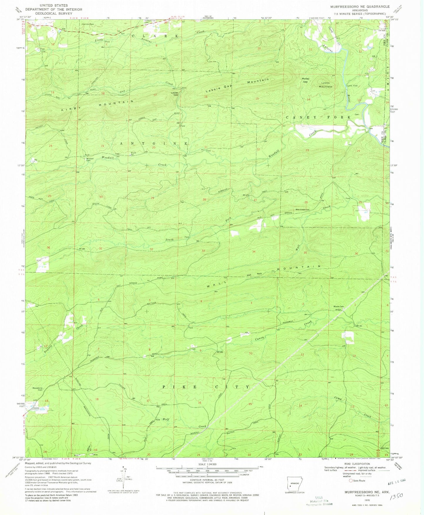
Classic USGS Murfreesboro NE Arkansas 7.5'x7.5' Topo Map
Couldn't load pickup availability
Historical USGS topographic quad map of Murfreesboro NE in the state of Arkansas. Map scale may vary for some years, but is generally around 1:24,000. Print size is approximately 24" x 27"
This quadrangle is in the following counties: Clark, Pike.
The map contains contour lines, roads, rivers, towns, and lakes. Printed on high-quality waterproof paper with UV fade-resistant inks, and shipped rolled.
Contains the following named places: Anderson, Caney Creek, Elk, Gap Creek, Hannon Cemetery, Kirby Mountain, Lassie Gap, Lassie Gap Mountain, Lissie, Lyons Ford, Lyons Mountain, Macedonia Cemetery, Motley Gap, Rabell, South Fork Woodall Creek, Sparks Cemetery, Stevensons Camp, Township of Antoine, Township of Caney Fork, Township of Pike City, Valley Grove Cemetery, Wall Creek Cemetery, Wall Mountain, Wall Rock, Woodall Cemetery, Woodall Creek, Woods Cemetery, Wright