MyTopo
Classic USGS Murphy Hot Springs Idaho 7.5'x7.5' Topo Map
Regular price
$16.95
Regular price
Sale price
$16.95
Unit price
per
Couldn't load pickup availability
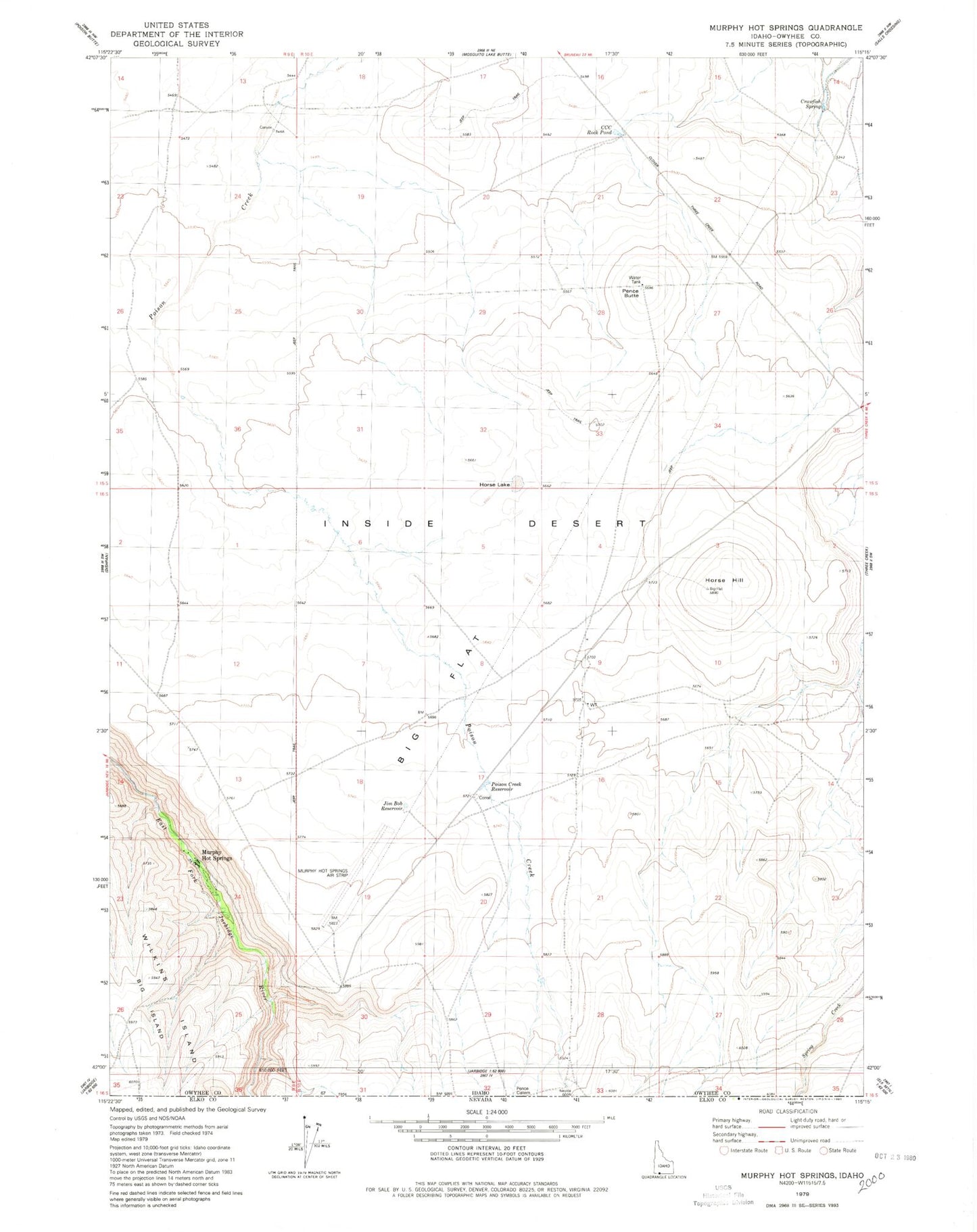
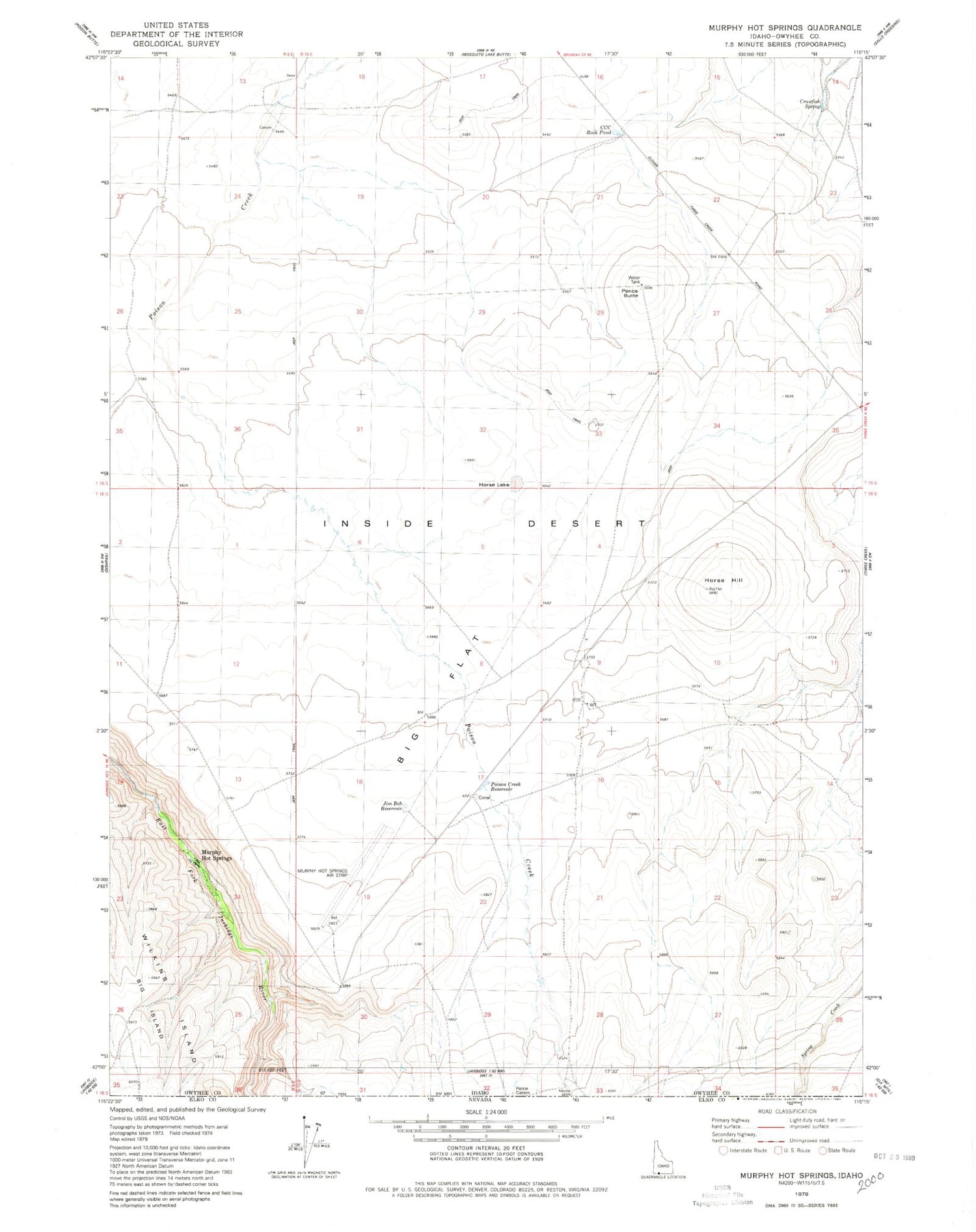
Historical USGS topographic quad map of Murphy Hot Springs in the state of Idaho. Map scale may vary for some years, but is generally around 1:24,000. Print size is approximately 24" x 27"
This quadrangle is in the following counties: Owyhee.
The map contains contour lines, roads, rivers, towns, and lakes. Printed on high-quality waterproof paper with UV fade-resistant inks, and shipped rolled.
Contains the following named places: Big Flat, CCC Rock Pond, Crawfish Spring, Horse Hill, Horse Lake, Jim Bob Reservoir, Murphy Hot Springs, Murphy Hot Springs Airport, Pence Butte, Poison Creek Reservoir