MyTopo
Classic USGS Murray Arkansas 7.5'x7.5' Topo Map
Couldn't load pickup availability
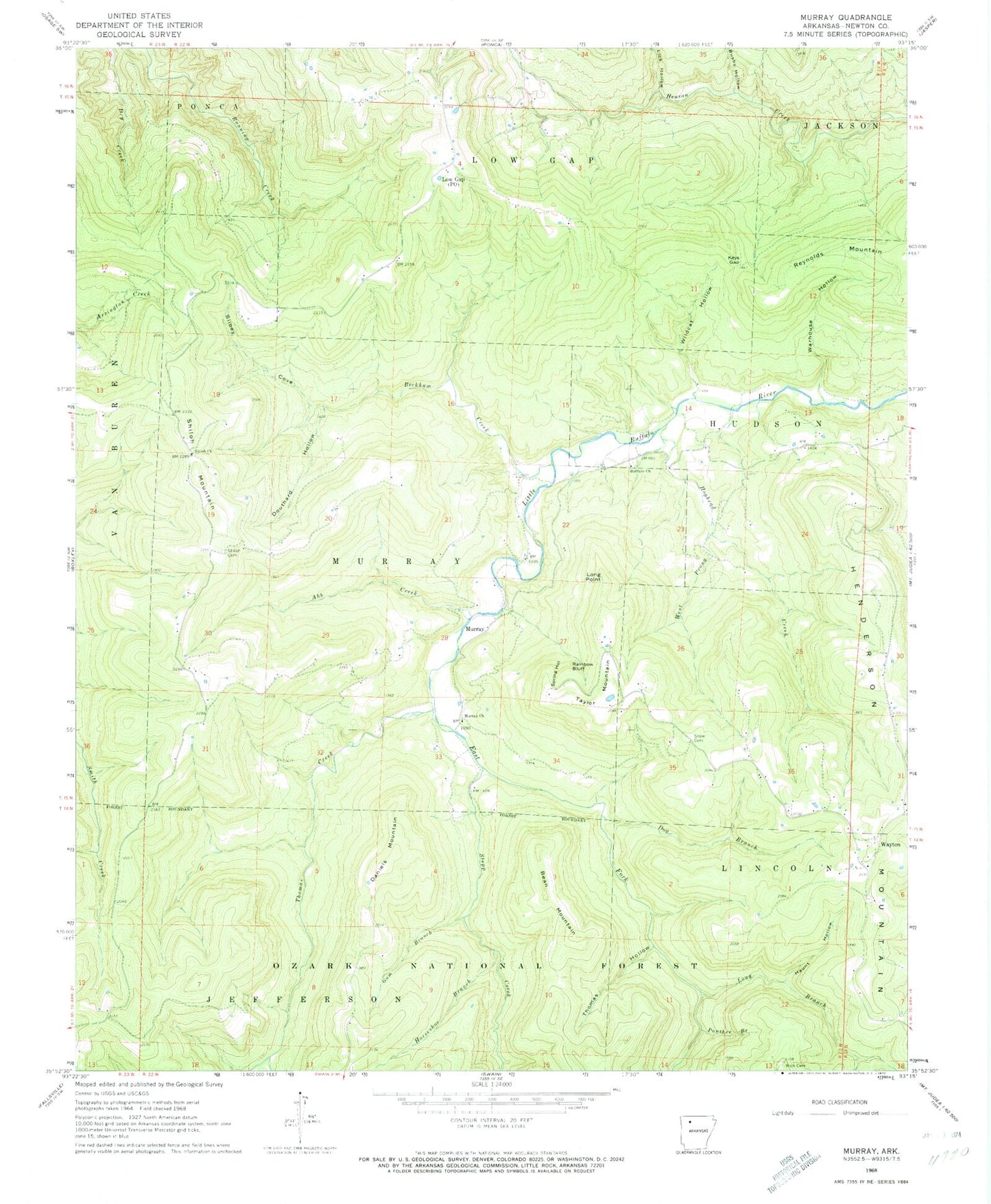
Historical USGS topographic quad map of Murray in the state of Arkansas. Typical map scale is 1:24,000, but may vary for certain years, if available. Print size: 24" x 27"
This quadrangle is in the following counties: Newton.
The map contains contour lines, roads, rivers, towns, and lakes. Printed on high-quality waterproof paper with UV fade-resistant inks, and shipped rolled.
Contains the following named places: Township of Lincoln, Township of Murray, Murray School (historical), Shiloh, Shiloh School (historical), Wayton School (historical), Abb Creek, Bean Mountain, Beckham Creek, Buffalo Church, Busby Hollow, Daniels Mountain, Dog Branch, Douthard Hollow, Dry Creek, East Fork Little Buffalo River, Gum Branch, Haunt Hollow, Hoghead Creek, Horseshoe Branch, Keys Gap, Lick Hollow, Long Branch, Long Point, Low Gap, Murray, Murray Church, Panther Branch, Rainbow Bluff, Reynolds Mountain, Shiloh Cemetery, Shiloh Mountain, Silbey Cove, Snow Cemetery, Spring Hollow, Stepp Creek, Taylor Mountain, Thomas Creek, Thomas Hollow, Warhouse Hollow, Wayton, West Prong Hoghead Creek, Wildcat Hollow, Rich Cemetery, Shiloh Primitive Baptist Church, Mount Sherman Volunteer Fire Department Shiloh Substation, Parthenon Volunteer Fire Wayton Substation, Taylor's Air Strip (historical), Wayton Census Designated Place