MyTopo
Classic USGS Muskallonge Lake SW Michigan 7.5'x7.5' Topo Map
Couldn't load pickup availability
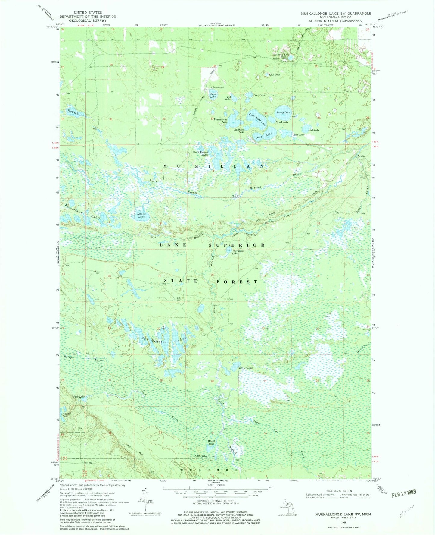
Historical USGS topographic quad map of Muskallonge Lake SW in the state of Michigan. Typical map scale is 1:24,000, but may vary for certain years, if available. Print size: 24" x 27"
This quadrangle is in the following counties: Luce.
The map contains contour lines, roads, rivers, towns, and lakes. Printed on high-quality waterproof paper with UV fade-resistant inks, and shipped rolled.
Contains the following named places: Beaver Lake, Beaverhouse Lake, Beavertown Lakes, Bob Lake, Brush Lake, Bullhead Lake, Camp Eight Lake, Camp One Creek, Dairy Creek, Deer Lake, Evergreen Lake, Holland Lake, Jack Creek, Jack Lake, Johns Creek, Kilp Lake, Ladue Lake, Little Whorl Lake, Long Lake, North Branch Lakes, North Branch Two Hearted River, Otter Lake, Pratt Lake, Pretty Lake, Sid Lake, South Branch Two Hearted River, Tank Lake, Two Hearted Lakes, West Branch Two Hearted River, Whorl Lake, Lookout Tower Campground, Pretty Lake State Forest Campground, Holland Lake State Forest Campground, Pratt Lake Campground