MyTopo
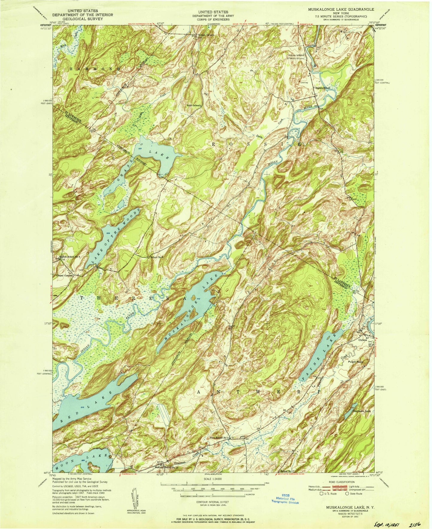
Classic USGS Muskellunge Lake New York 7.5'x7.5' Topo Map
Couldn't load pickup availability
Historical USGS topographic quad map of Muskellunge Lake in the state of New York. Map scale may vary for some years, but is generally around 1:24,000. Print size is approximately 24" x 27"
This quadrangle is in the following counties: Jefferson, St. Lawrence.
The map contains contour lines, roads, rivers, towns, and lakes. Printed on high-quality waterproof paper with UV fade-resistant inks, and shipped rolled.
Contains the following named places: Bartletts Corner, Big Bass Bay, Big Island, Chapel Corners, Dodds Creek, Elephants Foot, Grass Lake, Hanson Bridge, Honey Hill, Indian Bay, Lake of the Woods, Little Island, Little Sand Bay, Lucky Bay, Moon Lake, Muskellunge Lake, Muskellunge Point, Nelson Corner, Oscars Bay, Oxbow Census Designated Place, Payne Lake, Pulpit Rock, Rapids School, Red Lake, Riverside Cemetery, Robb School, Saint Patricks Cemetery, School Number 17, School Number 19, School Number 4, School Number 6, School Number 8, Sherman Lake, Town of Rossie, Zekes Bay