MyTopo
Classic USGS Muskhog Mountain Arizona 7.5'x7.5' Topo Map
Regular price
$16.95
Regular price
Sale price
$16.95
Unit price
per
Couldn't load pickup availability
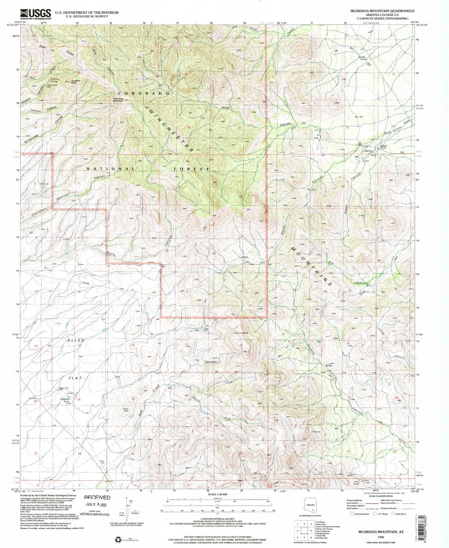
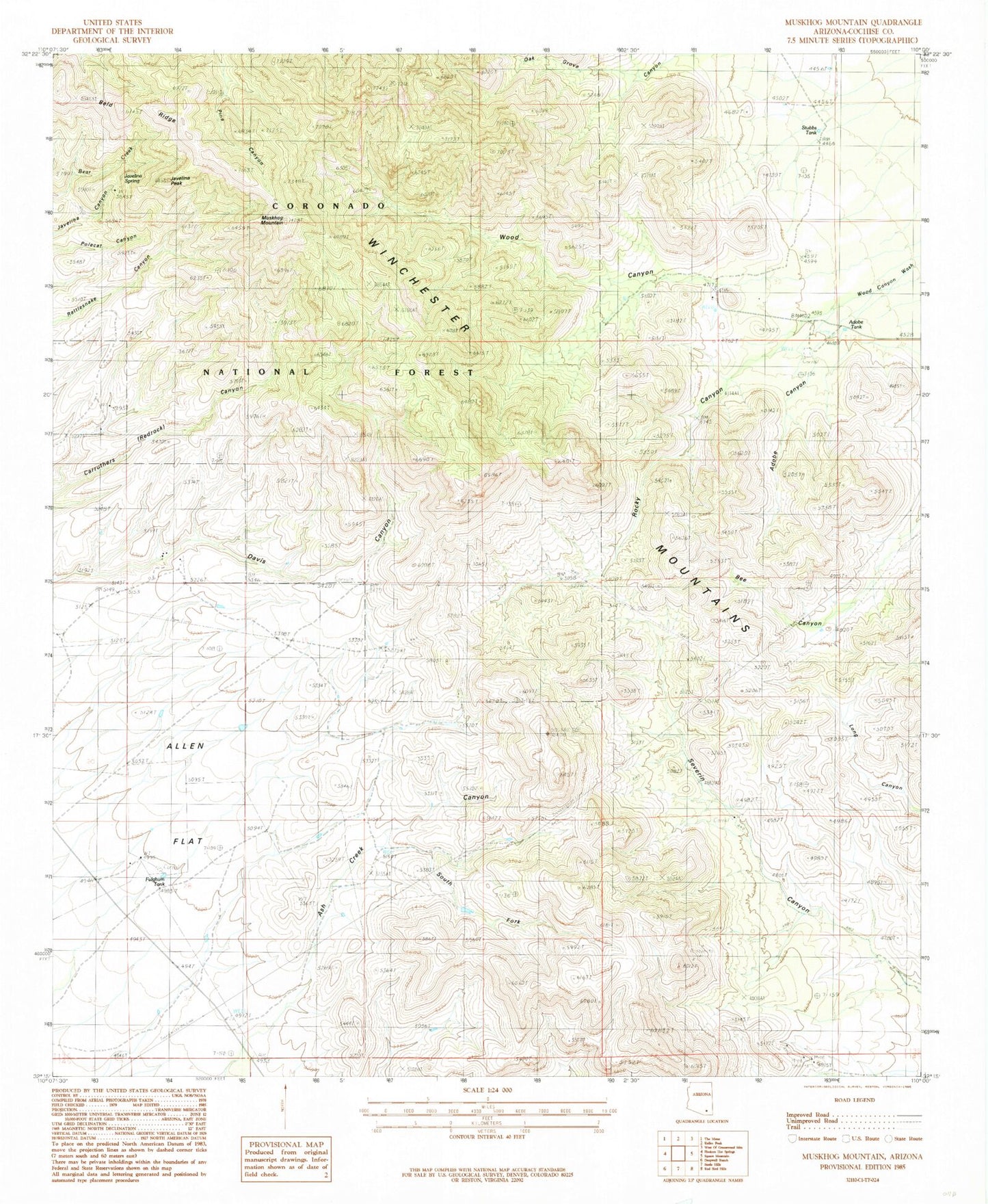
Historical USGS topographic quad map of Muskhog Mountain in the state of Arizona. Map scale may vary for some years, but is generally around 1:24,000. Print size is approximately 24" x 27"
This quadrangle is in the following counties: Cochise.
The map contains contour lines, roads, rivers, towns, and lakes. Printed on high-quality waterproof paper with UV fade-resistant inks, and shipped rolled.
Contains the following named places: Adobe Canyon, Adobe Tank, Ash Creek Canyon, Bald Ridge, Cement Dam Tank, Ellis Ranch, Fulghum Tank, G Bar Ranch, Javelina Peak, Javelina Spring, Muskhog Mountain, Rocky Canyon, South Fork Canyon, Stubbs Tank, Winchester Mountains, Wood Canyon