MyTopo
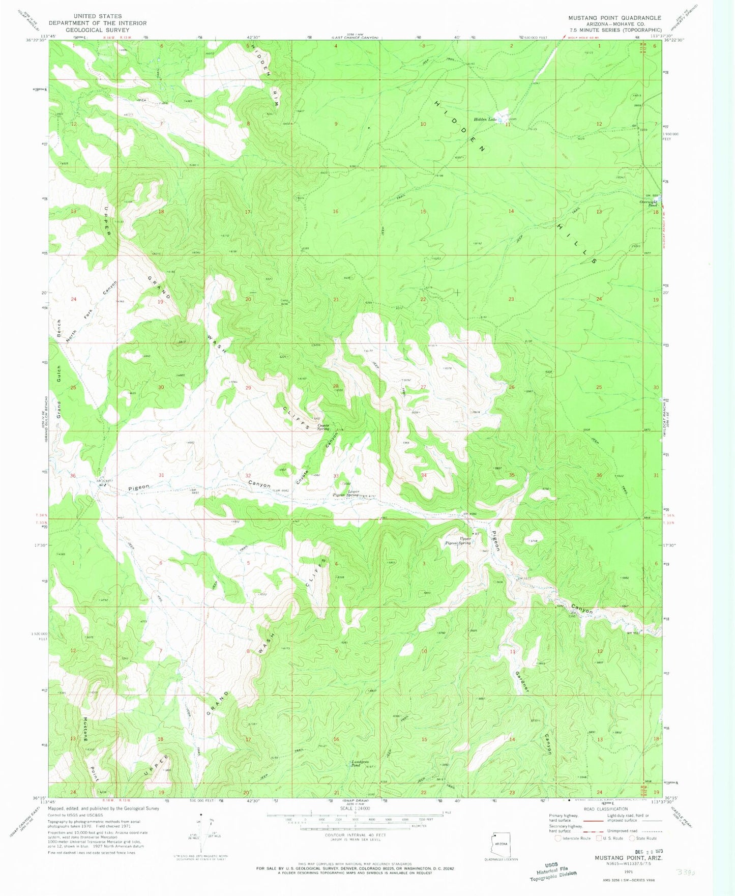
Classic USGS Mustang Point Arizona 7.5'x7.5' Topo Map
Regular price
$16.95
Regular price
Sale price
$16.95
Unit price
per
Couldn't load pickup availability
Historical USGS topographic quad map of Mustang Point in the state of Arizona. Map scale may vary for some years, but is generally around 1:24,000. Print size is approximately 24" x 27"
This quadrangle is in the following counties: Mohave.
The map contains contour lines, roads, rivers, towns, and lakes. Printed on high-quality waterproof paper with UV fade-resistant inks, and shipped rolled.
Contains the following named places: Coyote Canyon, Coyote Spring, Gardner Canyon, Grand Canyon - Parashant National Monument, Hidden Hills, Hidden Lake, Lower Pigeon Spring, Lundgren Pond, Mustang Point, Overnight Pond, Upper Pigeon Spring