MyTopo
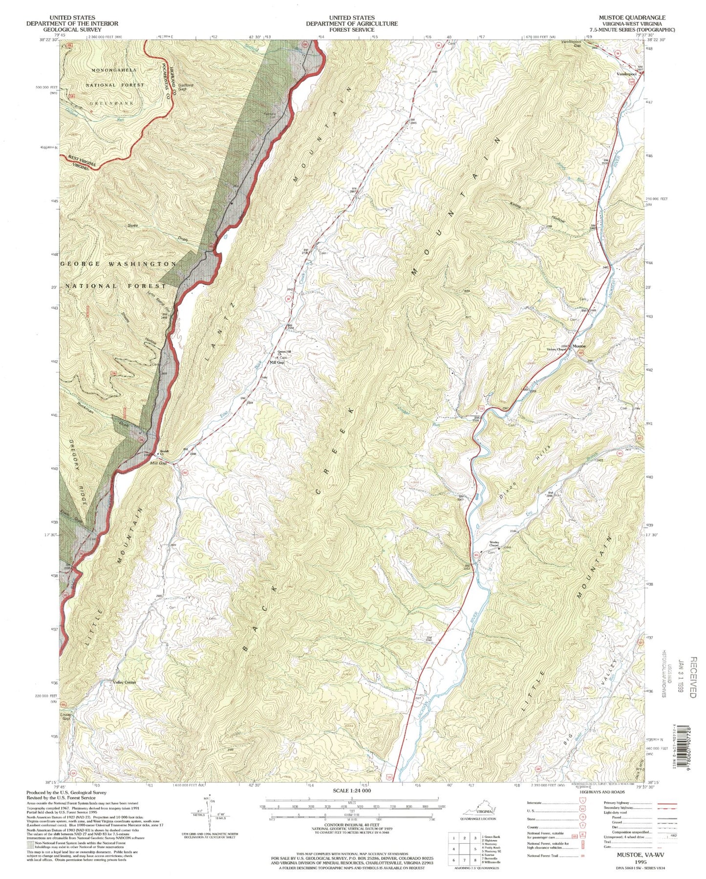
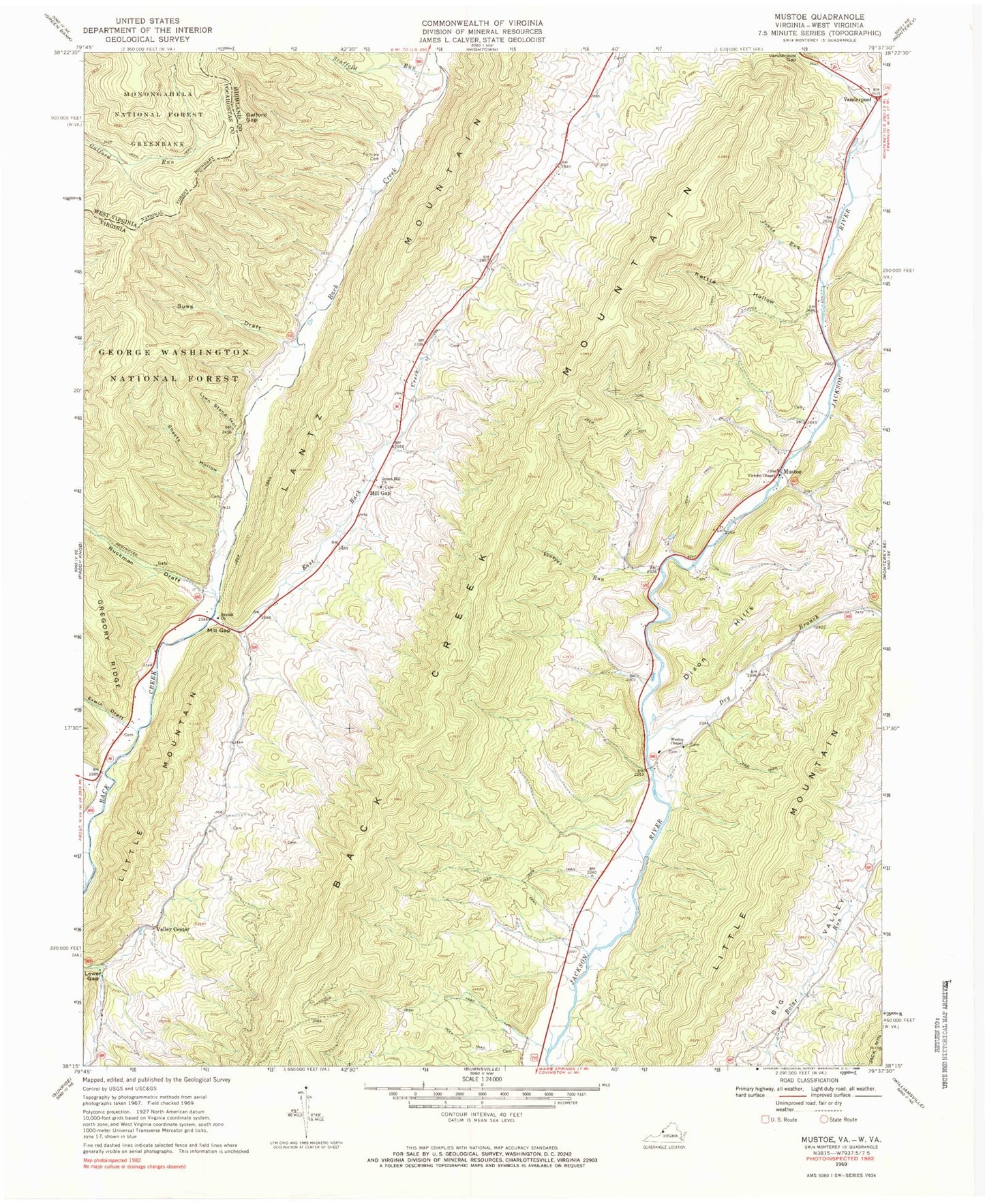
Classic USGS Mustoe Virginia 7.5'x7.5' Topo Map
Couldn't load pickup availability
Historical USGS topographic quad map of Mustoe in the state of Virginia. Typical map scale is 1:24,000, but may vary for certain years, if available. Print size: 24" x 27"
This quadrangle is in the following counties: Highland, Pocahontas.
The map contains contour lines, roads, rivers, towns, and lakes. Printed on high-quality waterproof paper with UV fade-resistant inks, and shipped rolled.
Contains the following named places: Back Creek Mountain, Beulah Presbyterian Church, Big Valley, Dixon Hills, Dry Branch, Dry Run, East Back Creek, Erwin Draft, Fairview Cemetery, Galford Gap, Green Hill Church, Jones Run, Kettle Hollow, Lynn Stand Hollow, Mill Gap, Ruckman Draft, Scaffold Run, Little Mountain, Sheets Hollow, Sues Draft, Townsend Draft, Valley Center, Victory Chapel, Vinegar Run, Wesley Chapel, Little Mountain, Mill Gap, Mustoe, Vanderpool, Green Hill School (historical), Griffin Cemetery, Plum Grove School (historical), River View School (historical), Riverview Church (historical), Woods-Terry School (historical), Buckeye (historical), Warwick Run, Naples (historical), Siebert Run, Lawson Knob, Cedar Ridge, Stark Ridge, Eowyns Run