MyTopo
Classic USGS Myakka City Florida 7.5'x7.5' Topo Map
Couldn't load pickup availability
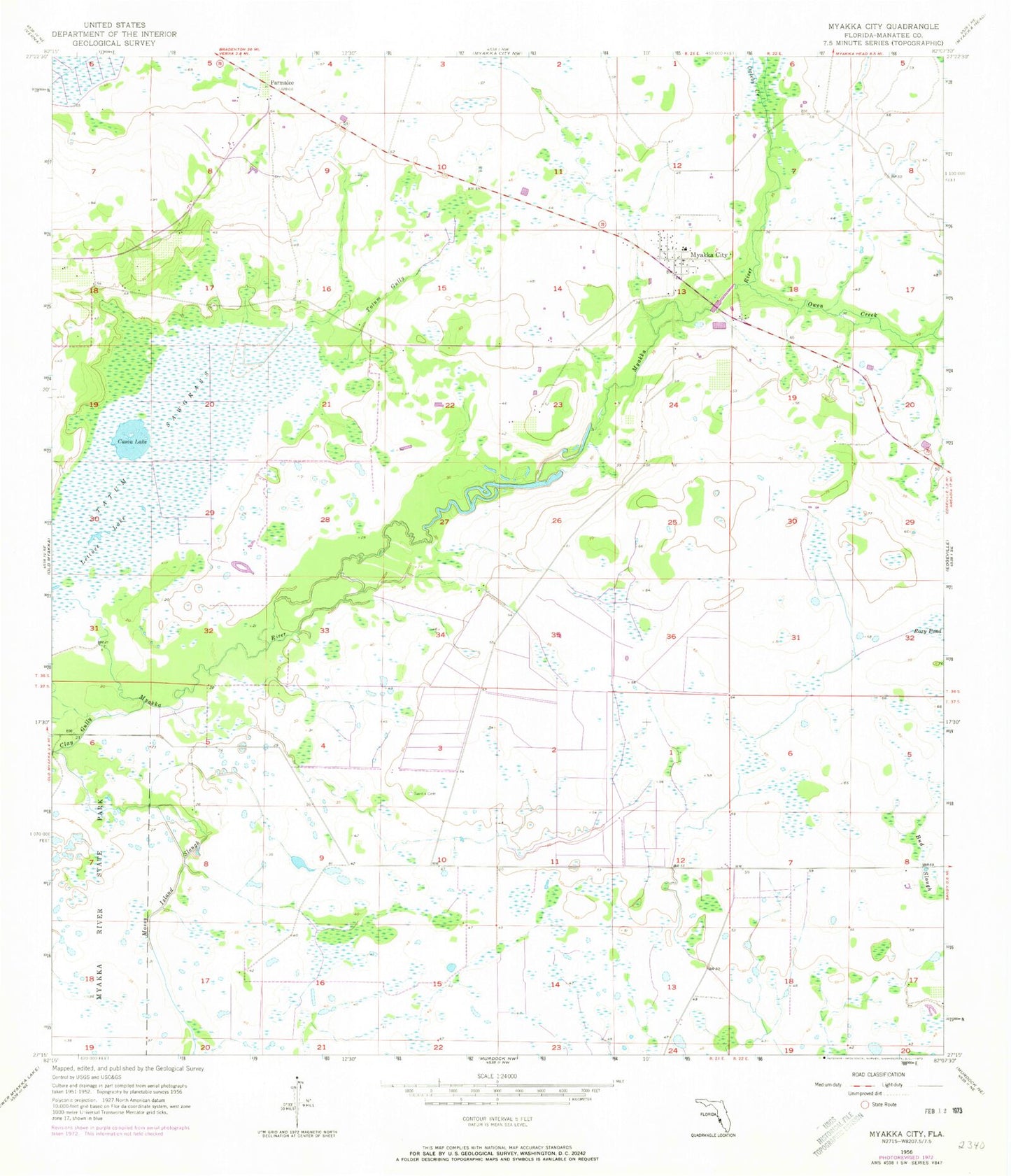
Historical USGS topographic quad map of Myakka City in the state of Florida. Map scale may vary for some years, but is generally around 1:24,000. Print size is approximately 24" x 27"
This quadrangle is in the following counties: Manatee.
The map contains contour lines, roads, rivers, towns, and lakes. Printed on high-quality waterproof paper with UV fade-resistant inks, and shipped rolled.
Contains the following named places: Cason Lake, Clay Gully, Lettuce Lake, Mobley Pond, Mossy Island Slough, Myakka City, Myakka City Division, Myakka City Fire Department Station 1, Myakka City Post Office, Myakka Elementary School, Ogleby Creek, Owen Creek, Parmalee, Sand Branch, Sardis Cemetery, Tatum Gully, Tatum Sawgrass