MyTopo
Classic USGS Myron Arkansas 7.5'x7.5' Topo Map
Couldn't load pickup availability
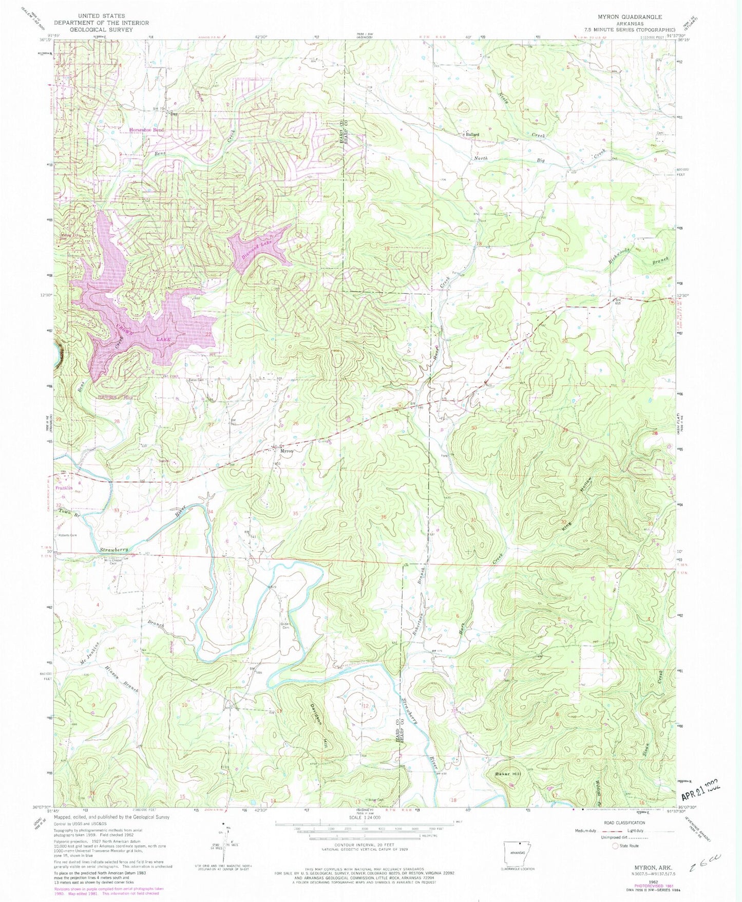
Historical USGS topographic quad map of Myron in the state of Arkansas. Map scale may vary for some years, but is generally around 1:24,000. Print size is approximately 24" x 27"
This quadrangle is in the following counties: Izard, Sharp.
The map contains contour lines, roads, rivers, towns, and lakes. Printed on high-quality waterproof paper with UV fade-resistant inks, and shipped rolled.
Contains the following named places: Baker Cemetery, Baker Hill, Ballard, Bates Cemetery, Bens Creek, City of Horseshoe Bend, Crown Lake, Crown Lake Dam, Davidson Hill, Day, Diamond Lake, Diamond Lake Dam, Godwin Cemetery, Hars Creek, Hills Chapel Cemetery, Hinson Branch, King Hollow, Love, McJunkins Branch, Myron, Myron Baptist Church, Neely Creek, Roberts Cemetery, Robertson Branch, Town Branch, Township of Jefferson, ZIP Codes: 72512, 72513