MyTopo
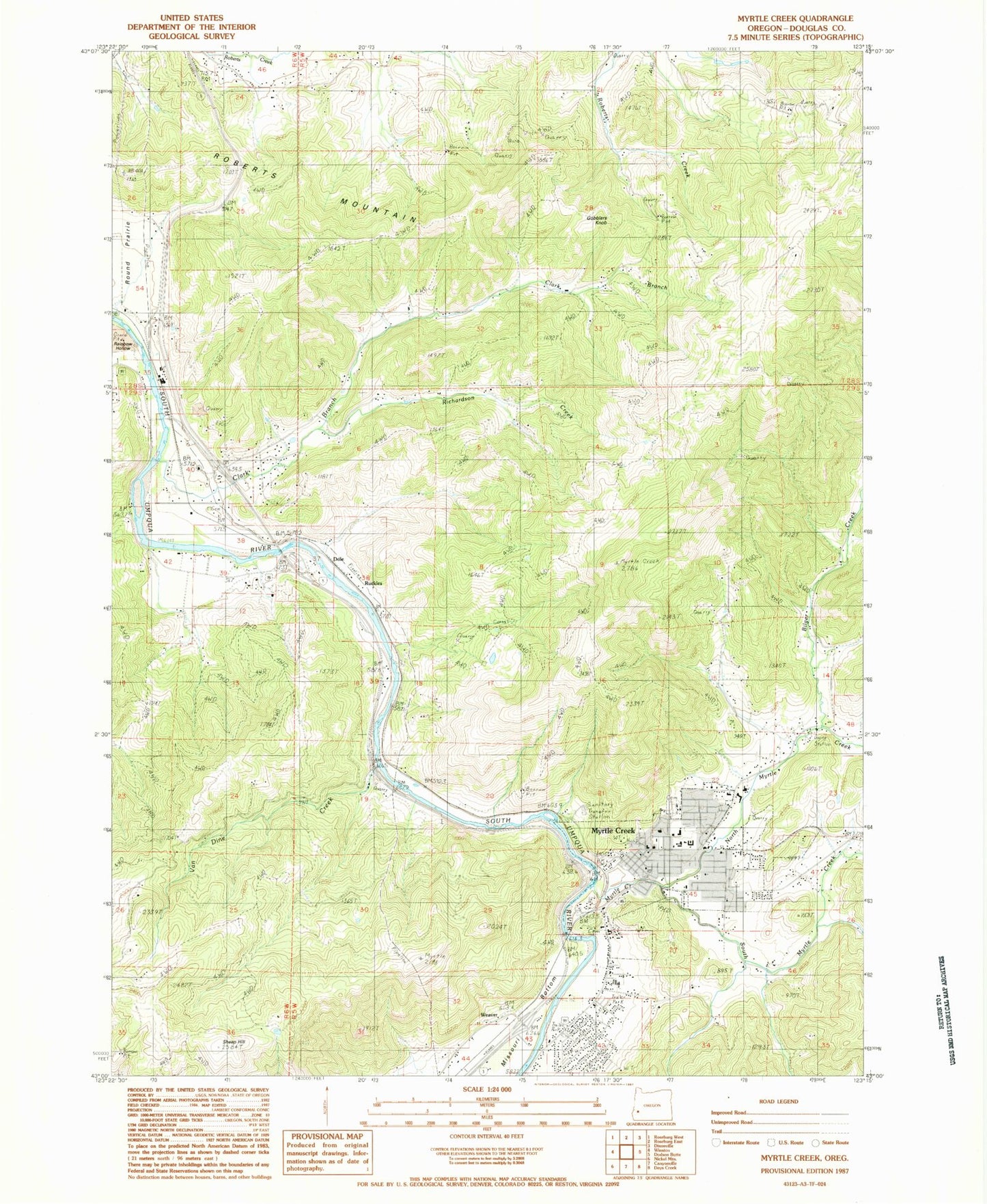
Classic USGS Myrtle Creek Oregon 7.5'x7.5' Topo Map
Couldn't load pickup availability
Historical USGS topographic quad map of Myrtle Creek in the state of Oregon. Map scale may vary for some years, but is generally around 1:24,000. Print size is approximately 24" x 27"
This quadrangle is in the following counties: Douglas.
The map contains contour lines, roads, rivers, towns, and lakes. Printed on high-quality waterproof paper with UV fade-resistant inks, and shipped rolled.
Contains the following named places: Bilger Creek, Boomer Hill School, Burnett Cemetery, Cedar Hollow, Church of the Nazarene, City of Myrtle Creek, Clark Branch, Clarks Branch Water Treatment Facility, Coffenberry Middle School, Dole, Douglas County Fire District 2 Station 8, Engles and Worth Log Pond, Gobblers Knob, Harrison Young Brook, Mary Moore Bridge, Millsite Park, Myrtle Creek, Myrtle Creek Branch Library, Myrtle Creek City Hall, Myrtle Creek Elementary School, Myrtle Creek Fire Department, Myrtle Creek IOOF Cemetery, Myrtle Creek Municipal Court, Myrtle Creek Pioneer Cemetery, Myrtle Creek Police Department, Myrtle Creek Post Office, Myrtle Creek Public Works, Myrtle Creek Sewage Treatment Plant, Myrtle Creek Springbrook Water Treatment Plant, Neal Lane Bridge, North Myrtle Creek, Richardson Creek, Roberts Mountain, Rock Creek, Round Prairie, Round Prairie Post Office, Ruckles, Ruckles Post Office, Seventh Day Adventist Church, Sheep Hill, South County Christian School, South Douglas Rodeo, South Myrtle Creek, South Umpqua Safety Rest Area, Van Dine Creek, Weaver, Weigle Landing