MyTopo
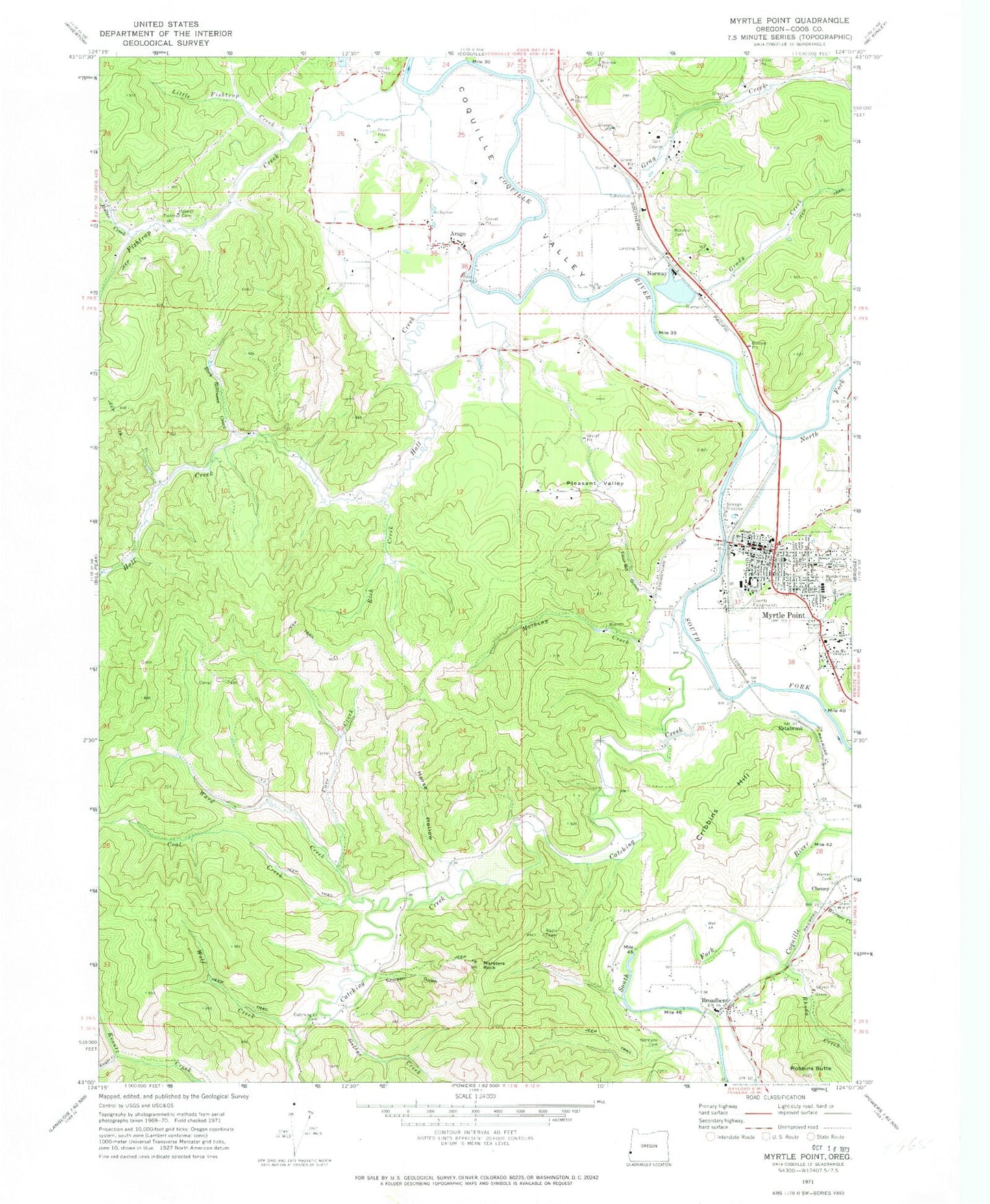
Classic USGS Myrtle Point Oregon 7.5'x7.5' Topo Map
Couldn't load pickup availability
Historical USGS topographic quad map of Myrtle Point in the state of Oregon. Map scale may vary for some years, but is generally around 1:24,000. Print size is approximately 24" x 27"
This quadrangle is in the following counties: Coos.
The map contains contour lines, roads, rivers, towns, and lakes. Printed on high-quality waterproof paper with UV fade-resistant inks, and shipped rolled.
Contains the following named places: Arago, Arago Community Church, Arago County Park Boat Ramp, Arago Post Office, Broadbent, Broadbent Post Office, Broadbent School, Bryant Boat Ramp, C C Carter, Catching Creek, Catching Creek Cemetery, Cheney, Chicken Gulch, City of Myrtle Point, Coal Creek, Coos County Fair and Rodeo, Coos County Fairgrounds Museum, Coos County Fairgrounds Outdoor Stage, Coos County Logging Museum, Coos White Cedar Company, Coquille Fire Department Station 2, Coquille Fire Department Station 4, Coquille Watershed Association, Cove Creek, Cribbins Hill, Elliott Post Office, Estabrook, Fishtrap Cemetery, Fishtrap Creek, Flora M Laird Memorial Library, Fort Kitchen, Four Bit Gulch, Gettys Creek, Grady Creek, Gray Creek, Hall Creek, Hall Prairie, Hermann Cemetery, Horse Hollow, Kausen Creek, Knight Creek, Lions Memorial Park, Little Fishtrap Creek, Llewellyn Creek, Maple School, Marsters Rock, Matheny Creek, Mineola, Myrtle Crest School, Myrtle Point, Myrtle Point City Hall, Myrtle Point Fire Department Station 1, Myrtle Point Fire Department Station 2, Myrtle Point High School, Myrtle Point Log Pond, Myrtle Point Municipal Court, Myrtle Point Police Department, Myrtle Point Post Office, Myrtle Point Public Works, Myrtle Point Sewage Treatment Plant, Myrtle Point Veneer Company Log Dam, North Fork Coquille River, Norway, Norway Airstrip, Norway Cemetery, Norway Post Office, Pleasant Valley, Rhoda Creek, Rich Creek, Robbins Butte, Rock Robinson Creek, Rollan Creek, Rotary Park, Saint James Lutheran Church, South Fork Coquille River, Sunset Park, Upper Fishtrap Cemetery, Ward Creek, Warner Cemetery, Warner Creek, Wolf Creek, York