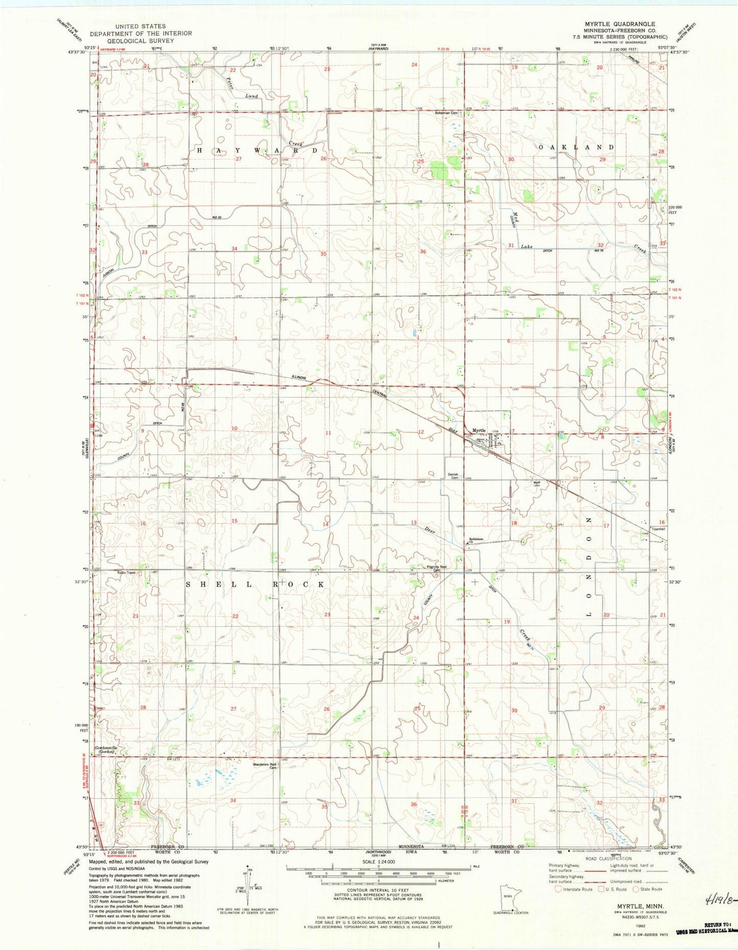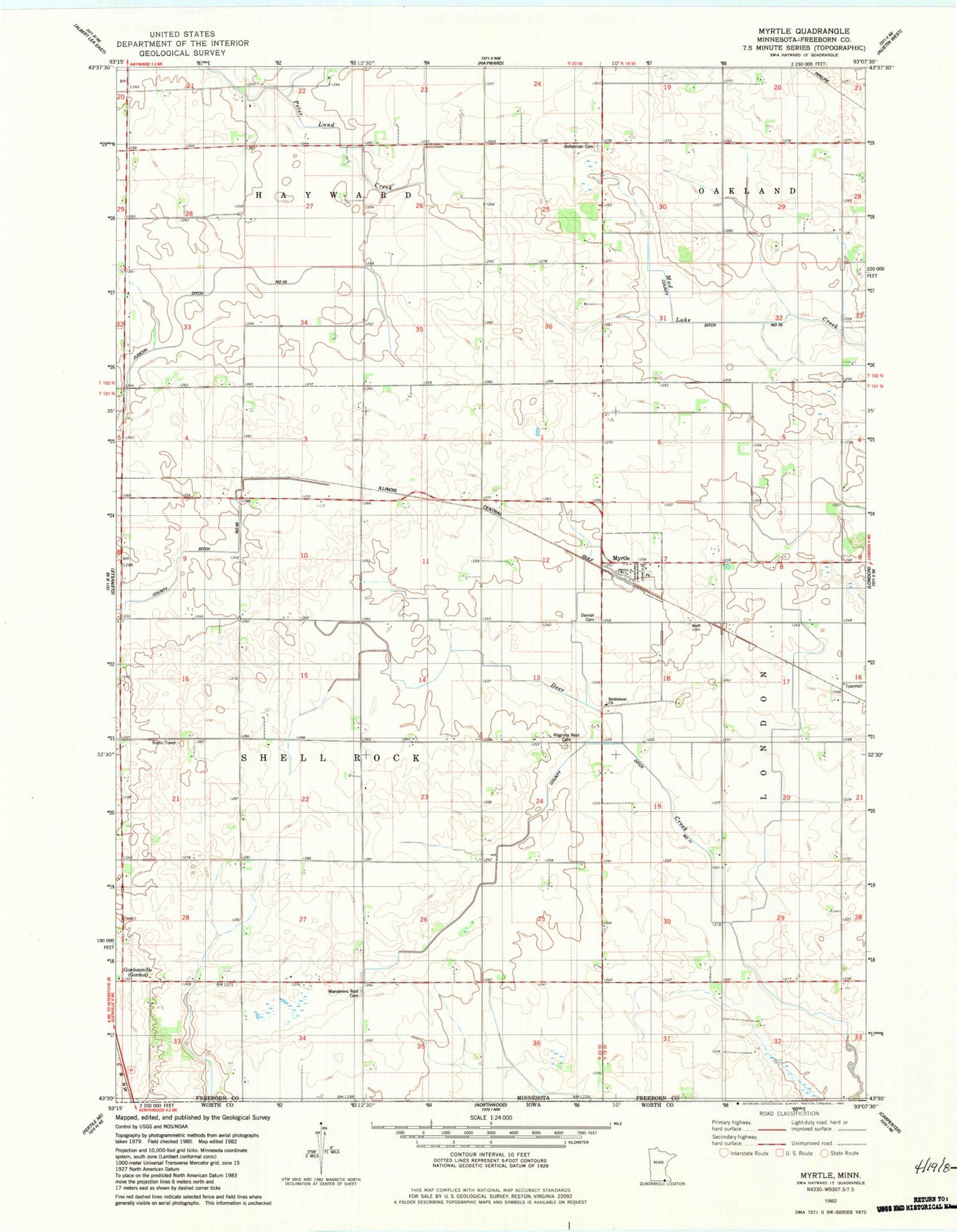
MyTopo
Classic USGS Myrtle Minnesota 7.5'x7.5' Topo Map
Couldn't load pickup availability
Historical USGS topographic quad map of Myrtle in the state of Minnesota. Map scale may vary for some years, but is generally around 1:24,000. Print size is approximately 24" x 27"
This quadrangle is in the following counties: Freeborn.
The map contains contour lines, roads, rivers, towns, and lakes. Printed on high-quality waterproof paper with UV fade-resistant inks, and shipped rolled.
Contains the following named places: Barron School, Benesh School, Bethlehem Church, Bohemian Cemetery, City of Myrtle, Corner School, County Ditch Number Fortynine, County Ditch Number Seventyone, Danish Cemetery, Davis School, Funfar School, Judicial Ditch Number Twenty, Kestner Cemetery, Kirk School, KQPR-FM (Albert Lea), Krikva Cemetery, Lao School, Mockingbird Hill Cemetery, Myrtle, Myrtle Fire Department, Myrtle Museum, Myrtle Post Office, Nelson School, Pilgrims Rest Cemetery, Schilling School, Township of Shell Rock, Wanders Rest Cemetery, Will School, ZIP Code: 56036