MyTopo
Classic USGS Myrtle West Virginia 7.5'x7.5' Topo Map
Couldn't load pickup availability
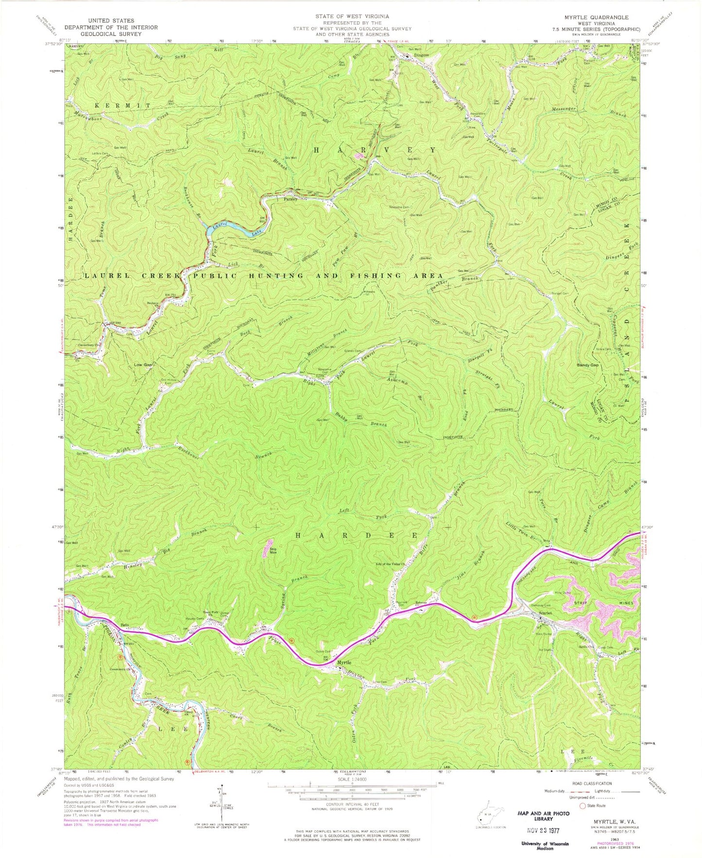
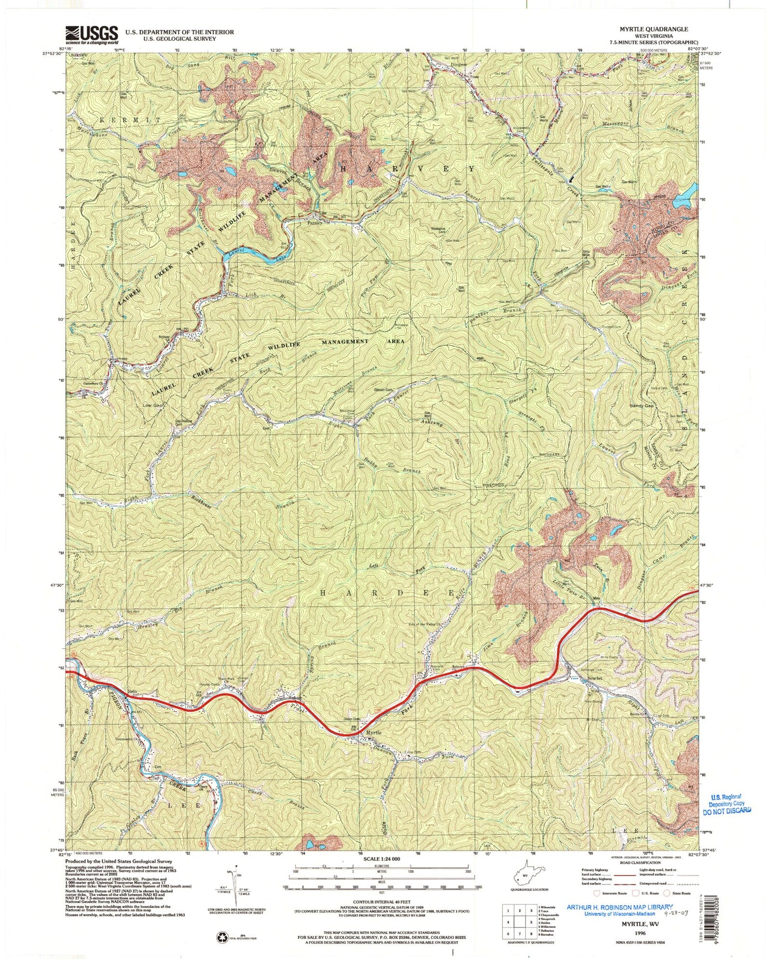
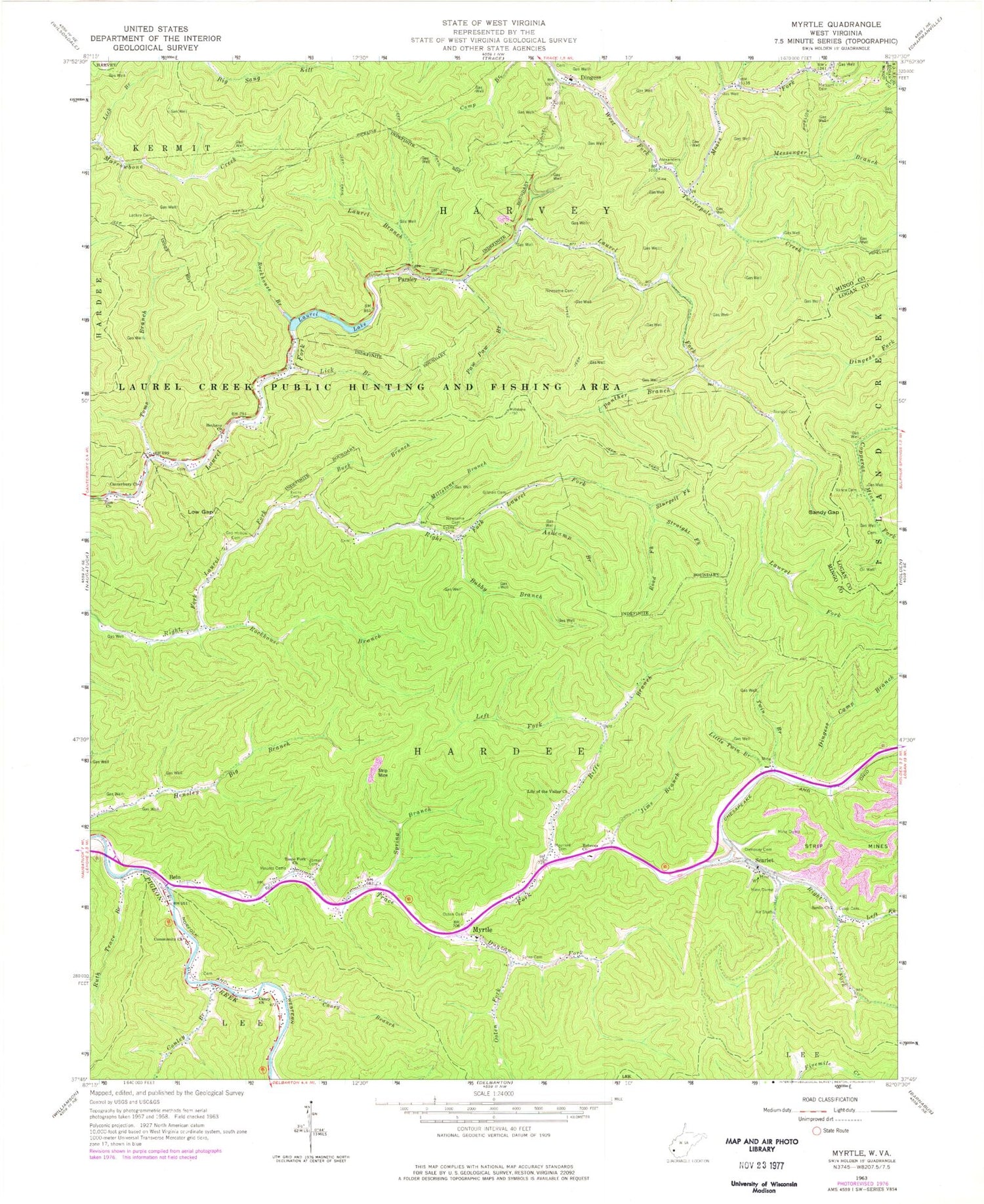
Historical USGS topographic quad map of Myrtle in the state of West Virginia. Map scale may vary for some years, but is generally around 1:24,000. Print size is approximately 24" x 27"
This quadrangle is in the following counties: Logan, Mingo.
The map contains contour lines, roads, rivers, towns, and lakes. Printed on high-quality waterproof paper with UV fade-resistant inks, and shipped rolled.
Contains the following named places: Alexanders Cemetery, Ashcamp Branch, Belo, Bethany Church, Bubby Branch, Buck Branch, Caney Branch, Caney Church, Canterbury Church, Conley Branch, Dempsey Cemetery, Dingess, Dingess Camp Branch, Dingess Elementary School, Dingess Post Office, Duncan Fork, Estep Cemetery, Evans Cemetery, Gap Hollow Cemetery, Gilman Cemetery, Hardee District, Jims Branch, Lackey Cemetery, Laurel Branch, Laurel Lake, Laurel Lake Dam, Laurel Lake State Wildlife Management Area, Laurel Lake Wildlife Management Area, Left Fork Riffe Branch, Left Fork Right Fork Trace Fork, Lick Branch, Lily of the Valley Church, Little Twin Branch, Low Gap, Marcum Cemetery, Maynard Cemetery, Messenger Branch, Millstone Branch, Moses Fork, Mounts Cemeteries, Myrtle, Myrtle Elementary School, Myrtle Post Office, Newsome Cemetery, Ooten Cemetery, Ooten Fork, Panther Branch, Parsley, Paw Paw Branch, Rebecca Church, Riffe Branch, Right Fork Trace Fork, Rockhouse Branch, Rodd Fork, Ruth Trace Branch, Sandy Gap, Sardis Church, Scarlet, Spring Branch, Straight Fork, Sturgell Cemetery, Sturgell Fork, Toms Branch, Trace Fork, Trace Fork Church, Twin Branch, Vance Cemetery, Zion Church, Zornes Cemetery, ZIP Code: 25676