MyTopo
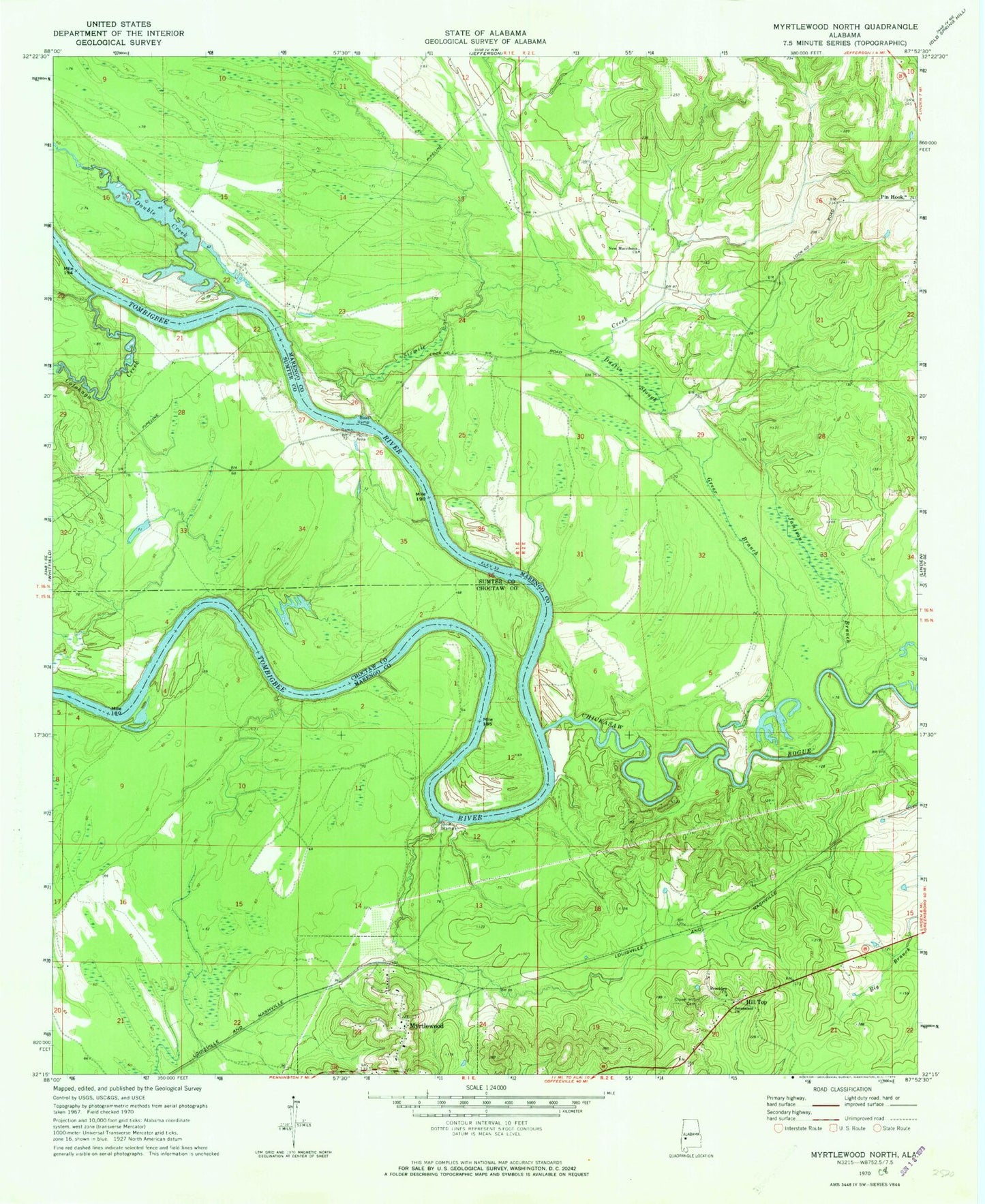
Classic USGS Myrtlewood North Alabama 7.5'x7.5' Topo Map
Couldn't load pickup availability
Historical USGS topographic quad map of Myrtlewood North in the state of Alabama. Map scale may vary for some years, but is generally around 1:24,000. Print size is approximately 24" x 27"
This quadrangle is in the following counties: Choctaw, Marengo, Sumter.
The map contains contour lines, roads, rivers, towns, and lakes. Printed on high-quality waterproof paper with UV fade-resistant inks, and shipped rolled.
Contains the following named places: Anopia, Beckleys, Beckleys Bar, Beckleys Landing, Besteda Landing, Blue Lock, Brooklyn Church, Bryant Burns Landing, Cedahoma, Chickasaw Bogue, Chickasaw Bogue Landing, Clover Hill Cemetery, Cotahaga Landing, Cotohaga Creek, Double Bar, Double Creek, Dustin Slough, Four Mile Bar, Gilmores, Greer Branch, Griffins, Griffins Landing, Hill Top, Indian Creek, Jamison Branch, Jerusalem Church, Lewis Lower Landing, Lewis Upper Landing, Lock Number Three, Lock Three Left Bank Public Use Area, Lock Three Right Bank Public Use Area, Lone Brothers Bar, Lost Creek, McNeals Landing, McNeils, Miles Shoal, Myrtlewood, Myrtlewood Elementary School, Myrtlewood Volunteer Fire Department, New Macedonia Church, Nick Lewis Bar, Oak Tree Landing, Oakchi Landing East, Port Clarion, Rainwater, Rainwater Bar, Rembert Landing, Remberts Bar, Remberts Landing, Rentz Ferry, Robert Emmet Bar, Robertson Landing, Shady Grove, Silmares Landing, Sixmile Creek, Smith Island, Town of Myrtlewood, ZIP Code: 36763


