MyTopo
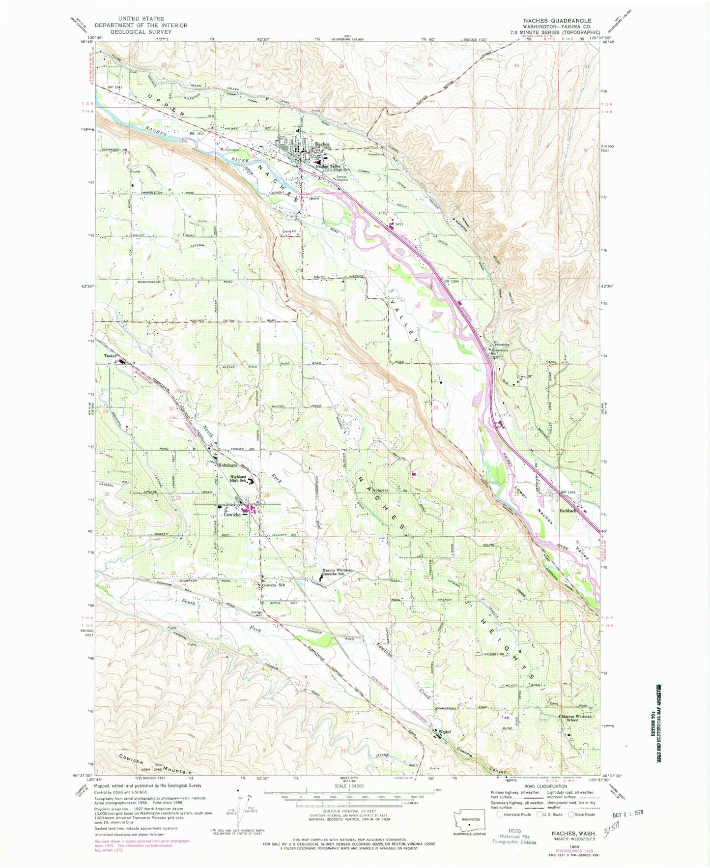
Classic USGS Naches Washington 7.5'x7.5' Topo Map
Couldn't load pickup availability
Historical USGS topographic quad map of Naches in the state of Washington. Map scale may vary for some years, but is generally around 1:24,000. Print size is approximately 24" x 27"
This quadrangle is in the following counties: Yakima.
The map contains contour lines, roads, rivers, towns, and lakes. Printed on high-quality waterproof paper with UV fade-resistant inks, and shipped rolled.
Contains the following named places: Bonlow, Cowiche, Cowiche Census Designated Place, Cowiche Post Office, Cowiche School, Dobie Orchard, Eschbach, Eschbach Census Designated Place, G and G Orchards, Highland High School, Holtzinger, Kelly Ditch, KRSE-FM (Yakima), KYKA-FM (Naches), Lateral C, Lateral G, Lateral J, Lowry Ditch, Marcus Whitman - Cowiche Elementary School, Marcus Whitman School, Naches, Naches Cemetery, Naches Heights, Naches Post Office, Naches Ranger District Fire Management, Naches Valley High School, Naches Valley Intermediate School, Naches Valley Middle School, North Fork Cowiche Creek, Selah Valley Canal, South Fork Cowiche Creek, Tasker, Town of Naches, Upper Naches Valley, Wapatox Canal, Weikel, Yakima County Fire District 1 Highland Fire Department Cowiche, Yakima County Fire District 3 Station 13 Naches Fire Department, Yakima County Fire District 9 Naches Heights Fire Department, Yakima Division, ZIP Code: 98923