MyTopo
USGS Classic Nacimiento Peak New Mexico 7.5'x7.5' Topo Map
Couldn't load pickup availability
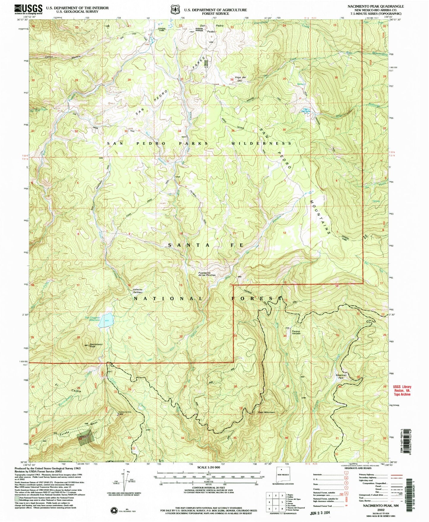
Historical USGS topographic quad map of Nacimiento Peak in the state of New Mexico. Scale: 1:24000. Print size: 24" x 27"
This quadrangle is in the following counties: Rio Arriba.
The map contains contour lines, roads, rivers, towns, lakes, and grids including latitude / longitude and UTM / MGRS. Printed on high-quality waterproof paper with UV fade-resistant inks.
Contains the following named places: American Park, Clear Creek Trail, Corralitos Creek, Cuba Ditch, Deer Mountain, El Cajete, Eureka Mesa, Highline Trail, Los Pinos Trail, Nacimiento Campground, Nacimiento Peak, Oso Creek, Palomas Trail, Parque Venado, Penas Negras Trail, Puertecito de las Perchas, Redonda Trail, Rito de las Perchas, Rito Anastacio, San Gregorio Reservoir, San Pedro Cabin (historical), San Pedro Parks, Vallecito Damian, Vega del Oso, Vega Redonda, San Pedro Mountains, Santa Fe National Forest, San Pedro Peaks, San Gregorio Reservoir Dam, Perchas Trail, Clear Creek Recreation Site, San Pedro Parks Wilderness