MyTopo
Classic USGS Nagogami Lodge Missouri 7.5'x7.5' Topo Map
Couldn't load pickup availability
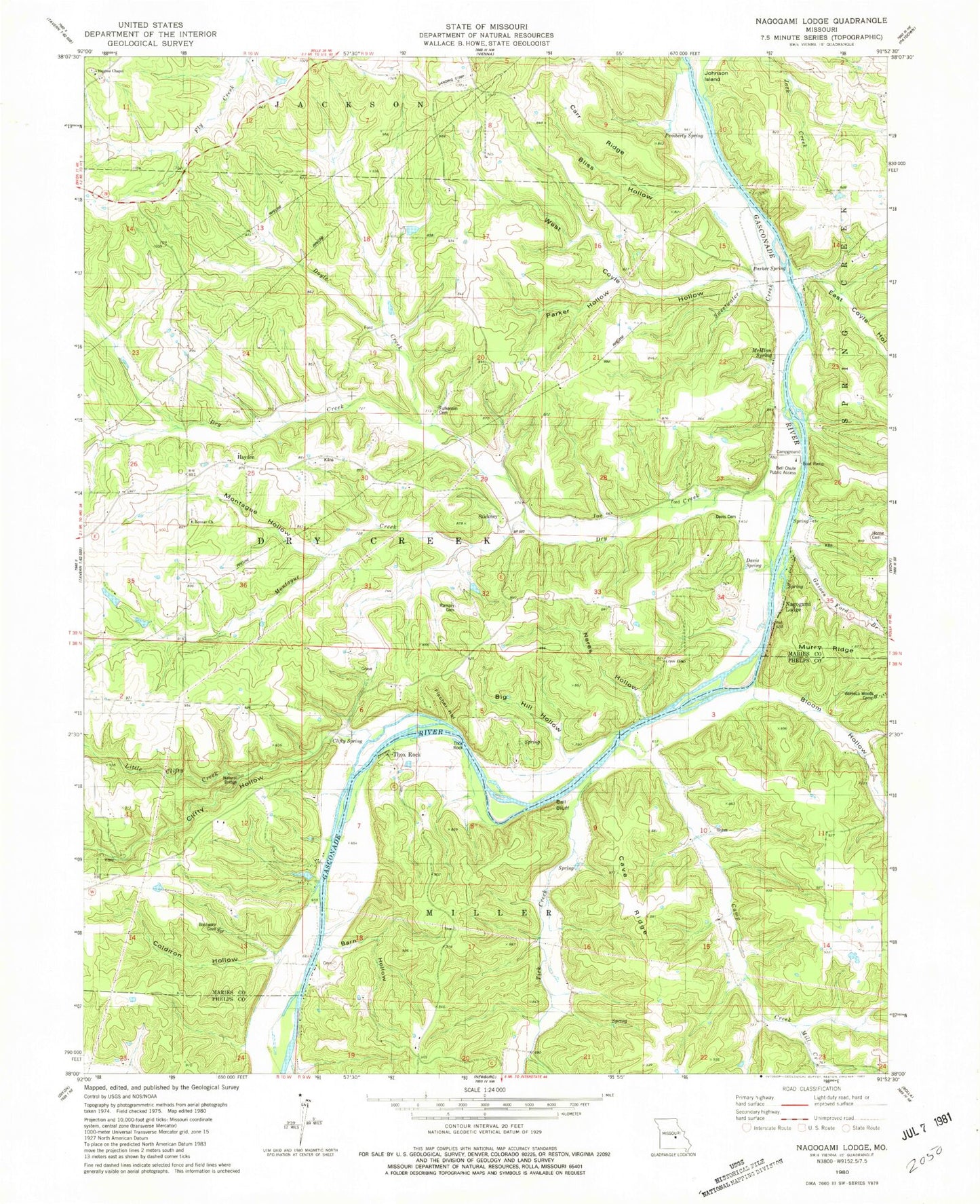
Historical USGS topographic quad map of Nagogami Lodge in the state of Missouri. Typical map scale is 1:24,000, but may vary for certain years, if available. Print size: 24" x 27"
This quadrangle is in the following counties: Maries, Phelps.
The map contains contour lines, roads, rivers, towns, and lakes. Printed on high-quality waterproof paper with UV fade-resistant inks, and shipped rolled.
Contains the following named places: Barn Hollow, Bell School, Big Hill Hollow, Bliss Hollow, Bloom Hollow, Brison Hollow, Cave Ridge, Clifty Hollow, Clifty Spring, Davis Spring, Doyle Creek, Dry Creek, Duerson Slide, Montague Creek, East Coyle Hollow, Fulkerson Cemetery, Gaines Ferry, Gaines Ford Branch, Kenner School, Little Clifty Creek, Low Gap, McMinn School, McMinn Spring, Montague Hollow, Nagogami Lodge, Nares Hollow, Clifty Creek Natural Bridge, Parker Hollow, Parker Spring, Pemberty Spring, Spencer Store, Sweetwater Creek, Turkey Creek, West Coyle Hollow, Prewett School, Coldiron Hollow, Thox Rock, Carr Ridge, Fischer Hollow, Bell Bluff, Thox Rock, Gaines Ford Spring, Gaines Ford (historical), Hayden, Stickney, Honse Cemetery, Bell Chute Public Access, Davis Cemetery, Ramsey Cemetery, Kenner Church, Granny Baker Graveyard, Camp Creek, Mill Creek, Tick Creek, Hughes Chapel School, Hughes Chapel, Koch Lake Dam, Wilson Lake Dam, Miller Lake Dam, Apex Lake Dam, Township of Dry Creek, Prewitt Cemetery