MyTopo
Classic USGS Nakina North Carolina 7.5'x7.5' Topo Map
Couldn't load pickup availability
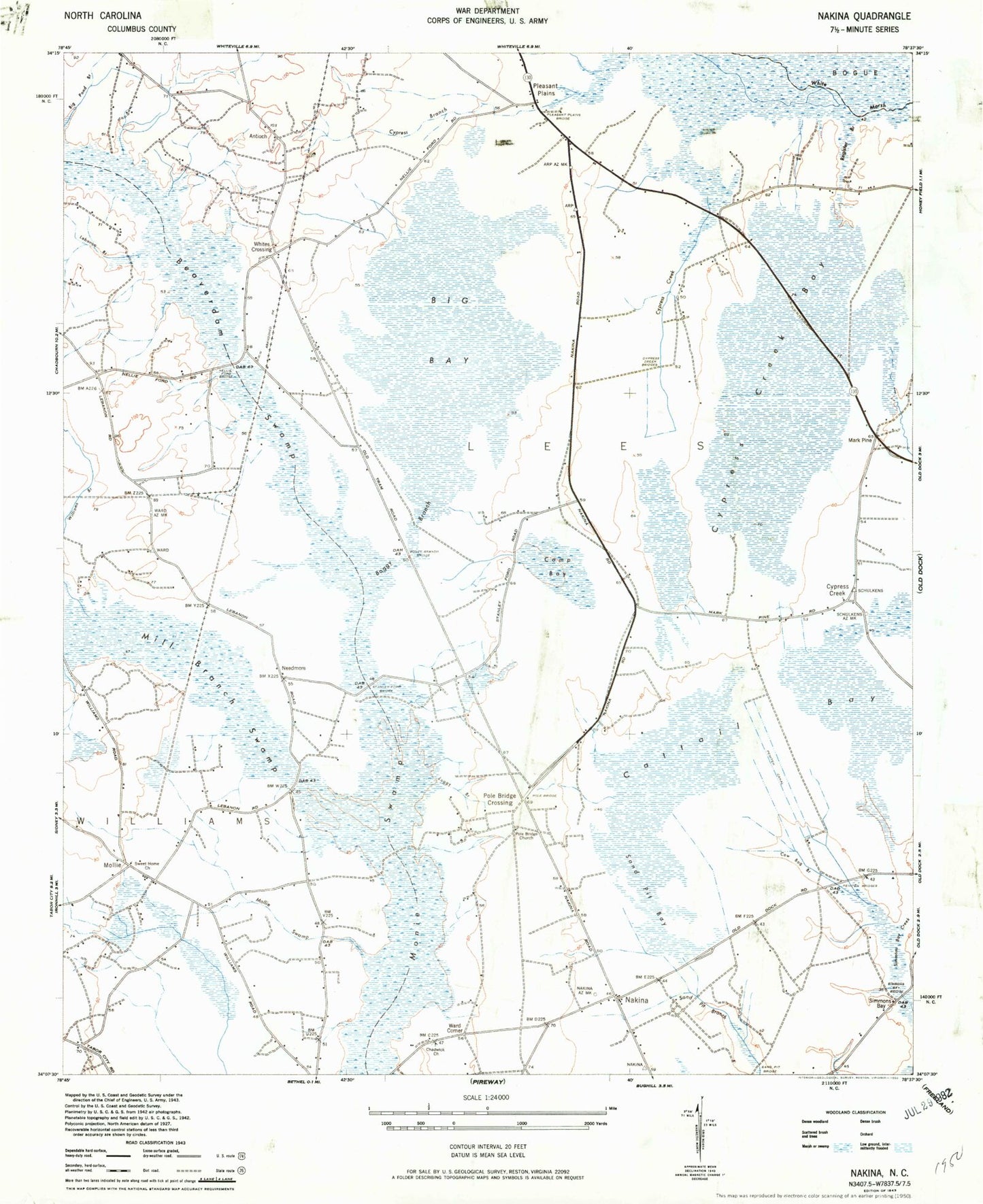
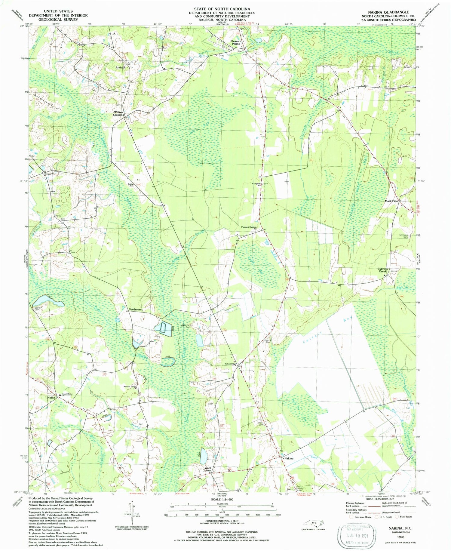
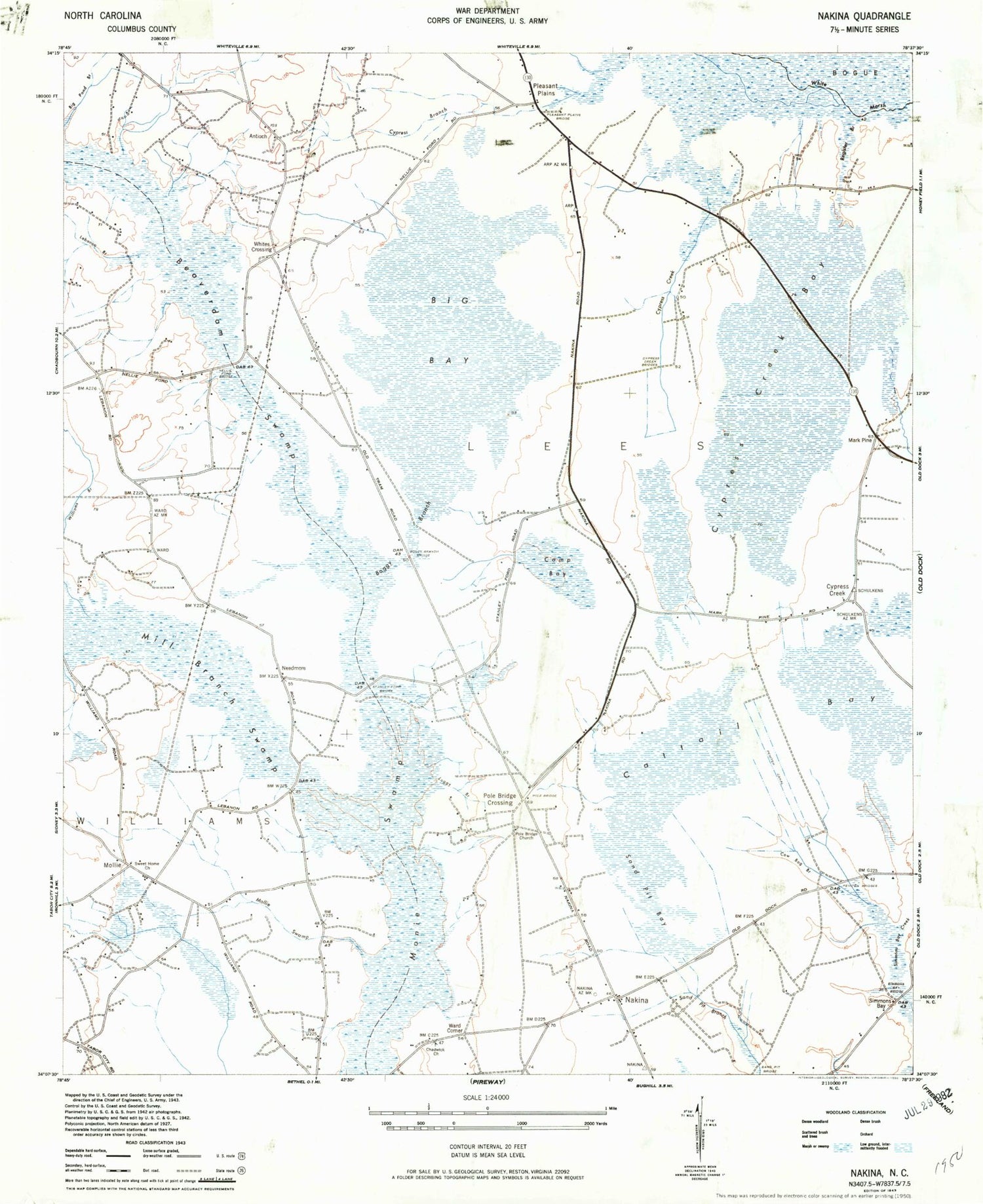
Historical USGS topographic quad map of Nakina in the state of North Carolina. Map scale may vary for some years, but is generally around 1:24,000. Print size is approximately 24" x 27"
This quadrangle is in the following counties: Columbus.
The map contains contour lines, roads, rivers, towns, and lakes. Printed on high-quality waterproof paper with UV fade-resistant inks, and shipped rolled.
Contains the following named places: Antioch, Antioch Church, Beaver Dam Swamp, Big Bay, Boggy Branch, Boggy Branch Bridge, Camp Bay, Campside Church, Cattail Bay, Chadwick Church, Coleman Cemetery, Cow Bog Branch, Cypress Branch, Cypress Creek, Cypress Creek Bay, Cypress Creek Bridges, Faith Church, Gum Swamp, Lebanon Branch, Loggy Branch, Mark Pine, McKeithan Cemetery, Mill Branch, Mill Branch Swamp, Mollie, Mollie Swamp, Monroe Stanley Cemetery, Nakina, Nakina Post Office, Needmore, Nellie Ford Bridge, Peniten Bridges, Peniten Canal, Pleasant Meadow Church, Pleasant Plains, Pleasant Plains Bridge, Pleasant Plains Church, Pole Bridge, Poley Bridge Church, Poley Bridge Crossing, Register Branch, Sand Pit Bay, Sand Pit Bridge, Simmons Bay, Simmons Bay Bridge, Simmons Bay Creek, Simmons Cemetery, Stanley Ford Bridge, Sweet Home Church, Ward Corner, Watts Cemetery, Whites Crossing, Williams Branch