
MyTopo
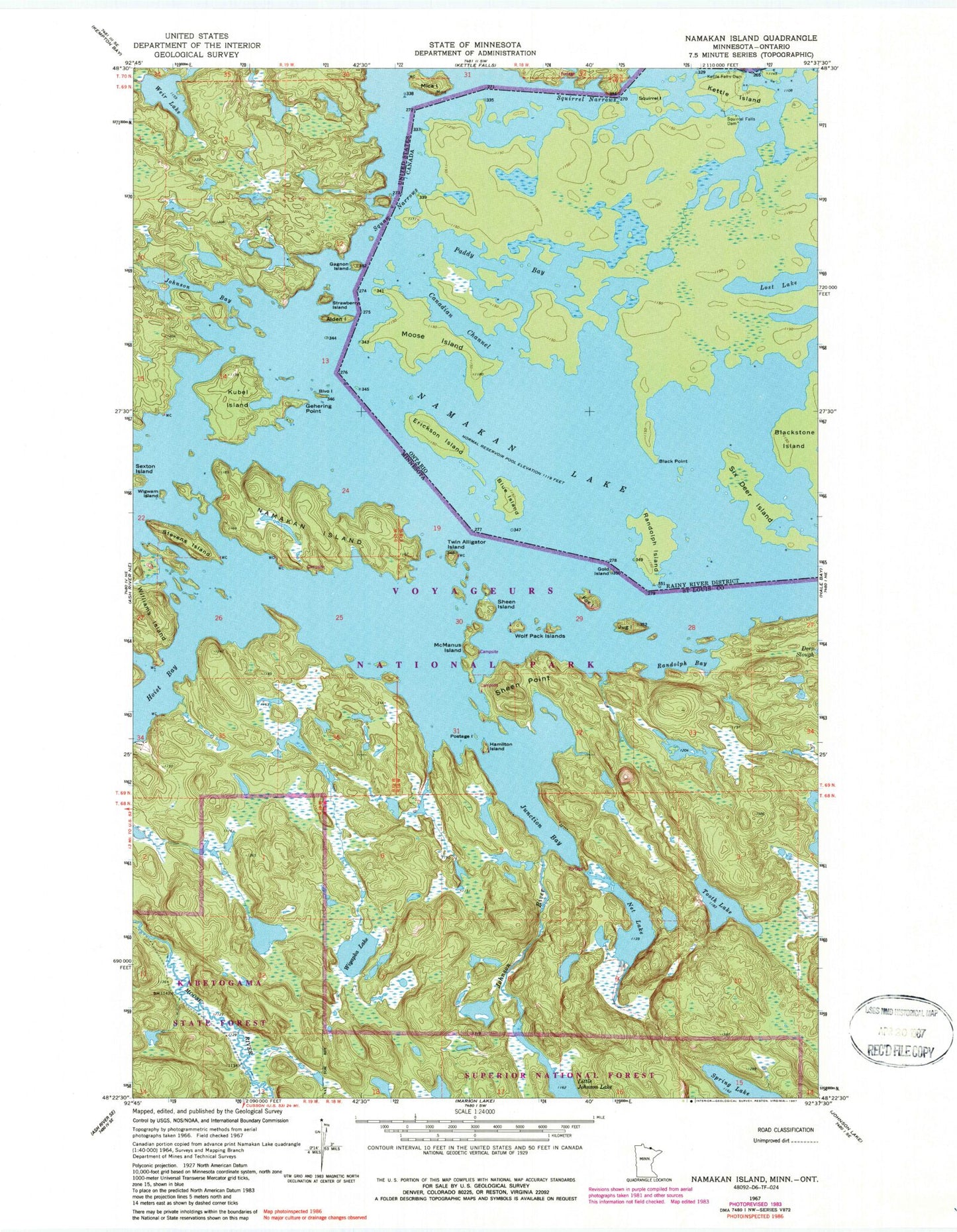
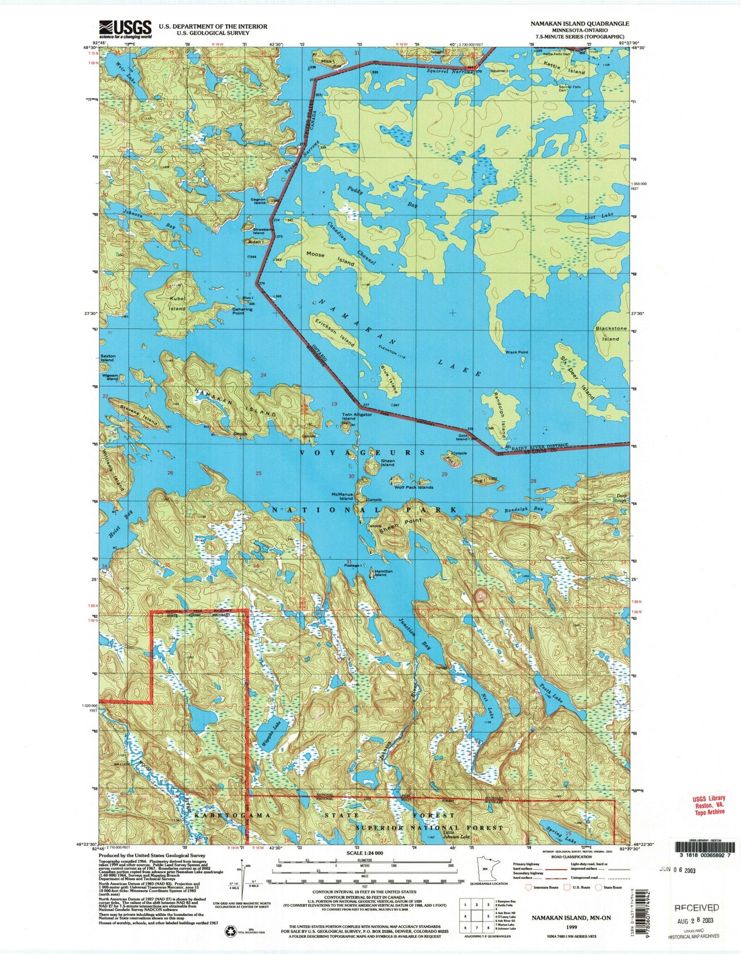
Classic USGS Namakan Island Minnesota 7.5'x7.5' Topo Map
Couldn't load pickup availability
Historical USGS topographic quad map of Namakan Island in the state of Minnesota. Typical map scale is 1:24,000, but may vary for certain years, if available. Print size: 24" x 27"
This quadrangle is in the following counties: St. Louis.
The map contains contour lines, roads, rivers, towns, and lakes. Printed on high-quality waterproof paper with UV fade-resistant inks, and shipped rolled.
Contains the following named places: Magie Island, Namakan Seaplane Base, Alden Island, Bivo Island, Fox Island, Gagnon Island, Gehering Point, Gold Island, Hamilton Island, Hoist Bay, Johnson Bay, Johnson River, Jug Island, Junction Bay, Kettle Falls Dam, Kubel Island, McManus Island, Mica Island, Namakan Island, Namakan Lake, Net Lake, Postage Island, Randolph Bay, Sexton Island, Sheen Island, Sheen Point, Voyageur Narrows, Squirrel Narrows, Stevens Island, Strawberry Island, Tooth Lake, Twin Alligator Island, Weir Lake, Wigwam Island, Wiyapka Lake, Wolf Pack Islands, Kettle Falls