MyTopo
Classic USGS Nameless Texas 7.5'x7.5' Topo Map
Couldn't load pickup availability
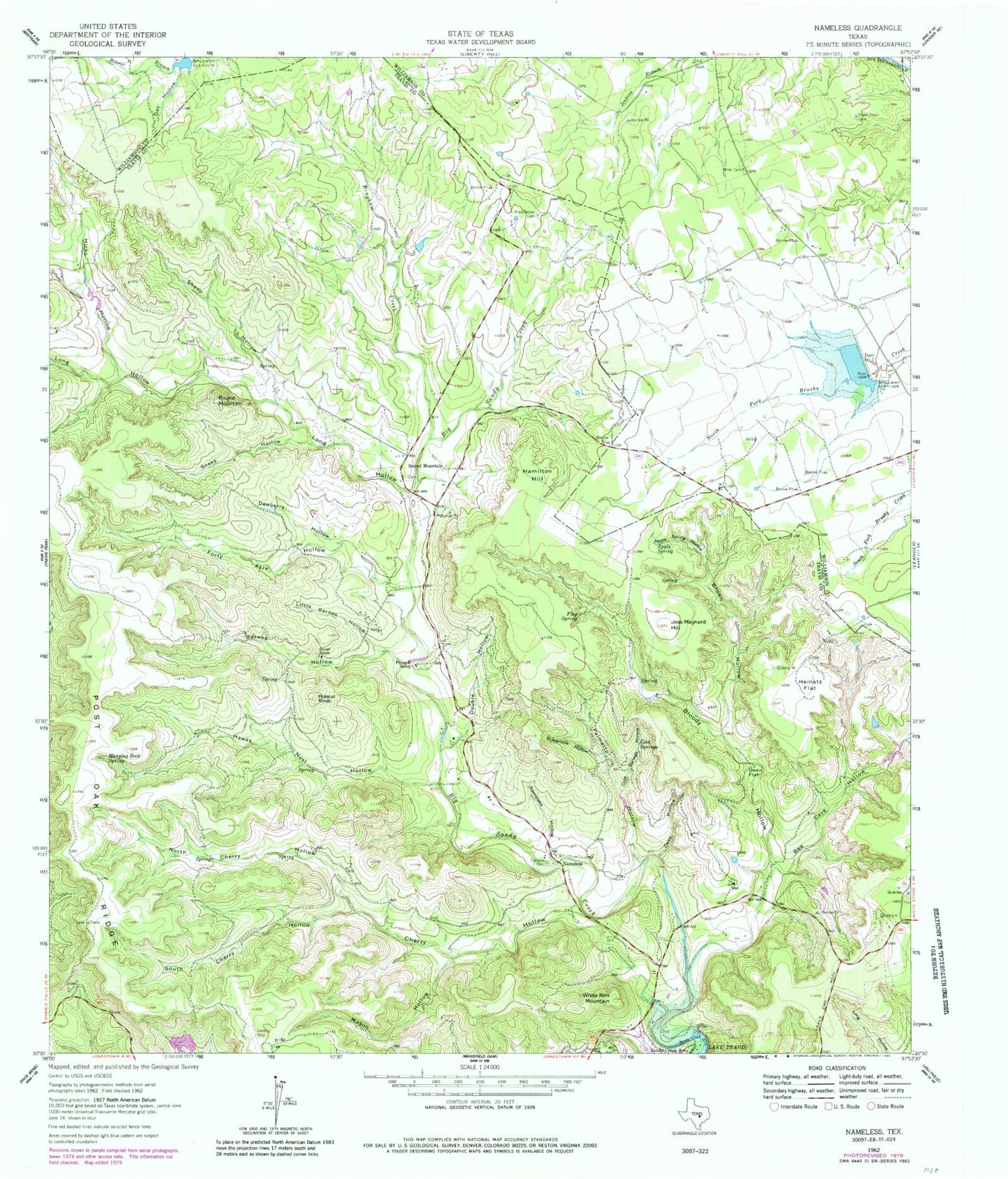
Historical USGS topographic quad map of Nameless in the state of Texas. Map scale may vary for some years, but is generally around 1:24,000. Print size is approximately 24" x 27"
This quadrangle is in the following counties: Travis, Williamson.
The map contains contour lines, roads, rivers, towns, and lakes. Printed on high-quality waterproof paper with UV fade-resistant inks, and shipped rolled.
Contains the following named places: Apple Spring, Apple Spring Hollow, Barnes Hollow, Barnes Hollow Spring, Bee Cave Hollow, Bible Memorial Stadium at Leander, Big Bear Hill, Big Sandy Creek, Bingham Creek, Bloody Hollow, Brown Hollow, Buttermilk Hollow, Cedar Brake Cemetery, Cedar Park-Liberty Hill Division, Cherry Hollow, Cold Springs, Cold Springs Hollow, Dam Number 1, Deep Hollow, Dewberry Hollow, Double Hollow, Fairview Cemetery, Flag Spring, Flying K Ranch, Forty Acre Hollow, Gay Hollow, Gillum Hollow, Hamilton Hill, Hanging Rock Spring, Hawks Nest Hollow, Heinatz Flat, Hicks Hollow, Huddleston Cemetery, Jess Maynard Hill, Leander Volunteer Fire Department Station 1, Little Barnes Hollow, Long Hollow, Mason Hollow, Miller Cemetery, Nameless, Nameless Hollow, North Cherry Hollow, Owen Flat, Palmetto Hollow, Polecat Knob, Round Mountain, Round Mountain Baptist Church, Sandy Creek Arm, Sheep Hollow, Snake Hollow, Soil Conservation Service Site 1 Dam, Soil Conservation Service Site 1 Reservoir, South Cherry Hollow, Sunset Ranch, Travis County Emergency Service District Number 1 Station 104, White Rim Mountain, Whitestone Elementary School, ZIP Code: 78641


