MyTopo
Classic USGS Names Hill Wyoming 7.5'x7.5' Topo Map
Regular price
$16.95
Regular price
Sale price
$16.95
Unit price
per
Couldn't load pickup availability
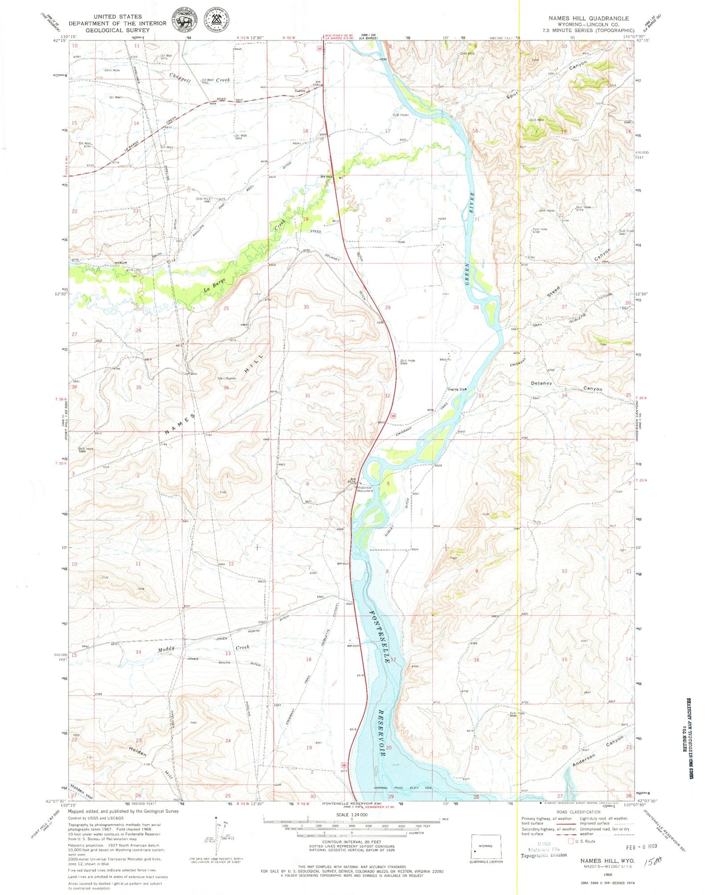
Historical USGS topographic quad map of Names Hill in the state of Wyoming. Map scale may vary for some years, but is generally around 1:24,000. Print size is approximately 24" x 27"
This quadrangle is in the following counties: Lincoln.
The map contains contour lines, roads, rivers, towns, and lakes. Printed on high-quality waterproof paper with UV fade-resistant inks, and shipped rolled.
Contains the following named places: Anderson Canyon, Chappell Creek, Delaney Canyon, Delaney Ditch, Hyrum Smith Ditch, Jones North Ditch, Jones South Ditch, Muddy Creek, Names Hill, Phillips and Reel Ditch, Spur Canyon, Steed Canyon, Steed Ditch, Sublet Ditch