MyTopo
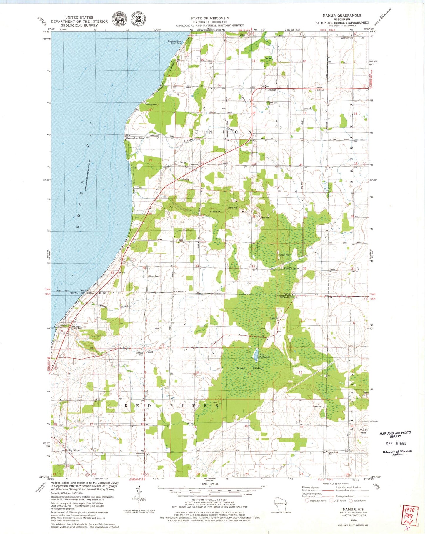
Classic USGS Namur Wisconsin 7.5'x7.5' Topo Map
Couldn't load pickup availability
Historical USGS topographic quad map of Namur in the state of Wisconsin. Map scale may vary for some years, but is generally around 1:24,000. Print size is approximately 24" x 27"
This quadrangle is in the following counties: Door, Kewaunee.
The map contains contour lines, roads, rivers, towns, and lakes. Printed on high-quality waterproof paper with UV fade-resistant inks, and shipped rolled.
Contains the following named places: Baudhuin Farms, Bay View, Bramblewood Farm, Chaudoirs Dock County Park, Degrave Farms, Duvall, Duvall Cemetery, Duvall Swamp, Gospel Truth Hall, Gospel Truth Hall Cemetery, High View School, Little Mud Lake, Macco Creek, Mick Schier Field Airport, Murray Sand and Gravel Pit, Namur, Norkin Farms, Pleasant Ridge School, Red River, Red River County Park, Red River Valley Farms, Renard Creek, Rocky Glen School, Saint Francis Catholic Church, Saint Marys Cemetery, San Sauveur School, Shoemaker Point, Sylvan Orchard, Tassout Farm, Town of Red River, Town of Union, WHET-FM (Sturgeon Bay)