MyTopo
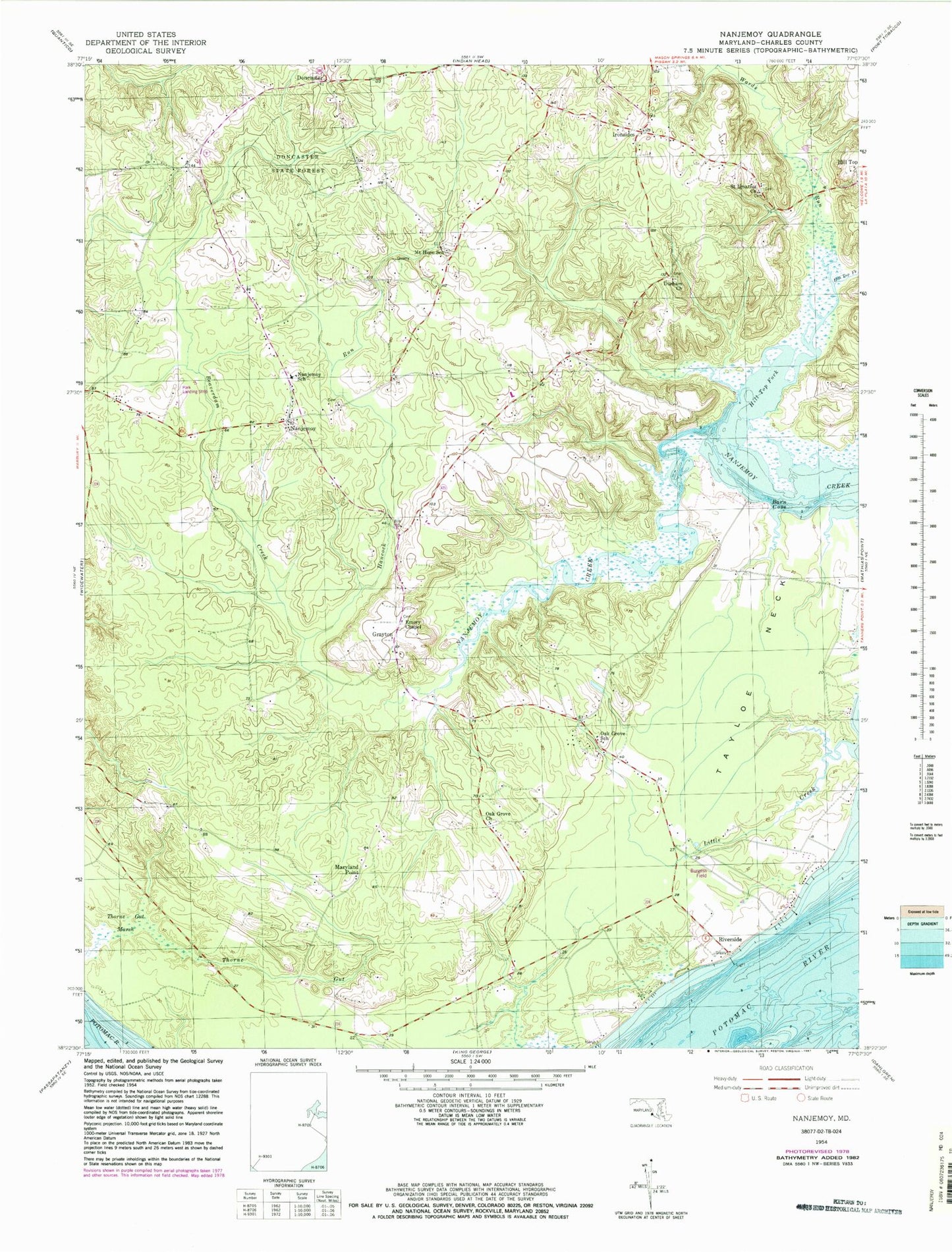
Classic USGS Nanjemoy Maryland 7.5'x7.5' Topo Map
Couldn't load pickup availability
Historical USGS topographic quad map of Nanjemoy in the state of Maryland. Typical map scale is 1:24,000, but may vary for certain years, if available. Print size: 24" x 27"
This quadrangle is in the following counties: Charles.
The map contains contour lines, roads, rivers, towns, and lakes. Printed on high-quality waterproof paper with UV fade-resistant inks, and shipped rolled.
Contains the following named places: Barn Cove, Beaverdam Creek, Durham Church, Emory Chapel, Hancock Run, Hill Top Fork, Little Creek, Mount Hope School, Nanjemoy, Nanjemoy School, Oak Grove Church, Oak Grove School, Saint Ignatius Church, Tayloe Neck, Thorne Gut Marsh, Wards Run, Doncaster, Ironsides, Thomas Point, Maryland Point, Riverside, Bunting Branch Dam, Bishopville Pond (historical), Washington Field (historical), Holly Springs Farm Airport, Burgess Field, Grayton, Burgess Landing, Chapel Hill School (historical), Christ Church Durham Parish Cemetery, King James Baptist Church Cemetery, Friendship Acres, Friendship Landing, Grafton (historical), Green Leek School (historical), Hickory Hill, Holly Springs School (historical), Ironsides Post Office, Jacksontown (historical), Marshope, Mount Hope, Mount Hope Baptist Church, Mount Hope - Nanjemoy Elementary School, Nanjemoy Volunteer Fire Department, Nanjemoy Episcopal Church, Nanjemoy Post Office, Neck Landing, Oak Grove Cemetery, Saint Ignatius of Loyola Cemetery, Smith Point School (historical), Stretchmark Hill, Trappe Bridge, District 3 Nanjemoy, Ironsides Volunteer Rescue Squad Company 58, Nanjemoy Creek Environmental Education Center