MyTopo
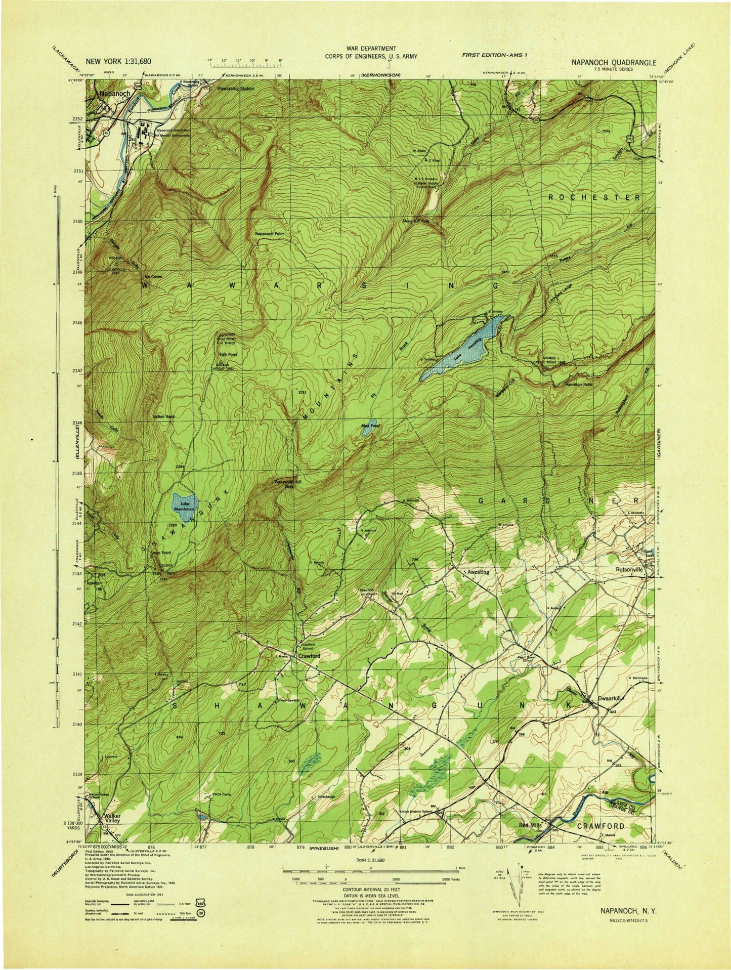
Classic USGS Napanoch New York 7.5'x7.5' Topo Map
Couldn't load pickup availability
Historical USGS topographic quad map of Napanoch in the state of New York. Typical map scale is 1:24,000, but may vary for certain years, if available. Print size: 24" x 27"
This quadrangle is in the following counties: Orange, Ulster.
The map contains contour lines, roads, rivers, towns, and lakes. Printed on high-quality waterproof paper with UV fade-resistant inks, and shipped rolled.
Contains the following named places: Lake Awosting, Beaver Brook, Camp Laurel, Camp Ridge-Ho, Castle Point, Crawford Church, Don Bosco Church, Mount Don Bosco, Dwaar Kill, Dwaarkill, Port Ben, Fly Brook, Hamilton Point, High Point, Indian Rock, Litchfield Ledge, Losees Hill, Lake Maratanza, Margaret Cliff, Mud Pond, Murrays Pond, Napanoch Point, Palmaghatt Kill, Quannacut YMCA Camp, Rutsonville, Sams Point, Sandburg Creek, Shingle Gully, Napanoch, Stony Kill Falls, Verkeerder Kill Falls, Awosting, Crawford, Red Mills, Walker Valley Golf Course, WWWK-FM (Ellenville), Town of Shawangunk, Murray Hill, Witches Hole, State Institution for Male Defective Delinquents (historical), Crawford School (historical), East Wawarsing School (historical), Pearl Street School (historical), Union District School (historical), Walker Valley School (historical), Village of Ellenville, Brimstone Hill Vineyards, Watchtower Farms, Shiloh Baptist Church, Walker Valley Post Office, Watchtower Census Designated Place, Watchtower, Napanoch Volunteer Fire Department Station 1, Eastern New York Correctional Facility, Ulster Correctional Facility, Napanoch Post Office