MyTopo
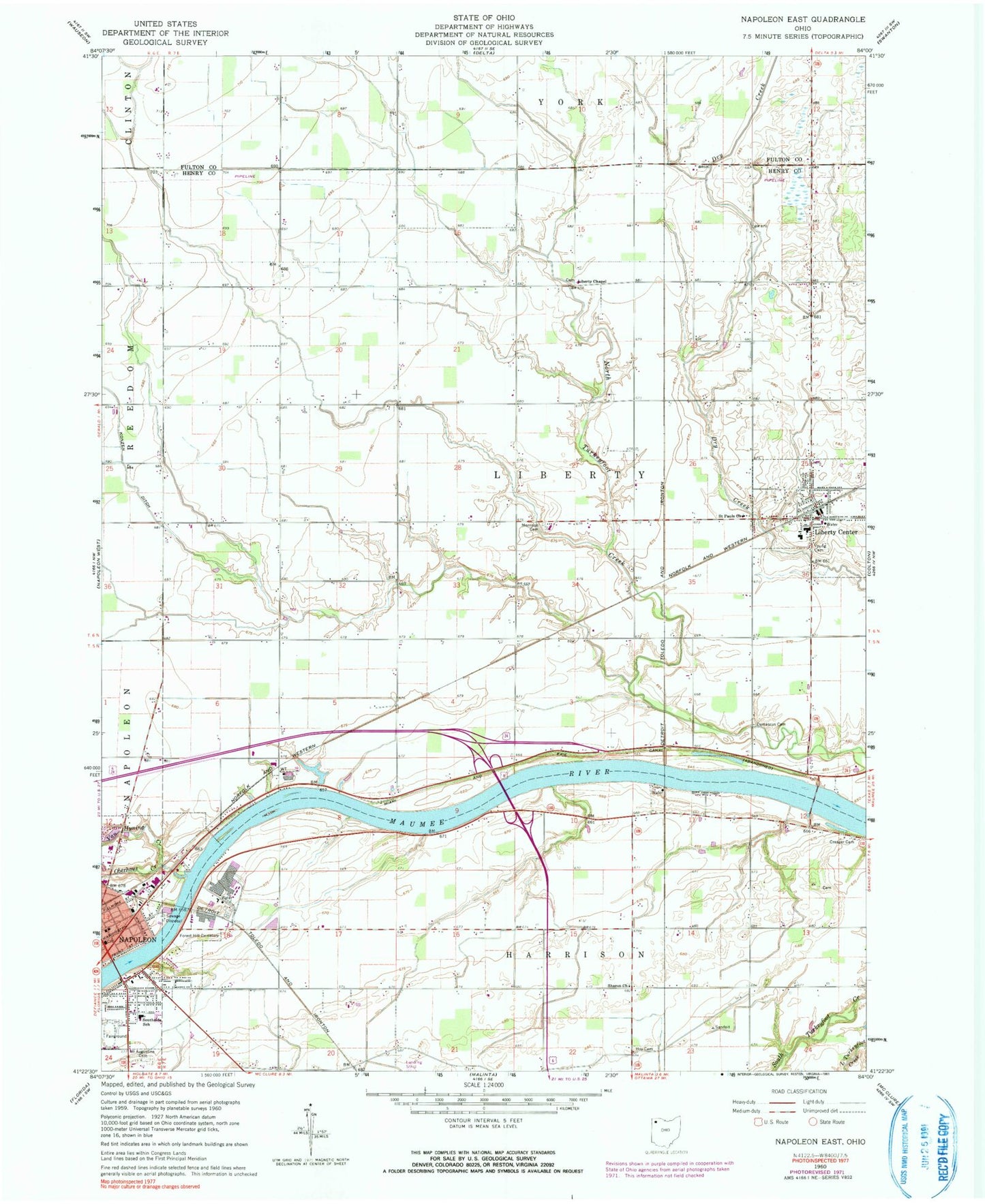
Classic USGS Napoleon East Ohio 7.5'x7.5' Topo Map
Couldn't load pickup availability
Historical USGS topographic quad map of Napoleon East in the state of Ohio. Map scale may vary for some years, but is generally around 1:24,000. Print size is approximately 24" x 27"
This quadrangle is in the following counties: Fulton, Henry.
The map contains contour lines, roads, rivers, towns, and lakes. Printed on high-quality waterproof paper with UV fade-resistant inks, and shipped rolled.
Contains the following named places: City of Napoleon, Cloverleaf, Colonial Manor Mobile Home Park, Countryside Estates, Creager Cemetery, Damascus, Damascus Cemetery, Damascus Post Office, Forest Hill Cemetery, Henry County Courthouse, Henry County Fairground, Henry County Hospital, Henry County Jail, Henry County Sheriff's Office, Hoy Cemetery, Konzem Ditch, Liberty - Washington Township Fire and Rescue Department, Liberty Center, Liberty Center Elementary School, Liberty Center High School, Liberty Center Post Office, Liberty Center-Colton United Methodist Church, Liberty Chapel Cemetery, Liberty Chapel United Methodist Church, Oak Mobile Home Court, Oberhaus Creek, Pilgrimage Holiness Church, Ratsville, Saint Augustine Catholic Church, Saint Augustine Cemetery, Saint Augustine School, Saint Pauls Lutheran Church, Sharon United Methodist Church, South Public School, Southside School, Spiess Trailer Park, Township of Liberty, Van Hyning Creek, Victory Chapel, Village of Liberty Center, Young Cemetery