MyTopo
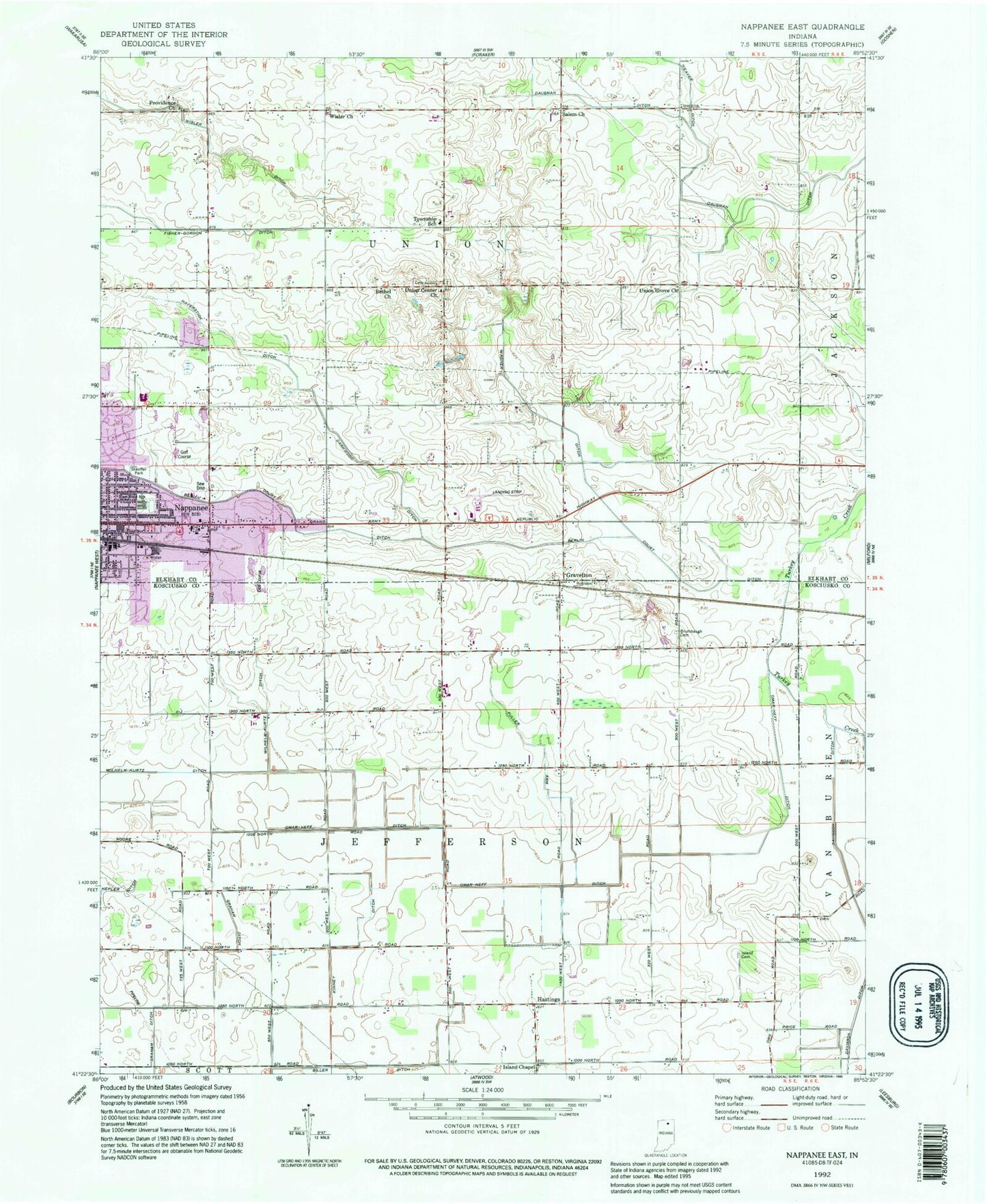
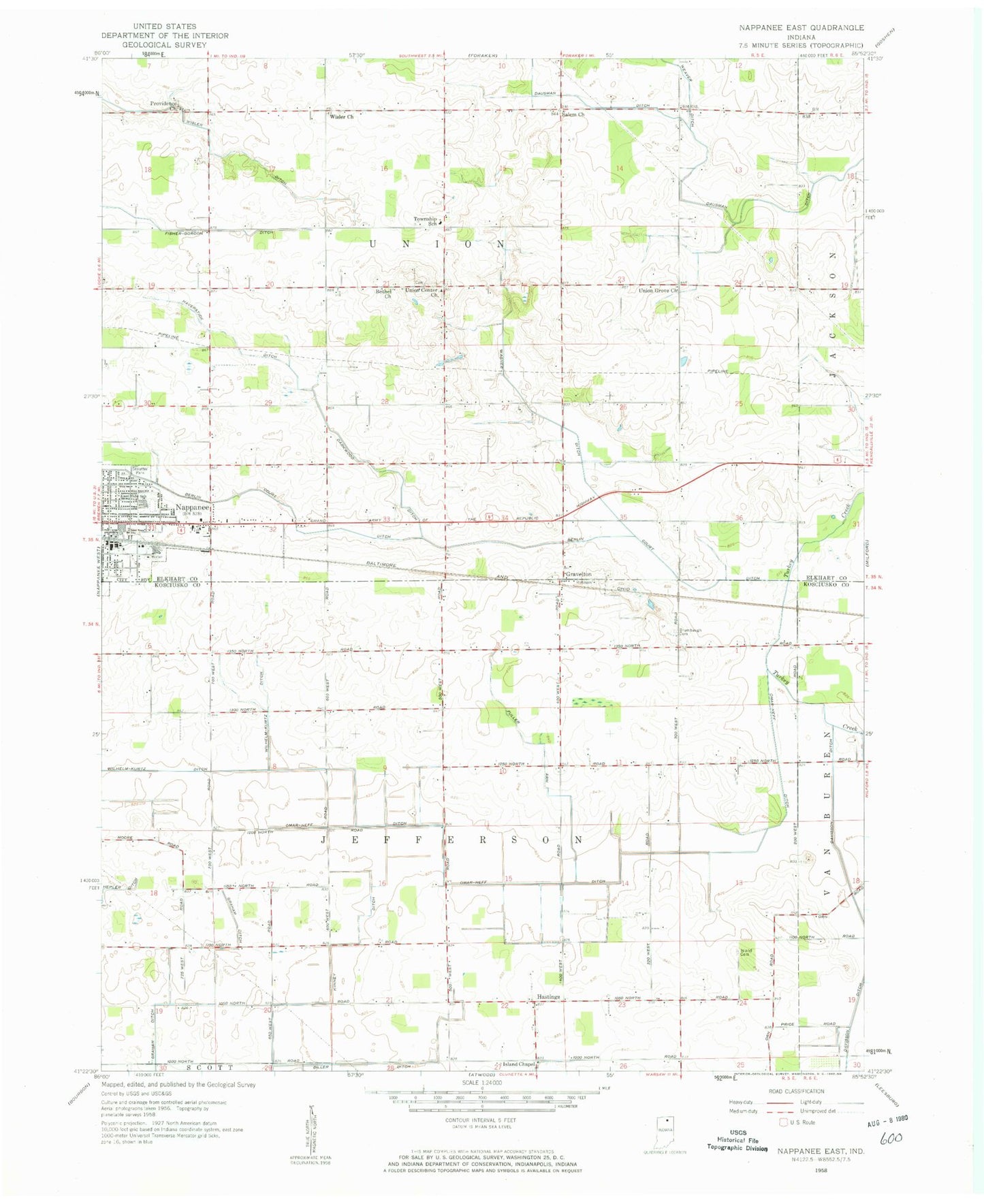
Classic USGS Nappanee East Indiana 7.5'x7.5' Topo Map
Couldn't load pickup availability
Historical USGS topographic quad map of Nappanee East in the state of Indiana. Map scale may vary for some years, but is generally around 1:24,000. Print size is approximately 24" x 27"
This quadrangle is in the following counties: Elkhart, Kosciusko.
The map contains contour lines, roads, rivers, towns, and lakes. Printed on high-quality waterproof paper with UV fade-resistant inks, and shipped rolled.
Contains the following named places: Berlin Court Grand Ditch, Bethel Church, Biller Ditch, Brumbaugh Cemetery, Calvary Baptist Church, City of Nappanee, Corner View Farm, Darkwood Ditch, Dausman Ditch, Davisson Ditch, East Side School, Fuller Arm, Graham Ditch, Gravelton, Hastings, Haverstick Ditch, Hill Top Duck Farm, Island Cemetery, Island Chapel, Kinney Ditch, Nappanee Church of the Brethren, Nappanee Municipal Airport, Nappanee Post Office, Omar Neff Ditch, Providence Church, Reed Farms, Rummel Farms, Salem Church, Sheets Farm, Stauffer Park, Township of Jefferson, Township of Union, Tri - County Ambulance Service, Union Center Church, Union Center Elementary School, Union Grove Church, Wagner Ditch, Wilhelm-Kurtz Ditch, Wisler Church, Wisler Ditch