MyTopo
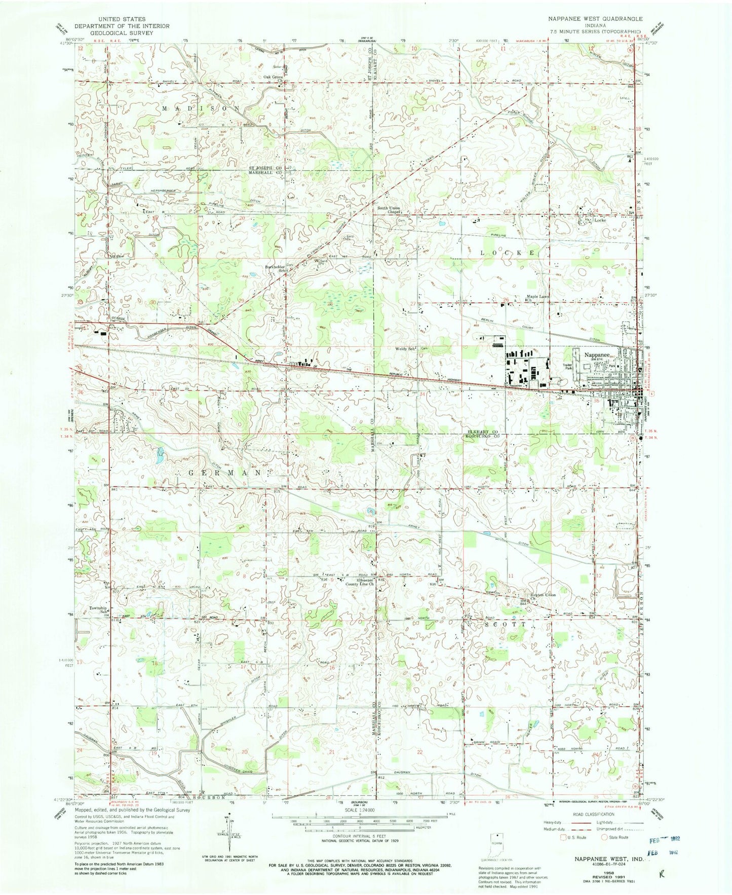
Classic USGS Nappanee West Indiana 7.5'x7.5' Topo Map
Couldn't load pickup availability
Historical USGS topographic quad map of Nappanee West in the state of Indiana. Map scale may vary for some years, but is generally around 1:24,000. Print size is approximately 24" x 27"
This quadrangle is in the following counties: Elkhart, Kosciusko, Marshall, St. Joseph.
The map contains contour lines, roads, rivers, towns, and lakes. Printed on high-quality waterproof paper with UV fade-resistant inks, and shipped rolled.
Contains the following named places: Armey Ditch, Borkholder Farm, Borkholder School, Ebenezer County Line Church, First Brethren Church, Fisher-Gordon Ditch, George Marberger Ditch, Hepler Ditch, Hepton Union Church, Heritage Trail Farm, Koontz Farm, Living Gospel Church, Locke, Maple Lawn Church, Nappanee, Nappanee Brethren in Christ Church, Nappanee Emergency Medical Services, Nappanee Fire Department Headquarters, Nappanee Police Department, Nappanee Public Library, North Main Street Mennonite Church, Oak Grove Church, Our Lady of Perpetual Help Church, Pippenger Farms, Pittman Ditch, Saint John's Lutheran Church, Sarber Farm, Shaum Dairy, Slabaugh Farms, South Union Chapel, Thomas Farms, Township of Locke, Township of Scott, Unsicker Farms, Unsicker-Craig Ditch, Walter Wisler Ditch, Weldy Amish School, Whishler Ditch, Zion Mennonite Church, ZIP Code: 46550