MyTopo
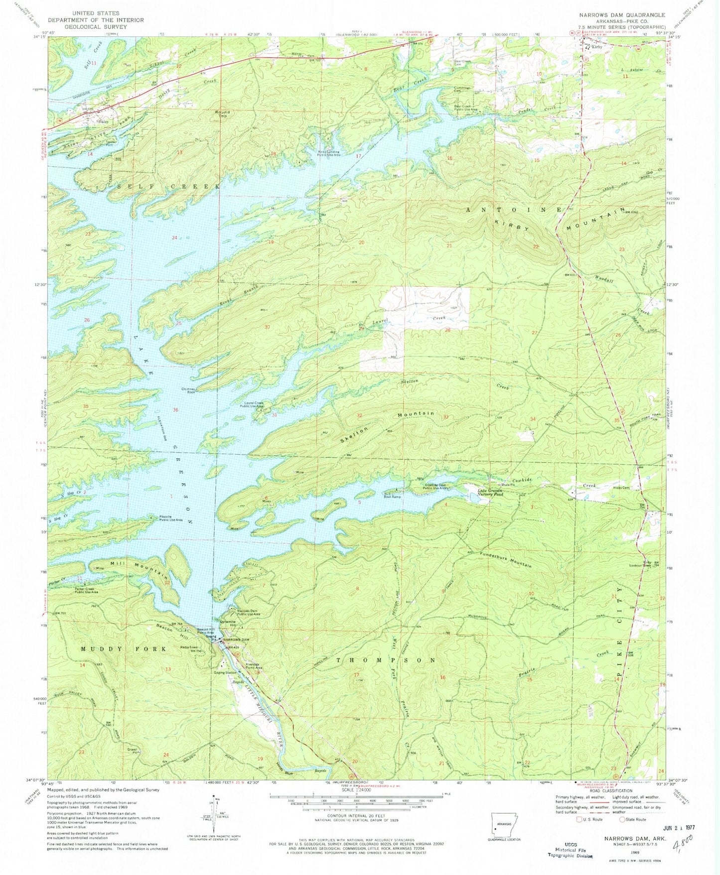
Classic USGS Narrows Dam Arkansas 7.5'x7.5' Topo Map
Couldn't load pickup availability
Historical USGS topographic quad map of Narrows Dam in the state of Arkansas. Typical map scale is 1:24,000, but may vary for certain years, if available. Print size: 24" x 27"
This quadrangle is in the following counties: Pike.
The map contains contour lines, roads, rivers, towns, and lakes. Printed on high-quality waterproof paper with UV fade-resistant inks, and shipped rolled.
Contains the following named places: Beacon Hill, Beacon Hill Picnic Area, Bear Creek Cemetery, Chimney Rock, Cowhide Creek, Cummings Cemetery, Daisy, Daisy Creek, Daisy State Park, Hicks Cemetery, Hinds Bluff, Laurel Creek, North Hog Creek, Parker Creek, Ponder Creek, Riverside Picnic Area, Rough Branch, School Creek, Skelton Creek, Dynamite Hill, Funderburk Mountain, Mill Mountain, Round Top, Skelton Mountain, Abner (historical), Bethlehem Missionary Baptist Church, Helbig (historical), Kirby Cemetery, Kirby Elementary School, Kirby High School, Pleasant Grove Primitive Baptist Church, Stanley (historical), Township of Self Creek, Pike County, Bear Creek, Narrows Dam, Bear Creek Public Use Area, Cowhide Cove Public Use Area, Kirby Landing Public Use Area, Laurel Creek Public Use Area, Midway Missionary Baptist Church, Narrows Dam Public Use Area, Parker Creek Public Use Area, Pikeville Public Use Area, South Hog Creek, Lake Greeson Nursery Pond Dam, Lake Greeson Nursery Pond, Kirby Lookout Tower, Kirby Post Office, Daisy Volunteer Fire Department, Kirby Volunteer Fire Station, Town of Daisy